Advancing Coastal Environmental Indicators for Effective Management and Assessment
This document outlines the objectives and methodologies of various initiatives aimed at developing advanced indicators for measuring coastal environmental conditions across US coastlines. The initiatives focus on linking stressors to ecosystem responses, integrating indicators across different spatial and temporal scales, and establishing reference conditions for benchmarks. Key results emphasize assessing human impacts on aquatic ecosystems, including land use changes and their effects on estuarine health. These integrated approaches provide essential tools for managers and stakeholders in addressing issues like eutrophication and hypoxia.

Advancing Coastal Environmental Indicators for Effective Management and Assessment
E N D
Presentation Transcript
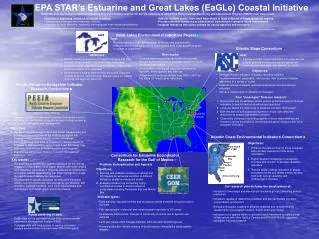
Plum Island LTER Chesapeake Bay Neuse/ Pamlico North Inlet EaGLe GLEI www.asc.psu.edu glei.nrri.umn.edu www.aceinc.org EPA STAR’s Estuarine and Great Lakes (EaGLe) Coastal Initiative • Goal: Develop the next generation of indicators of environmental condition for the US coastlines to help EPA’s Environmental Monitoring and Assessment Program (EMAP) meet state needs. • Five keys to improving indicators of coastal condition: • Link stressors (causes) with responses (effects) • Separate multiple stressors, especially anthropogenic from natural perturbations. • Address multiple scales, from small watersheds to large estuaries or biogeographical regions. • Provide reference conditions as a benchmark from which to compare future assessments. • Integrate indicators into suites suitable for use by agencies and managers. Great Lakes Environmental Indicators Project • Goal: • Develop indicators that can effectively, efficiently, and economically measure and monitor the condition of the Great Lakes coast as well as point to causes of impairment Atlantic Slope Consortium • Key results: • Establishment of a process and method to quantify multiple human disturbance gradients across the whole US Great Lakes basin • Development of biological response indicators for nutrients, exotic species and land use • Assessment of land use change from 1992 – 2001 for the entire US Great Lakes watershed • Objectives: • Identify relevant coastal environmental indicators and their potential stressors within the Great Lakes watershed • Establish a large-scale field study to examine relationships between stresses and responses • Recommend a suite of hierarchically-structured indicators (spatial, temporal, and biological) that are useful for making informed management decisions • Goal: • Develop and test a set of indicators in freshwater and coastal systems that are ecologically appropriate, economically reasonable, and relevant to society • Objectives: • Develop and test indicators of aquatic resource condition • Use environmental, geographic, and stressor data to predict indicator responses at a variety of scales • Establish linkages between upstream watersheds and downstream estuaries • Deliver a nested suite of indicators to managers Pacific Estuarine Ecosystem Indicator Research Consortium • Four “messages” from our research: • A taxonomic key of indicators can be used to guide managers to the best indicators to use for various situations and questions • Land use affects the attainment of estuarine condition downstream • Both the amount and spatial arrangement of land uses affect the attainment of stream and wetland condition. • Community efficiency in providing quality of life for watershed/estuary residents can be assessed by combining ecological indicators with socio-economic indicators. • Goal: • Develop indicators of salt marsh condition that can be used to diagnose the significance of specific causes of stress as well as to facilitate restoration and management www.bml.ucdavis.edu/peeir USEPANCER • Objectives: • Identify an integrated approach to salt marsh management and monitoring that complements the existing ecological risk paradigm used to assess effects of toxic substances • Develop an integrated suite of indicators to assess effects of stressors at multiple scales using a large scale field study that evaluates relationships between stresses and response • Evaluate the utility of our findings in current management scenarios Atlantic Coast Environmental Indicators Consortium • Objectives: • Enhance the data archive for these estuaries with remotely sensed and time-series information • Exploit detailed knowledge of ecosystem structure and function to develop candidate indicators • Test the ability of these indicators to gauge ecosystem health and detect trends resulting from both natural variability and anthropogenic stresses Consortium for Estuarine Ecoindicator Research for the Gulf of Mexico • Key results: • Development of an indicator species approach for monitoring effects of contaminants in salt marsh species with tools ranging from molecular techniques to diagnose specific contaminants to population viability assessments that allow managers to weigh the significance of detrimental responses. • Development of specific indicators for endocrine disruption effects, nutrient enrichment, bird abundance and diversity, fish condition, shellfish condition, toxic metal bioavailability and mobilization, and marsh plant community change. Problem: Eutrophication and hypoxia • Objectives: • Develop and validate indicators of nutrient and DO impacts on estuarine condition at different biological, spatial and temporal scales • Evaluate indicators by conducting highly-coordinated studies in distinct estuarine ecosystems including Pensacola Bay and Mobile Bay • Our research plan includes the development of: • Indicators of microalgal and macrophyte functional groups controlling primary production • Indicators capable of determining plankton and fish community structure (organization) and function • Biological indicators coupled to physical-chemical and remote sensing assessments of ecosystem function, trophic state and change • Indicators to be applied within a national coastal framework by establishing collaborations with other EaGLe Centers and EPA/NSF/NOAA-supported ecological indicator research www.usm.edu/gcrl/ceer_gom • Indicator types: • Early warning: microbial biofilms and crustacean genes sensitive to hypoxia and/or nutrients • Fish reproduction: molecular and morphological responses to DO stress • Invertebrate communities: changes in community structure due to hypoxia and nutrients • Land use: cause-effect linkages between land use and nutrients/hypoxia • Primary production: remote sensing of whole-estuary chlorophyll a using satellite imagery • Public archiving of data: • EaGle data will be archived through EPA’s Environmental Information Management System (EIMS) • Prototype data archiving system to capture and make publicly available data collected under EPA STAR grants