Download
1 / 30
300 likes | 498 Views
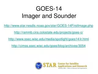
GOES-14 Imager and Sounder. Timothy J. Schmit NOAA/NESDIS/Satellite Applications and Research Advanced Satellite Products Branch (ASPB) Mathew M. Gunshor, Tony Schreiner, Scott Bachmeier, Joleen Feltz, Steve Wanzong, SSEC Data Center, etc. CIMSS/SSEC, Madison, WI. a preliminary look.

E N D
GOES-14Imager and Sounder Timothy J. Schmit NOAA/NESDIS/Satellite Applications and Research Advanced Satellite Products Branch (ASPB) Mathew M. Gunshor, Tony Schreiner, Scott Bachmeier, Joleen Feltz, Steve Wanzong, SSEC Data Center, etc. CIMSS/SSEC, Madison, WI a preliminary look Don Hillger and Tim Schmit co-lead the NOAA Science Test
Outline • Introduction • First imager and sounder images • Issues • Comparisons • Improved imager band 6 (13.3 um) spatial resolution • Preliminary inter-calibration results • Improved INR and Operation thru eclipse • Initial products (imager and sounder) • Web links
GOES-14 GOES-13/14/P have similar instruments to GOES-8-12, but on a different spacecraft bus. Spring and fall eclipse outages will be avoided by larger onboard batteries. Improved navigation Improved radiometrics GOES-8/12 GOES-13/14/P
von Karman vorticies GOES-14 • GOES-O Science Test web page: http://rammb.cira.colostate.edu/projects/goes-o/
sediment plume vortex in the marine layer clouds , snow Amazon suppressing the formation of cumulus actinoform clouds
First GOES-14 Images (sub-sampled) Note the ‘brighter’ GOES-14 visible image From NOAA ASPB
GOES-12 (for comparison) Note the sub-satellite points are different From NOAA ASPB
GOES-14 Sounder! Note clean signal, especially bands 1, 2, 12 and 15.
GOES-12 Sounder Data has been remapped to a common projection.
River Fog GOES-14 GOES-12 The fog is a bit brighter and a appears more extensive in the GOES-14 image. GOES-14 is able to discern urban centers more readily than GOES-12.
Improved spatial resolution of GOES-14 Imager band 6 H GOES-14 GOES-12 • The improved spatial resolution of the Geostationary Operational Environmental Satellites (GOES)-14 imager band 6 has been verified. This band, centered at 13.3 um, has a number of uses, the main being cloud height determination. • Important diagnostic work was under-taken. After an issue was raised dealing with the data stream of imager band 6, the suggested fix was implemented at the ground station. Many groups, both within NOAA/NESDIS, the Cooperative Institutes, NASA and others, quickly worked together to fix this issue. The 13.3 um band 6 of the GOES-12 (left panel) has an 8 km IGFOV (Instantaneous Geometric Field of View); while the same band on the GOES-14 (right panel) has a 4 km IGFOV. Note the finer resolution of the cloud edges and the ‘cleaner’ image. The improved spatial resolution of the GOES-14 imager band 6 (over GOES-12/13 imagers) has been verified with initial on-orbit data. Sponsor: OSD G-PSDI Program (Courtesy of T. Schmit)
Methodology: GEO – IASI Intercal • Collocation in time and space. • Within 30 minutes at geostationary subpoint (GSNO – Geostationary Simultaneous Nadir Observation) • Low Satellite View Angles (< 14) • Spatial smoothing • 100km “running average” mitigates the negative effects of poor spatial and temporal collocation, poor navigation, and spatial resolution differences. • Average radiances, not temperatures. • Compare a common area around the GEO sub-point, not “pixel to pixel” comparisons • “Convolve” high spectral resolution Radiance spectra with GEO Spectral Response Function. • Compare mean scene brightness temperatures (converted from mean scene radiances).
Preliminary intercalibration results with GOES-14 Imager using IASI • Mean temperature differences with IASI (for 12 cases) are: • -0.4 K for the Shortwave Window band (5 night cases) • +0.8 K for the Water Vapor band • +0.1 K for the IR Window band • -0.6 K for the CO2 Absorption band • The CO2 band SRF may be updated before the science test takes place. • Some of these results may include cases where navigation was not optimal. • Similar results from Dr. Wu (not shown)
GOES Series Sounder Noise GOES-14 – the best Sounder yet wrt noise performance! Units: mW/(m2 ster cm-1) Preliminary
SRF • There maybe updated imager and sounder GOES-14 spectral response functions (SRF) released.
GOES-14Imager and Sounder http://rammb.cira.colostate.edu/projects/goes-o/ http://www.star.nesdis.noaa.gov/star/GOES-14FirstImage.php http://www.ssec.wisc.edu/media/spotlight/goes14/ir.html http://cimss.ssec.wisc.edu/goes/blog/archives/3054 http://www.ssec.wisc.edu/data/geo/index.php?satellite=goes14&file=jpg http://cimss.ssec.wisc.edu/goes/rt/sounder-dpi.php