Download
1 / 30
300 likes | 543 Views
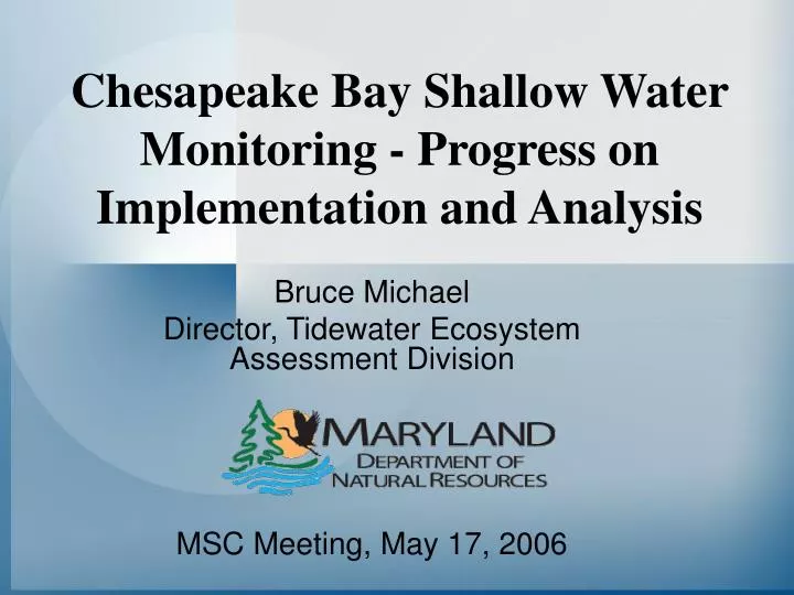
Chesapeake Bay Shallow Water Monitoring - Progress on Implementation and Analysis. Bruce Michael Director, Tidewater Ecosystem Assessment Division MSC Meeting, May 17, 2006. Chesapeake Bay Shallow Water Monitoring Design Consists of 2 Components Integrated with Other Forms of Monitoring.

E N D
Chesapeake Bay Shallow Water Monitoring - Progress on Implementation and Analysis Bruce Michael Director, Tidewater Ecosystem Assessment Division MSC Meeting, May 17, 2006
Chesapeake Bay Shallow Water Monitoring Design Consists of 2 Components Integrated with Other Forms of Monitoring Mapping Buoys/ Profilers Fixed Station Continuous Monitors • Continuous Monitors • All criteria • Shallow-water designated use • Water Quality Mapping • All criteria • Shallow & open-water designated use • Existing Fixed Stations • All criteria • All but shallow-water designated use
Continuous Monitors • Generally, deployed April – October, over a 3-year period • A subset of meters are telemetered real-time to website • Measures water quality parameters every 15 minutes YSI 6600 EDS – Measures Dissolved Oxygen, Turbidity, Chlorophyll, Water Temperature,Salinity, pH
Water Quality Mapping • Monthly cruises, April – October, over a 3-year period • Measures water quality parameters every 4 seconds YSI 6600 EDS – Measures Dissolved Oxygen, Turbidity, Chlorophyll, Water Temperature, Salinity, pH Dataview Real – Time GIS Software Water Quality Mapping Stowaway YSI/Flow Unit Electronics
Better Coordination with Other Long-Term Monitoring Programs New 2006 Segments and Partners • Entire Potomac • CBL • SMCM • VA DEQ • VIMS • COG • GMU • CBOS • EPA • NOAA • USGS • US Army • St. Mary’s Co. • Choptank • HPL • USDA • Creekwatchers • Wicomico • SU & HPL • Creekwatchers • NERRS
Water Quality Mapping Potomac River April 10-14th 2006
Water Quality Criteria Assessment Protocols (CAP) Workgroup • The Chesapeake Bay Program established this workgroup to:- develop assessment methods to evaluate attainment of the criteria and designated uses, - address many unresolved issues regarding assessment of water quality criteria
CAP Workgroup’s SWM Chlorophyll/Turbidity/DO Analysis Team • Elgin Perry – statistics consultant • Ken Moore - VIMS • Walter Boynton - CBL • Julie Baldizar – USGS • Bill Romano – MD DNR • Mark Trice – MD DNR • MD & VA State and Federal partners
CAP Workgroup SWM Tasks - Shallow water issues * water clarity assessment procedures * chlorophyll assessment procedures * use of fixed stations for high frequency DO measurements * temporal adjustment of spatial mapping data - Reporting * how should assessment results be reported * what type of information should be reported * how should information be managed/stored * what is the schedule for reporting assessment results
Directions Needed for Potential Water Clarity Assessment • Baywide Consistency • Simplicity • Use of CFD for Clarity Assessment
Attainment Depth Contour Clarity Criteria Assessment Method 1 (MD&VA) Attainment of SAV Acreage Goal SAV Area A SAV Area B Attainment Defined as: SSAV Acreage > SAV Goal Single Best Year
Attainment Depth Contour Clarity Criteria Assessment Method 2 (VA) Attainment of Water Clarity Acreage Goal SAV Area A SAV Area B Water Clarity Area A Attainment Defined as: SSAV Acreage < SAV Goal SWater Clarity Acreage > WC Goal Single Best Year Water Clarity Area B
Attainment Depth Contour Clarity Criteria Assessment Method 3 (MD) Attainment of Water Clarity Criteria Based on CFD SAV Area A Attainment Area SAV Area B No Grow Zone Non-Attainment Area Attainment Defined as: SSAV Acreage < SAV Goal Calculate % Area in Attainment Assess Using CFD
Attainment Depth Contour Clarity Criteria Assessment Method 4 (MD) Attainment of Combined SAV & WC Acreage Goals SAV Area A Clarity Attainment Area SAV Area B No Grow Zone Non-Attainment Area Attainment Defined as: SSAV Acreage < SAV Goal (SSAV Acreage + SWC Acreage) > SAV Goal
Issues Related to Current State Standards • Method 1 - Attainment of SAV Acreage Goal • No Issues. Method is accepted by both States, CBPO and EPA Region 3 • Method 2 - Attainment of Water Clarity Acreage Goal • No attainment depth and thus not consistent definition of spatial extent. • Method of summarizing multiple cruises in one year is unclear. • Comparison to goal precludes use of CFD. • Method 3 - Attainment of Water Clarity Criteria Based on CFD • No issues other than those related to normal use of CFD. • Method 4 - Attainment of Combined SAV & WC Acreage Goals • Method of summarizing multiple cruises in one year is unclear. • Comparison to goal precludes use of CFD.
Chlorophyll and Turbidity Measurement Issues • Although YSI 6600 chlorophyll approximates extractive chlorophyll a at many stations, the criteria will be in terms of chlorophyll a • kd will be used to evaluate the Bay water clarity standards, so turbidity would be used at shallow water sites • kd can also be used in the Gallegos optical model to partition light attenuation into TSS and chlorophyll components
Develop a post-calibration chlorophyll model • Match extractive and YSI 6600 chlorophyll • Outlier prediction model to remove data • Test for significant differences (adjust all data, or only for significant differences?) • Geographical differences • Background fluorescence adjustment • Photo-inhibition (diel study conducted on the Patuxent estuary)
Develop a kd model • Using linear regression, USGS found that turbidity was the best single variable predictor of kd at 5 of 10 sites (r2 from 0.23 to 0.62) • Turbidity was significant, but not best at one site • Other than turbidity, TP, DOC, salinity, TN, DIN, and TVS were found to good predictors of kd • VA found that in general, turbidity was the best predictor of kd in their systems
Next steps • Complete assembling multiyear shallow water monitoring database (MD and VA) • Determine best model approach based on spatial distribution (lumping or splitting) • Evaluate models using both continuous and water quality mapping data • Provide documentation for review • Publish by late 2006
Time of Day Averaged Continuous Monitoring DO Magothy R., April 15 - October 31, 2001
Correcting DO Data for Time of Day to “Normalize” Water Quality Mapping • Average 15-minute intervals of Continuous Monitoring DO data from a 2-week period surrounding a water quality mapping cruise (8/22/01). • Fit 3rd-order polynomial regression of averaged continuous monitoring DO data from 5am to 1-hr after DATAFLOW cruise. • Use regression equation to obtain time-based correction factor for water quality mapping and adjust to daily minimum (0600). • Mapping Data - (Predicted (Tcollected) - Predicted T0600)
Water Quality Mapping: Uncorrected vs. Corrected (to daily min.)
Corrected vs Non-Corrected Spatial Data Minimum DO Cruise Uncorrected Corrected <5 mg/l >5 mg/l
Water Quality Criteria Assessment Protocols Workgroup • SCHEDULE • - Workgroup efforts initiated in spring 2005 • - Assessment results for States 2006 impaired waters listing for dissolved oxygen and shallow water SAV coverage completed in November 2005 • - Concerted efforts beginning January 2006 to complete tasks by June 2006 meeting of Water Quality Steering Committee to review efforts. • Develop draft document addressing criteria • assessment issues for science review - summer 2006 • - Complete/release technical report by December 2006 for States to consider in updating regulations