Download
1 / 37
370 likes | 420 Views
Explore how relief formations, from mountains to oceans, are created by geological processes and external agents like erosion. Learn how relief influences climate, vegetation, and human activities globally and in Spain.

E N D
Contents • Reliefformation • TheEarth’srelief • Thecontinents • Water • Rivers and lakesaroundtheworld • Climates and landscapes • Therelief of Spain • Water in Spain • Climates and landscapes in Spain
Keywords • - Averagealtitude: altura media. • Groundwater: acuífero. • - Glacier: glaciar. • - Landscape: paisaje. • - Climatezones: zonas climáticas. • - Climate chart/graph: climograma. • - Tides: mareas. • - Waves: olas. • - Marine currents: corrientes marinas. • - Scarceresource: recurso escaso. • - Flat areas: planicies. • - Overexploitation: sobreexplotación. • - Humanconsumption: consumo humano. • - Freshwater: agua potable. - Relief: relieve. - Landforms: formas del relieve. - Tectonicplates: placas tectónicas. - Crust: corteza terrestre. - Limestone: calizas. • Karstic: relieve kárstico (calizas). • Siliceous: rocas silíceas. • Clay: arcilla, relieve arcilloso. - Plains: llanuras. • Plateau: meseta. - Depression: depresión. - Cliffs: acantilados. • Capes: cabos. • Gulf: golfo. - Cape: cabo. - Mountain range: cadena montañosa.
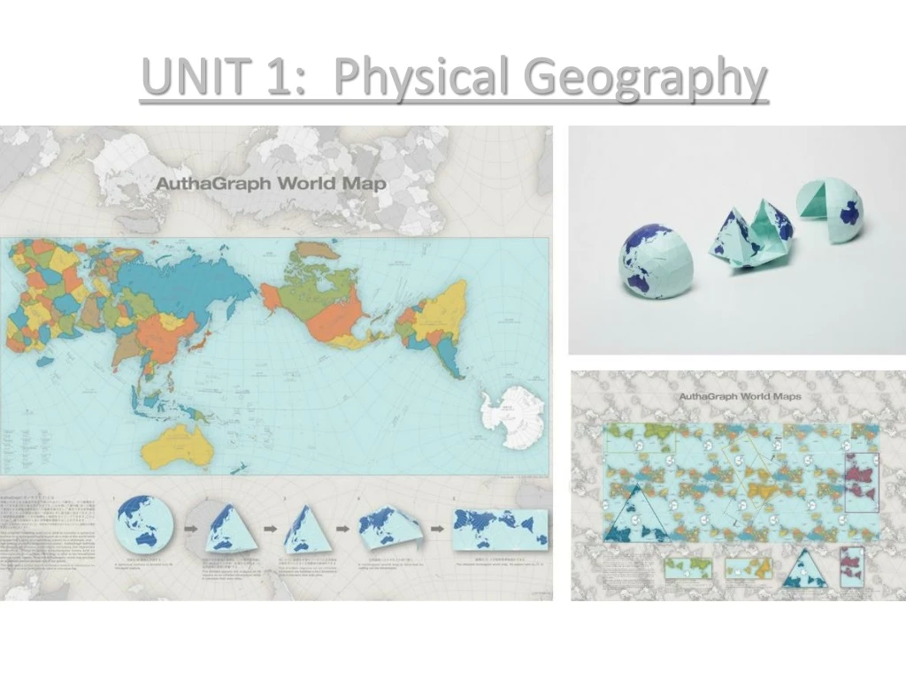
1. Reliefformation What is relief? The landforms of the Earth’s surface are called relief. These variations are found on the surface of our continents and also on the ocean. How is relief formed? Relief formation is explained by Theory of Plate Tectonics. The Earth’s crust is made up of plates which float on the top layer of the mantle. It could be compared with an orange, these plates separate, slide against each other or collide. When the plates separate rifts (cracks) are formed in the oceanic or continental crust. The magma inside the earth pushes up through the cracks and then when it cools forms another crust (with new landforms). For example the Rift Valley in Afica. A plateau on the ocean’s crust sometimes collides with the edge of a continental plate, and it pushed down into the Earth’s interior. It forms faults and folds. Magma pushes up through the continental crush, creating volcanoes on the Earth’s surface (for example Teide). Two continental plates sometimes collide, and the high pressure forms ondulations in the Earth’s surface. It forms the biggest mountains like the Himalayas in Asia or the Alps in southern Europe.
Exogenous (external) processes In addition to internal forces relief is also formed by external processes: - Erosion of rocks, which are worn away, fragmented and dissolved. - Transport of the eroded materials. - Sedimentation or the deposition of materials in another place. The erosion of rocks is caused by the interaction of external agents over a long time. These forces are water, wind and temperature. Rivers carve out deep valleys. Glaciers also cause erosion when they move. The force of the sea erodes cliffs, changing the coastline. Sea water transports the materials from the cliffs forming new beaches. Sharp changes in temperatura can break up the rocks. Sometimes water filters down through the cracks of rocks and then when the water freezes may break rocks in to pieces. Limestone and gypsum do not fragment but dissolve, it forms a karstic relief.
2. TheEarth’srelief The main forms of continentalrelief are the following: - Mountains, higher than 1000 metres, isolated or grouped together in mountain ranges. - Valleys which are áreas of low land between mountains. - Plains are flat áreas of land near the coast or in the basins of large rivers. - Plateaus are high raised plains between 400-600 metres. - Depressions are very low areas under the sea level. - On the coast we find relief forms such as cliffs, which are steep rock formations, and beaches, which are found in the coastal áreas. Gulfs and bays (small gulfs) are where the sea extends inland. Capes and penínsulas are áreas of land that extend into the sea.
The main forms of ocean floor are the following: - A continental shelf, is a large plateau that surrounds a continent, reaching a depth of 200 metres. A continental slope leads down from the continental shelf into the deeper part of the ocean. - Abbysal plains are vast plateaus at a depth of 3000-7000 metres. Mid-ocean ridges are long mountain ranges that are found on the abbysal plains. - Ocean trenches are long and deep cracks in the ocean floor.
The influence of relief in our lives The nature and altitude of relief influences climate, vegetation and land use. It affects both population and economic activity. Most of the world population lives in flat areas bellow 500 metres of altitude near the coast and in river valleys. The climate over there is mild and conditions are very good for agriculture and communications. However, technological advances have reduced our dependence on environment.
3. Thecontinents Africa. The continent has a high average elevation of 750 metres because of its many plateaus. There are great deserts (Kalahari, Sahara) and many mountain ranges (Atlas, Drakensberg). The Great Rift Valeys is in the east. The coastline is regular.
Asia. Mountain ranges are mainly in the centre. The Himalayan mountain range contain top peaks in the world (Everest, K2). Plateaus include the Plateau of Tibet, the highest in the world. Vast plains are crossed by big rivers (Yangtze, Yellow River, Mekong). The main basins contain inland seas (Caspian, Aral and Dead Seas). The coastline is irregular with many gulfs (Bay of Bengal, Persian Gulf), peninsulas and archipelagos (Japan, the Philippines or Indonesia).
America. The great mountain ranges are the Rocky Mountains, Sierra Madre and the Andes, they run parallel to the Pacific Coast. Inland plateaus include the MarroGrosso and the Bolivia Altiplano. The Great Plains are in North America. The coastline of North America is more irregular than that of South America.
Europe. Great plains occupy the centre and east of the continent. The oldest mountains are in the north (Scandinavian Mountains) and east (Urals) by the are not very high because of erosion. High, Young mountain ranges from an arc round the Mediterranean Sea (Pyrenees, Alps, Carpathian, Balkans and Caucasus. The coastline is irregular with islands (Iceland, Sicily) and peninsulas (Iberian, Italian, Escandinavian).
Oceania. Reliefvariesfromoneislandtoanother. Australia has coastalplains, lowdesert in the interior and the Great DividingRange in theeast. New Guinea and New Zealand are mountaniouswhilePacificIslands are mainlylow.
Antarctica. It has thehighestaveragealtitude (2000 metres) and ismainlycoveredby ice.
4. Water Water covers more than 70% of the Earth’s surface. Continental water Rivers, lakes, groundwater and ice contain fresh water (3% of all the Earth’s water). - Rivers are continuous flows of water that originate in rain, melting ice or groundwater. They flow into the a sea, a lake or another river. Rivers are important cause they provide water for human consumption, farming and hydroelecric energy. - Lakes are enclosed masses of water which accumulate in depressions. - Groundwater accumulates when rain and river water infiltates porous ground until the water flow reaches a layer of impermeable rock and forms an aquifer. - Ice is found in the polar ice caps an in mountain glaciers.
Marine water Oceans and seas hold 97% of theEarth’swater, they are in constantmovement: - Marine currents are masses of waterwhichmovelikeriverstroughtheoceans, theycouldbe warmorcoldcurrents. - Tidesare thedailyrise and fall of the sea levelcausedbythegravitionalmovement of the Moon and Sun. - Wavesare theondulatingmovements of thewateronthesurface of the sea causedbywind.
Water as a scarce resource - Wateris a preciousresource, mostwaterisnotsuitablefor human consumption. - Overexploitationof theEarth’swater has ledtoemptyaquifers and lakes. - Thedistribution of water in theEarthisuneven and itcouldvarybetweenseasons and years. - Hydraulicengineering (reservoirs, canals, wells) helpstomakeavailableallaroundtheworldbuttheyhave a deepimpactonlanscapes and environment.
5. Rivers and lakes of theworld • AFRICA: rivers Nilo, Congo, Niger and Zambeze. Lakes Victoria and Tanganyka. • ASIA: rivers Mekong, Tangtze, Yellow, Ganges. Lakes Aral, Caspian, Black and Baikal • AMERICA: rivers Mississipi, Amazon, Orinoco. Great lakes and Titicaca. • EUROPE: rivers Danube, Volga, Rin. Lakes Ladoga and Onega. • OCEANIA: rivers Murray and Darling
6. Climates and landscapes The sun does not warm all the Earth’s surface to the same extend. The Sun’s rays are perpendicular in the ecuator and oblique in the poles. As a result of that we have five climate zones: a hot zone between the tropics, two temperate zones in both hemispheres and two cold zones around the poles. Altitude, relief and proximity to the sea also influence climate. There are different types of climates within each climate zone: hot (equatorial, tropical and desert), temperate (Mediterranean, Oceanic and Continental) and cold (Polar and Mountain). Climate has a great influence on human societies.
Mountain climate Mountain climate is different and very important in Spain as there are mountains all across the Iberian Peninsula. The temperature on mountains becomes colder the higher the altitude gets (minus 0’6 degrees per 100 metres). Mountains tend to have much wetter climates than the surrounding flat land (Föehn effect): .
GEOLOGY. A longmountainrangewasformed in the West of IberianPeninsulaabout 300 millonyears ago. Overlong time, itwaseroded and formed a largeplateau. DuringtheTertiary Era (65 millonto 2 millonyearsago), theinternalforces of theEarthcausedgreatchanges: • ThePlateaufractured and becametheInnerPlateau. • Other blocks rose and becameGalicianMassif, CantabrianRange, theMountains of Toledo and Sierra Morena. • Thematerialsdeposited at theedge of theplateautwisted and becameeasternCantabrianRange and theIberian Mountain Chain. • The Ebro and Guadalquivir depressionswereformed at thesame time as thePyrenees and theBaeticChain. • Volcanicactivity in thebed of AtlanticOceanformedtheCanaryIslands.
GEOLOGY. Thesubstrate of Spainisveryvaried. There are fourmaintypes of rocks: • Siliceousrockslikegraniteorslate. There are veryold and rigidrocksformed in Palaeozolic era whichbegan 570 millonyears ago. • Limestonerocks come fromthe marine sedimentsdepositedduringtheSecundaryorMesozoic era wichbegan 250 millonyears ago. • Clays are therocksdeposited in lowareas in the late Tertiary era and duringtheQuaternary era, 1.6 millonyears ago. • Volcanicrockswereformed in theTertiary era and are common in theCanaryIslands.
Relief of Spainexplained Spain has anaveragealtitude of 660 metres. Peninsular relief has threemainfeatures: • TheInnerPlateauformsthe central part of theIberianPeninsula. Itisdividedintotwo sub-plateausbythe Central Mountain Chain. TheSouthern Sub-plateauiscrossedbythemountains of Toledo and isformedbythesedimentarybasins of the Tajo and Guadiana. • TheGalicianMassif, TheCantabrianRange, TheIberian Mountain Chain and the Sierra Morena surroundtheInnerPlateau. • Thefollowingmountains are beyondtheInnerPlateau: thePyrenees, TheBaeticChain, theCatalanCoastalChain and the Guadalquivir and Ebro basins. • Spain has more than 6000 kilometres of coastline. Thecoast of Cantabria and Galicia haverockycliffswhilethemediterranean and atlanticcoastlines are more regular. • TheBalearicIslands are anextention of theBaeticchain. TheCanaryIslands are shapedwith a volcanicrelief.
TheIberianPeninsula has threewatersheds, which are thedividinglinesbetweendrainagebasins: they are theCantabrian, theAtlantic and theMediterranean. • TheCantabrianwatershed, theriverswhichflowintotheCantabrian Sea. Therivers are short and theirflowisabundant and regular, forexample Bidasoa, Nervión, Nalón, Narcea... • TheAtlanticwatershed, theriverswhichflowintotheAtlanticocean. Theserivers are long (exceptGalicianrivers) with irregular flow of water, forexample Duero, Tajo, Guadiana, Guadalquivir… • TheMediterraneanwatershed, theriverswhichflowintotheMediterranean sea. Theserivers are smallwith a weak and irregular flow of water; exceptthe Ebro that looks likeanAtlanticriver.
HOMEWORK!!! 1. Define thefollowingterms: Plateau, mountainrange, cape, peninsula, cliff, abyssalplain. 2. Describe in yourownwordsthetheoryof platetectonics. 3. Make a physicalmap of Africawiththemostimportantafricanlandforms: • Mountains: Atlas, Drakensberg, Peak Kilimanjaro. • Plateaus: Tibesti, Ahaggar, Darfur, Ethiopian, Great Lakes. • Depressions: Rift Valley, Congo Plain. • Deserts: Sahara, Kalahari. • Rivers: Nilo, Congo, Niger, Zambeze, Orange. • Lakes: Victoria, Malawi, Tanganika, Chad. • Capes: Cape of Good Hope, Cape Verde, Cape Blanco. • Gulfs: Guinea, Benguela, Aden. • Peninsulas: SomalianPeninsula. • Islands: Canary, Madagascar. • Seas: AtlanticOcean, IndianOcean, Mediterranean Sea, Red Sea.
4. Make a physicalmap of Asia withthemostimportantlandforms: • Mountains: Himalayas, Zagros, Tauro, Ural, Caucasus. • Plateaus: Arabian, Decan, Mongolian and SiberianPlateau. • Rivers: Yangze, Mekong, Yellow, Ganges, Indo, Obi, Amur, Tigris and Eufrates. • Seas and lakes: Dead, Aral and Caspian Sean; Baikal Lake. Arabian Sea, Red Sea, South China Sea, East China Sea, Sea of Japan, Yellow Sea. • Peninsulas: Arabian, Decan, Korean, Indochina, Kamchatka. • Islands: Japan, Philippines, Indonesia; Sri Lanka, Taiwan • Gulf: PersianGulf, BelgalaGulf, AdenGulf • Bering Strait, Suez Canal. • Great ChinesePlain, SiberianPlain. 5. Make a physicalmap of Americawiththemostimportantlandforms: • Mountains: Rocky Mountains, Apalaches, Andes, Sierra Madre, McKenzieMountains. • Plateaus: Mato Grosso, Guyana, Altiplano. • Seas and lakes: Great Lakes, Titicaca and Maracaibo lakes, Caribean Sea, Bering Sea, AtlanticOcean, PacificOcean, Bering Sea. • Peninsulas: Labrador, Florida, Yucatan, California, New Scotland, San Lorenzo. • Islands: Cuba, Montreal, Bahamas. • Gulfs: Gulf of Mexico, Gulf of Panama, Hudson Bay, Gulf of California. • Straits: BerinStrait, Strait of Magellan. • Plains: Great American Plains, Patagonia, Chaco. • Rivers: Mississipi, Amazon, Orinoco, Paraguay, Grande,
6. Make a physicalmap of Europewiththemostimportantlandforms: • Mountains: Alps, Pyrenees, Balkans, Carpathian, Caucasus, Scandinavian, Apenines. AlsoPeakMontBlanc. • Plateaus: Massif Central (France). • Seas: AtlanticOcean, Mediterranean Sea, Black Sea, Aegean Sea, Adriatic Sea, Ionian Sea, Baltic Sea, North Sea, Norwegian Sea. • Peninsulas: Iberian, Italian, Balkan, Scandinavian, Jutland. • Islands: British Isles, Iceland, Malta, Cyprus. • Gulfs: Bay of Biscay, Gulf of Genoa, English Channel, Gulf of León. • Straits: Strait of Gibraltar. • Plains: North EuropeanPlain, East EuropeanPlain. • Rivers: Loire, Rhine, Danube, Ural, Volga, Dnieper, Don, • Lakes: Onega, Ladoga. 7. Define: River, lake, groundwater, tides, waves, marine currents. 8. Explaintheinfluence of climateover human societies. 9. Make and explaintheclimate charts providedbefore in page 24.
10. Explain in yourownwordstherelief of Spain. 11. Make a summaryabouttheformation of Spain’sreflief. 12. Make a mindmapaboutspanishlandscapes. 13. Explainwidelymediterraneanclimate. 14. Explainbrieflyoceanicclimate (in Spain). 15. Explainclearlythe tropical climate of theCanaryIslands. 16. Describe and themountainclimate of theIberianPeninsula.
Made by Francisco Javier AbadesAnsián History teacher at Castilla y León (Spain) Feel free to study or share this presentation


