Download
1 / 61
620 likes | 941 Views
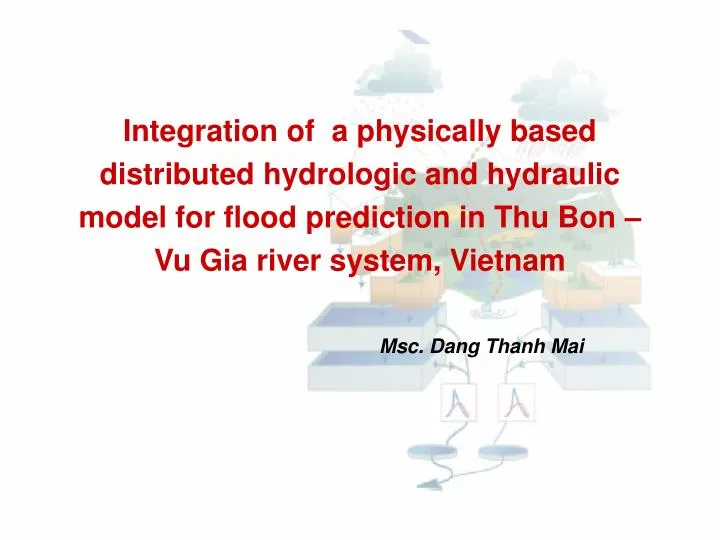
Integration of a physically based distributed hydrologic and hydraulic model for flood prediction in Thu Bon – Vu Gia river system, Vietnam. Msc. Dang Thanh Mai. Introduction.

E N D
Integration of a physically based distributed hydrologic and hydraulic model for flood prediction in Thu Bon – Vu Gia river system, Vietnam Msc. Dang Thanh Mai
Introduction The Thu Bon – Vu Gia river system located in Central Vietnam is often affected by large floods and inundations causing considerable damages to people and infrastructure. The floods are a serious and major issue for the development of Thu Bon – Vu Gia Basin The flood protection and mitigation in the region has led to heighten interest in real-time flood forecasting systems in which the crucial component is the flood forecasting modelling.
Introduction The main objective : to develop a tool for flood forecasting using integration of a physically based distributed hydrological and hydraulic models. Models used: GIS based distributed hydrological model : WETSPA One-dimensional hydraulic model: HECRAS 3 steps are implemented • Calibration and verification of WETSPA model • Calibration and verification of HECRAS model • Development of software to integrate two models and can be used in real-time flood forecast in the study area
Introduction • Wetspa model is a grid based, fully spatially distributed model for water and energy transfer between soil, plants and atmosphere a grid based. • Due to the complexity of Thu Bon – Vu Gia river system and effects of tide to flow in the downstream area.The one-dimensional unsteady state flow model HECRAS (USACE, 2001) is chosen for coupling with the Wetspa model to simulate peak discharge, flow and water level hydrographs in this area. • The integration of two models is becoming more capable for flood prediction, and decision making in the river. • The WetSpa model calculates discharges from rainfall and potential evaporation inputs. • The simulated flows from the Wetspa model are used as the input for the HECRAS model for flow routing at an upstream discharge point.
Measured data Maps Soil Land use DEM Measured Water level Maning coef. Geometric data Cross sections Parameters Parameters Parameters q(x,t) at upstream boundaries HEC-RAS spatial distribution of runoff component q(x,t), h(x,t) at cross sections an reaches WETSPA Rainfall pattern Rainfall Radar image Measured discharge Structure of the WetSpa and HECRAS models and their coupling
WetSpa? Water and Energy Transport between Soil, Plants and Atmosphere Hydrological model: Rainfall Runoff (measure) (simulate/predict)
Q = Qs + Qi + Qg Surface runoffQs Discharge InterflowQi Groundwater dischargeQg Time WETSPA MODEL DEM Soil Map Land-use/cover For each grid cell, four layers are divided as vegetation zone, root zone, transmission zone and saturated zone. Several hydrological processes such as precipitation, evapotranspiration, interflow, etc. are taken into account to calculate a water balance and excess rainfall for each cell.
N I Simulating hydrological processes Mixture of empirical and physically based equations: • Evapotranspiration (E) • Runoff Production (V) Potential Runoff Coefficient (C) C = f(slope, soil type, land use) • Percolation (R) • Interflow (F)
Soil Water Balance • Groundwater Balance • Total Evapotranspiration
= 3600 Flow routing • Diffusive Wave Approximation: • Flow Response Function: • Outflow Hydrograph
Cell Level • Flow Path Level Convolution • Watershed Level Areal summation Flow Flow Flow Time Time Time Linear routing system
Digital Spatial Data (DEM, Landuse, Soil type) Time Series (Precipitation, Potential EP, Temperature, Discharge) GIS Methods WetSpa Programs Peak Discharges Flow Hydrographs Spatial Characteristics Model input and output
HECRAS HECRAS is a hydraulic model package of the US Army Corps of Engineers - Hydrologic Engineering Center (HEC). The package contains three one-dimensional hydraulic analysis components for: (1) steady flow water surface profile computations; (2) unsteady flow simulation; (3) movable boundary sediment transport computations. The Unsteady flow is simulated based on two equations (USACE, 2001) The Continuity Equation The Momentum equation
Where: – Cross-sectional area; t – time; Q – flow ; S – storage from non conveying portions of cross section; X – distance along the channel; ql – Lateral inflow per unit distance The Continuity Equation The above equation can be written for the channel and floodplain: Where the subscripts c and f refer to the channel and floodplain, respectively, ql is the lateral inflow per unit length of floodplain, and qc and qf are the exchanges of water between the channel and the floodplain.
The Momentum equation: • Where • Q – Discharge; • t – time; • V – velocity; • x – distance along the channel • g – acceleration of gravity; • - Cross-sectional area; Sf – friction slope Mf and Mc are the momentum fluxes per unit distance exchange between the floodplain and the channel. The above equation can be written for the channel And for the floodplain
The study area Thu Bon – Vu Gia river system and location of hydro-meteorological stations.
Some characteristics of the study area • Annual average temperature ranges from 21OC to 26 OC • Annual average relative humidity of 85%. • Mean annual precipitation from 1960 to 4000 mm. • Rainy season prolongs from September to December accounting from 60-80 % of yearly rainfall. • The high floods of Thu Bon – Vu Gia occur usually from October to November. • The effect of the upstream tidal influence is clearly visible during periods of low water • Flood and inundation usually follows heavy rains, typhoon, and tropical depression. Large floods only occur under the affect of synoptic combination of typhoon, tropical depression with cold air surge.
Graph of dry season, rainy season and yearly precipitation in Thu Bon – Vu Gia river basin
Input data for models • GIS data: • DEM( 50x50 m) map: derived from 1:50.000 resolution elevation contour maps. • Land use map: consists of 25 land use types. A reclassification is made using nine land use types. • Soil type map: The map is reclassified to 12 USDA soil texture classes • Hydrological data: • 14 rain gauges and stream gauges data : Daily and 6-hourly time step. • Tidal data available at Da Nang for a long period of time • River geometry and cross section data: 320 cross sections
Rainfall calculation The grid of precipitation was created using Thiessen polygon method
Calibration and verification of WETSPA model Wetspa model is apply for 2 catchment namely Thanh My and Nong Son and 12 sub-catchments in Thu Bon –Vu Gia river basin Location of Sub-Catchments
DEM, Soil type and Land use of Nong Son sub-catchment. DEM, Soil type and Land use Hiep Duc sub-catchment.
Digital Elevation Model Digital Elevation Model Landuse Map Landuse Map Soil Map Soil Map Accumulation Accumulation Slope Slope Roughness Roughness coefficient Direction Hydraulic conductivity Stream net Stream net Porosity Porosity Root depth Hydraulic Hydraulic radius radius Field Capacity Field Capacity Interception capacity Wilting point Wilting point Evap . parameters Velocity Velocity Velocity Residual soil moisture t Pore distribution index c c D D D t t 0 0 0 s s s WetSpa WetSpa Runoff coefficient Runoff coefficient & Depression storage capacity Model Parameter Derivation
Some parameter maps of Hiep Duc sub-catchment. Some parameter maps of Nong Son sub-catchment.
Calibration and verification of WETSPA model Model Parameters: • Distributed parameters: Maps • Global parameters : 8 parameters Model Calibration • Manual calibration Data: 6 hourly data: flood season 2002-2005 6 hourly data: flood season 2006-2007 Model verification • Graphical comparisons • Statistical comparisons Model Evaluation Global parameter of Thanh My and Nong Son sub-catchment.
Parameter Results • Calibration process was performed mainly for the global parameters: • The interflow scaling factor was calibrated by matching the computed discharge with the observed discharge for the recession part of the flood hydrograph. • Groundwater flow recession coefficient was obtained by the analysis of recession curves at discharge gauging stations. • Refinement of this base flow recession coefficient was necessary to get a better fit for the low flows. • The initial soil moisture and initial groundwater storage were adjusted based on the comparison between the calculated and observed hydrographs for the initial period. • And the runoff exponent and the rainfall intensity threshold were adjusted based on the agreement between calculated and observed flows for the small storms with lower rainfall intensity.
Evaluated result Thanh My station on Vu Gia river Calibration result Verification result
Calibration result : Observed and calculated 6-hourly water level in flood season 2004 at Thanh My station on Vu Gia river
Verification result : Observed and calculated 6-hourly water level in flood season 2007 at Thanh My station on Vu Gia river
Evaluated result Nong Son station on Thu Bon river Calibration result Verification result
Calibration result : Observed and calculated 6-hourly water level in flood season 2003 at Nong Son station on Thu Bon river
Verification result : Observed and calculated 6-hourly water level in flood season 2007 at Nong son station on Thu Bon river
Result • The model performance is satisfactory for both calibration and validation periods • Flow peak discharges are quite well reproduced: the Nash-Sutcliffe coefficients were between 0,64 to 0,82; model bias within the range of -0.09 to 0.15; model determination coefficient within the range of 0.82 to 1.05; the flow efficiency coefficient within the range of 0.54 to 0.9, while the efficiency coefficient ranges from 0.60 to 0.9 for low-flow, and 0.56 to 0.92 for high-flow. • The model calculation results have a good agreement with observed hydrographs. • The model can well reproduce high flows, but low flows are a little under estimated • Evaluation criteria for both calibration and verification show that model is reliable performance and give a reperesentation of both low flow and high flow
Calibration and verification of HECRAS model Three steps to flood simulation using the HECRASS model are performed including 1 - Processing the geometry data in HECRAS; 2 - Integration of hydrologic data as initial conditions and boundary conditions in the HECRAS unsteady flow data file; 3 - Calibration and simulation flood using HECRAS model
The river system is represented by 320 cross sections, 8 storages which connected together by reaches Geometric data for downstream area of Thu bon - River basin
The flows of the upstream catchments which were results of Wetspa model were linked with the river network in the downstream area as upstream boundary condition
Calibration and verification of HECRAS model • Hydrographs of the flood season from 2002 to 2007, obtained from the Wetspa model for upstream sub-catchments of Vu Gia and Thu Bon branches are used as upstream boundary conditions. • Tidal hydrographs recorded at Da Nang are used as a downstream boundary condition for the river network • The initial flow conditions are the base flow conditions for Vu Gia and Thu Bon branches
Calibration and verification of HECRAS model • Data for calibration is 6-hourly water level hydrograph at Ai Nghia, Giao Thuy and Cau Lau station from 2002 to 2005. • For model verification, the calibrated parameters are used to simulate the 6-hourly stream flow for flood seasons from 2006 and 2007 • The calibration adjustments to HECRAS parameters were made in Manning's n. • Model calibration was discrete into two schemes: Rough scale, Delicate scale: • Rough scale: The calibration process divides the Manning’s values into 0.005 interval from the values of 0.02 to 0.05 by applying statistical method to finally evaluate the best interval value as an input for next step. • Delicate scale: The calibration process divides the Manning’s values into 0.001 interval from the selected rough scale values and applying statistical method to evaluate the best n Manning’s values for this study
Evaluated result Ais Nghia station on Vu Gia river Calibration result Verification result
Calibration result : Observed and calculated 6-hourly water level in flood season 2003 at Ai Nghia station on Thu Bon river
Verification result : Observed and calculated 6-hourly water level in flood season 2007 at Ai Nghia station on Thu Bon river
Evaluated result Cau Lau station on Thu Bon river Calibration result Verification result
Calibration result : Observed and calculated 6-hourly water level in flood season 2005 at Cau Lau station on Thu Bon river
Verification result : Observed and calculated 6-hourly water level in flood season 2007 at Cau Lau station on Thu Bon river
Result • The model performance is satisfactory for both calibration and validation periods • The calculated hydrograph is generally in a good agreement compared with the observed hydrograph. • The peak flood at Ai Nghia and Cau Lau is good simulated with the maximum error of 1,05 m. • Peak discharges, concentration time, and flow volumes are quite well predicted. • These results for calibration and verification indicate that the model can represent both low-flow and high-flow runoff.