Download
1 / 33
350 likes | 685 Views
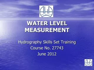
WATER LEVEL MEASUREMENT. Hydrography Skills Set Training Course No. 27743 June 2012. AN EARLY HISTORY. Originated in Ancient Egypt (3000 year s ago) - monitoring of Nile River water level for flood prediction

E N D
WATER LEVEL MEASUREMENT Hydrography Skills Set Training Course No. 27743 June 2012
AN EARLY HISTORY Originated in Ancient Egypt (3000 year s ago) - monitoring of Nile River water level for flood prediction - approximately 20 recording stations (‘Nilometers’) were located - ‘Nilometer’ attached to temple walls, quays and the inside walls of temple annexes - units of measurement were ‘cubits’ (the measurement from the elbow to the tip of the middle finger, approximately 450mm to 530mm) - modern day methods of measurement have evolved from this primitive method of water level measurement
Options for Water Level Measurement Manual Measurement Float Operation Submersible ‘Wet’ Pressure Sensor Gas Purge Operation
Options for Water Level Measurement Manual Measurement
Manual Measurement Contact Gauges Staff Gauge
Manual Measurement DIP ZERO DEPTH The following example shows how depth of flow can be calculated by this method in a sewer. • From a fixed point a measurement is taken to water level (ie the ‘dip’) • This reading is subtracted from a known measurement (ie the ‘Zero’) • Depth = ‘Zero’ – ‘Dip’
Manual Measurement Cantilevered Weight Gauge (Clear Ck at Golden, Colorado)
Manual Measurement Maximum Height Indicator (Skokomish River, Washington).
Options for Water Level Measurement Float Operation
Options for Water Level Measurement Submersible ‘Wet’ Pressure Sensor
Pressure Transducers – ‘Wet’ ‘Gauge’ Type (stainless steel) ‘Gauge’ Type (delrin/brass) ‘Absolute’ Type
Options for Water Level Measurement Gas Purge Operation
Gas Purge (Open) System ‘Bubbler’ Basic Operating Principle • dry nitrogen (or air) bubbled into the stream via a small diameter tube • bubbles escape from the end of the tube (orifice) • pressure transducer monitors changes in pressure within the tubing • available as ‘single’ or ‘dual’ orifice/riverline options System pressure is proportional to water level
Bubble Unit Operating Principle • Uses ‘dry nitrogen’ cylinder • Provides a constant ‘differential’ of 3-5 PSI (21-35 kPa) above the • pressure head at the orifice • Differential maintains a constant stream of bubbles at the orifice • HS23 bubble rate ‘pre-set’ at factory • Eliminates risk of silicon oil entering ‘riverline’ • ‘Quick Connect’ fitting available for check of bubble rate
Compressors • Alternative to gas cylinders (Safety Issues) • Effective air drying system essential - moisture ingress • - aquatic growth • Some limitations – ‘riverline’ length < 200 metres • - maximum head of 30 metres • Low powered types available (12V: 38aH with solar)
Gas Purge (Open) System‘Bubbler’ Single Orifice / Single Line
Gas Purge (Open) System‘Bubbler’ Single Orifice / Dual Line
Gas Purge (Open) System ‘Bubbler’ Dual Orifice
Ultrasonic Systems • Ultrasonic pulses emitted by the transducer • Pulses are reflected by the water surface and reflected back to the transducer • Time from emission to receipt of the signals is proportional to the level in the vessel • Mounted vertically above stream
Doppler Systems • If the distance between the transducer and the reflecting object is decreasing, frequency increases • If the distance between the transducer and the reflecting object is increasing, frequency decreases • Water level measured by ‘vertical’ acoustic beam • Systems also capable of flow measurement
Radar Systems • Extremely short microwave impulses are emitted by the antennae system to the water surface • These impulses are reflected by the water surface and received again by the antenna system • Time from emission to reception of the signals is proportional to water level in the stream
Laser Systems • Changes in water level based characterised by intensities of angular reflectance of light