THE WORLD OCEAN
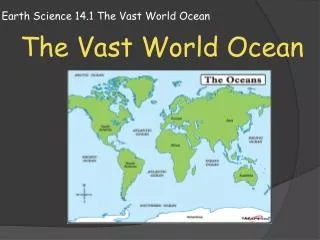
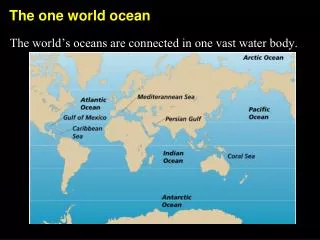
THE WORLD OCEAN. Covers 71 % of the planet (59.4 % is seafloor) Divided into major basins – Atlantic (N & S) Pacific Arctic Indian Southern Pacific – largest & deepest. BATHYMETRY OF THE OCEAN FLOOR. Structures on the ocean floor are mapped by SONAR -

THE WORLD OCEAN
E N D
Presentation Transcript
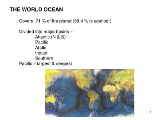
THE WORLD OCEAN Covers 71 % of the planet (59.4 % is seafloor) Divided into major basins – Atlantic (N & S) Pacific Arctic Indian Southern Pacific – largest & deepest
BATHYMETRY OF THE OCEAN FLOOR Structures on the ocean floor are mapped by SONAR - sound navigation and ranging (echo sounding) (speed of sound in H20) depth = time x 1460 meters/sec 2 (round trip) sea floor
Continental Margin: the submerged outer edge of a continent marks the transition between continent and ocean, composed of shelf, slope & rise a. continental shelf - underwater extension of the continent, most biologically productive area because of light availability b. continental slope – sloping transition between the continent (granite) and the deep-ocean floor (basalt) - sediments tumbling down the slope can form turbidity currents which cut submarine canyons (deep, V-shaped valley running perpendicular to the shoreline) c. continental rise – wedge of sediments covering the joint between ocean crust and continental crust NOAA
Ocean Basin: a. abyssal plain - flat, featureless region similar to a desert; common in Atlantic and Indian Oceans, rare in the Pacific b. abyssal hill - occur where sediment is not thick enough to cover the underlying rock completely. Usually extinct volcanoes or small formations of rock once extruded in molten form. c. seamount - peaks of volcanic mountains (sea mountains) d. guyot - submerged, inactive volcano truncated by erosion; like “plateaus” e. island - seamounts extending out of the water. They differ from continents because they have no margins. Volcanic eruptions create and destroy the terrain. Hot spots under moving plates cause island arcs such as the Hawaiian Island chain. Parts of the chain are submerged. More about this later . . .
Hawaii’s volcano, Mauna Kea, is the highest mountain on Earth. It’s 31,000 ft. from the Pacific floor - although only 13,823 ft. of it are above water. f. trenches – arc-shaped depression in the deep-ocean floor with very steep sides and flat sediment-filled bottoms, associated with subduction zones where ocean crust is being recycled into the mantle Trenches form a boundary around the Pacific; called the Ring of Fire because of the volcanic and seismic activity.
Mt. Everest, at 29,000 ft., could fit into the Mariana trench and still be 7,000 ft. below sea level. g. MOR - 40,000 mile long mountain range where new oceanic floor is being formed. Divergent plate boundaries are found in all parts of the ocean - not just in the middle of the Atlantic. NOAA Iceland is a large section of the MOR extending above the water.
h. rift “valley” – down-dropped section of a MOR occurring at divergent plate boundaries, outpouring of magma creates new ocean floor NASA Oceanic bathymetry is very similar to continental topography except that continent features are smaller due to erosion