Download
1 / 8
80 likes | 284 Views
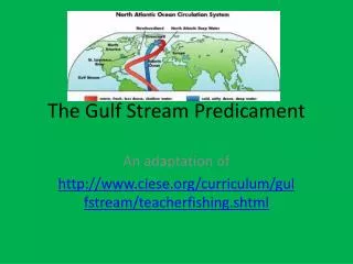
The Gulf Stream Predicament. An adaptation of http://www.ciese.org/curriculum/gulfstream/teacherfishing.shtml. So what’s the problem?.

E N D
The Gulf Stream Predicament An adaptation of http://www.ciese.org/curriculum/gulfstream/teacherfishing.shtml
So what’s the problem? • You and your partner are the owners of an east coast fishing fleet. Among the many game fish your boats pursue is the Yellowfin Tuna, a highly prized fish, found in warm open ocean waters, near the surface. Currently you have boats in the following areas, Cape Hatteras, NC, Boston, MA, and Halifax, Nova Scotia. Unfortunately at this time, your company only has enough money to support one boat to fish, the others will remain at port.Using several sources of real time data, you and your partner must determine which boat would have the greatest opportunity to catch fish. To make the decision, you will study information about the fish, about the waters, and determine what other factors may have an influence over your decision of which boat to send fishing.
Step 1: Where are you? • On your map, you need to locate the following places. • Cape Hatteras, North Carolina • Boston, Massachusetts • Halifax, Nova Scotia (Canada) • Click on this link to help you locate these places. • North American cities • Canadian Cities
Step 2: The Fish • Use the links below to find out about the Yellowfin Tuna. Fill in part of your worksheet about normal geographic range, normal temperature range, and optimal temperature range. • Fishbase: Yellowfin Tuna • Comfort Temperatures
Step 3: Noting the Changes • Click on the link below. You will explore sea surface temperatures in each season. You will need to change the dates at the top to gather information. After you set the date, choose one day and look at the temperatures which are represented by color. Answer the questions on your sheet. • For Winter: Dates: December 2009 – February 2010 • For Spring: Dates: March 2010 – May 2010 • For Summer: Dates: July 2010 – August 2010 • For Fall: Dates: October 2010 – November 2010 • CLICK HERE
Step 4: Current Temperatures • Click on the link below to look at today’s sea surface temperatures. Based on the Yellowfin profile information you have already gathered, can you identify possible areas of the ocean where Yellowfin Tuna may be? • CLICK HERE
Step 5: Narrow it Down • It is important to verify the satellite image. To verify that the satellite is accurately reporting data, collect the sea surface temperature data from a buoy and compare the temperature to the color on the satellite image. • Cape Hatteras • Boston • Halifax
Step 6: Put it all together! • Utilizing all of the data collected, identify which area of the ocean you think the fish might be and which boat should leave port to fish. Be prepared to defend your selection in a group discussion.