Download
1 / 20
210 likes | 241 Views
Learn about NNC's partnership with NOAA and NWS to enhance public understanding and response to flood warnings and forecasts. Explore social science projects, tools, and feedback for better preparedness.

E N D
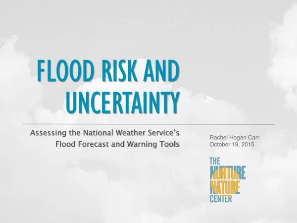
FLOODRISKAND UNCERTAINTY Assessing the National Weather Service’s Flood Forecast and Warning Tools Rachel Hogan Carr October 19, 2015
Nurture Nature Center is a non-profit organization in Easton, PA, that has been working to educate the public about flooding. NNC has undertaken several projects with NOAA and NWS, including its “Focus on Floods” education campaign, to understand and share information about how the public perceives and acts upon flood risk.
Social Science: A Key Step in Building a Weather-Ready Nation • One of four social science projects awarded in 2012 to look at decision-making during extreme weather events. • These projects support NOAA’s Weather-Ready Nation Initiative. • Projects are managed through the Office of Weather and Air Quality in the NOAA Office of Oceanic and Atmospheric Research with funding from the U.S. Weather Research Program and the NOAA National Weather Service (NWS). This presentation was prepared by NNC under award number NA12OAR4590115 from NOAA, U.S. Dept. of Commerce. The statements, findings, conclusions and recommendations are those of the authors and do not necessarily reflect the view of NOAA or the US Dept. of Commerce.
Partners: • East Carolina University • National Weather Service (NWS) Mid-Atlantic River Forecast Center • (NWS) Mt. Holly, NJ Weather Forecast Office • (NWS) Binghamton, NY Weather Forecast Office • RMC Research Corporation (evaluators)
What Is the Issue? NWS flood forecast and warning tools offer tremendous amounts of timely, accurate data. But: People often don’t respond the way they should to protect life and property. FLOOD RISK AND UNCERTAINTY PROJECT “ What we need now is to package and communicate weather warning information so that people understand it and take the right action with the time they are given.” Gary Szatkowski, Meteorologist in Charge of the NWS Philadelphia, PA/Mt. Holly NJ WFO
Research Questions: • How do people living in the Delaware River Basin understand and use NWS products and services in understanding flood risk? • What improvements to NWS flood forecast products would better motivate people to take flood preparedness and response actions?
What Are the Tools? NWS Flood Forecast and Warning Tools: • Advanced Hydrologic Prediction Service (including hydrograph and • flood inundation mapping) • Flood Forecast Watches and Warnings (including flash flooding) • Meteorological Model-Based Ensemble Forecasting System (demonstrate uncertainty in forecasts)
What Methods Are We Using? Focus group participants respond to flood tools through an extreme flood scenario akin to that of the flood of record in the region, the Flood of 1955. • Total of eight focus groups • Four in urban Easton, PA area • Four in less dense Lambertville, NJ • Both are flood-prone communities • with heavy residential impacts EASTON, PA LAMBERTVILLE, NJ
Flood Scenario: A Simulated East Coast Hurricane The 7-day scenario includes a series of products issued by the NWS, including: • Hurricane cones • Hydrographs • Significant River Flood Outlooks • Quantitative Precipitation • Forecasts • Flood Watches and Warnings • Ensemble forecasts showing • uncertainty
Focus Groups: A facilitated discussion about the tools • 15 participants per session, average, flood-affected individuals Participants gave feedback about: • Timing of products • Graphic design and visual clarity • Ways the products motivated action • How they share the information with others
River Levels Matter HYDROGRAPH was the highest-ranked product: • “Very clear, easy to read & useful.” • High results for visual clarity, • usefulness and location specificity. • Suggestion: link every flood • product to hydrograph
Use Color, and Use It Carefully COLORin graphics can help or hurt people’s understanding of risk. Participants discussed: • Positive use of color (Quantitative • Precipitation Forecast) • Confusing use of color (inundation maps • and flood outlooks) • Lack of color/font variations (Flood • Watches and Warnings)
Location Details GEOGRAPHIC SPECIFICITY helps understanding of risk: Use hyper-local info when possible • Poor ratings for this product • due to lack of location detail • Product unhelpful; did not • prompt action
Uncertainty UNCERTAINTY MESSAGESneed to be carefully considered. • Current ensemble forecast graphics were very confusing • Some participants did want to receive uncertainty information • Almost no participants could properly interpret the information from the current suite • of Meteorological Model Ensemble River Forecasts (MMEFS) graphics MMEFS Graphics:
Example of a Draft Mocked-up Hydrograph Incorporates various focus groups recommendations, including the careful use of text, and color variation
Example of a Draft Mocked-up Uncertainty Graphic Incorporates various focus groups recommendations, including the careful use of text, and color variation
Example of a Draft Significant River Flood Outlook Adds geographic specificity, demarcates service area boundaries, differentiates between levels of risk and provides more specific legend.
Transition to Operations • MMEFS – is a regional product.A team including all four RFCs in the region incorporated findings into a new design for products • Team presented new graphics for review to user groups • Implementation anticipated by the end of the year • AHPS – is a national product. Suggested revisions have been put into the NWS requirements process, where they will be reviewed and prioritized. • Significant River Flood Outlook – is a regional product. This study triggered a review of how SRO is generated nationally, and a team is delivering an implementation plan that will incorporate recommendations from the study.
Socialscience.Focusonfloods.org • research bibliography on • social science related to flooding • project information • educational materials • final reports and papers Includes already: In development: Going forward: • Second Social Science Study about • Coastal Flooding tools • (Coastal.Focusonfloods.org)
Thank you! Rachel Hogan Carr Director Nurture Nature Center Easton, PA www.nurturenaturecenter.org www.focusonfloods.org socialscience.focusonfloods.org rhogan@nurturenature.org 610-253-4432