Download
1 / 24
240 likes | 350 Views
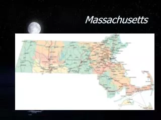
This project aims to develop GIS watershed analysis tools for Massachusetts. These tools provide quick and reliable methods for delineating basins, offering broad applicability to hydrologic investigations. The tools are designed to be flexible and demonstrate their usability through pilot applications that address management concerns. The project involves working with MassGIS to enhance the tools based on project applications and improve features. Development includes compilation of DEM/GRID data, creation of centerline data, and enforcement programs for drainage. The goal is to streamline watershed analysis processes and expedite basin delineation.

E N D
Watershed Tools For Massachusetts Pete Steeves USGS WRD MA-RI District
A Cooperative Environment • MassGIS • development of centerline data (24k) • creation of the ARCVIEW interface and initial set of tools • AVENUE expertise • USGS WRD -- MA/RI District • initial watershed delineation programs in ARC • compilation of DEM/GRID data and drainage enforcement programs • working with MassGIS to enhance the watershed tools with new and improved features based on project applications
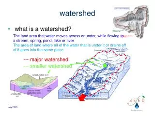
Goals for the Development of GIS Watershed Analysis Tools • Quick and reliable method for delineating basins from any point on any river in the State • Broad and flexible in its applicability to hydrologic investigations • Demonstrate its use through pilot applications that address management concerns
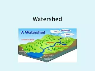
Datalayer Pre-requisites • Networked centerline of USGS DLG hydrography with a system of reach codes attached • Sub-basin boundaries within a watershed that will help to minimize the dependence on DEM based basin delineation and speed up subsequent analysis • Drainage enforced DEM/Grid data
Working Environment: ARCVIEW • Perform actions on the network such as ‘upstream trace’ and ‘find all downstream events’ • Delineate a basin from a selected point on the network • Batch delineate basins using an event table • Make linear events from point events to establish a population of segments
Drainage Enforcement Steps For 24K DEMs • Merge DEM derived grids and ‘clip’ to a 4000 foot buffer around selected watershed • ‘VIP’ 70% of the cells into a point coverage • Run ‘Topogrid’ • resample cell size to 10 meters • input would include vector centerline and VIP elev points • watershed may have to be broken up and pieced back • Run ‘agree.aml’ from University of Texas • exaggerate the depths of the streams by canyonizing them • enhances the topogrid processing • minimize smooth distance tolerance • Run ‘fill’ on the output, followed by ‘flowdirection’ and ‘flowaccumulation’
Application I • Obtaining streamflow statistics for Massachusetts streams on the WEB • User chooses any point on any stream • The watershed is delineated • The application calculates variables(area of stratified drift, total length of streams, mean elevation and slope values) from which stream flow statistics are calculated, including: • Peak-flow frequencies - mean annual, 10-, 25-, 50-, 100-, and 500-year floods • Low-flow frequencies - 7-day, 2- and 10-year low flows • Flow durations - 99 through 1 % exceedance probabilities • August median flow
THE STREAM STATISTICS WEB PAGEhttp://ma.water.usgs.gov/streamstats/
Application II • Characterize water resources (streams, lakes/ponds) on a river network (Neponset River Basin) for water-quality monitoring: • Define a population of stream segments • Determine physical characteristics of stream segments (length, stream order) • Classify stream segments in terms of watershed characteristics that might affect water quality (i.e. - land use)
Stream Segments are Defined Based on Locations Where a Change in Water-Quality May Occur: Tributary confluences Significant lakes (> 5 acres) Significant point-source discharges (NPDES sites)
Physical Characteristics of StreamsNeponset River Basin Total: 312 stream segments152 stream miles 45 significant lakes(not shown) Stream Order
Determining Watershed Characteristics Requires Delineating Watersheds Batch Delineation
Development of Watershed Tools in the NHD ArcView Toolkit • Currently working on adding watershed delineation functionality to the Toolkit • Focusing on areas where 1:24,000 scale National datalayers are available • Testing the validity of using 1:100,000 scale NHD • Plans to incorporate other tools into the Toolkit (event creation and search, a raindrop tool, batch delineation of watersheds…)