Download
1 / 35
460 likes | 1.08k Views
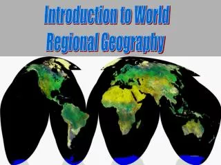
World Regional Geography. Instructor: Jessica Douglas Lecture 1 Introduction. Introduction to World Geography. Census Syllabus Ch. Introduction Lecture Intro Activity Video Student Questions. A World on Maps. IN THIS CHAPTER The power of maps The spatial order of the world

E N D
World Regional Geography Instructor: Jessica Douglas Lecture 1 Introduction
Introduction to World Geography • Census • Syllabus • Ch. Introduction Lecture • Intro Activity • Video • Student Questions
A World on Maps IN THIS CHAPTER • The power of maps • The spatial order of the world • Global climate change • Dangerous places • Globalization and its discontents • The power of place World Geography
A World on Maps INTRODUCTIONA World on Maps Geography’s Perspective Maps in Our Minds • Mental Maps • Maps in our minds of our activity spaces The Map Revolution • Cartography—the making of maps • Remote Sensing—scanners and cameras on satellites send information to computers on Earth • Geographic Information System (GIS)—programs allow presentation and analysis of spatial data Spatial Perspective—spatial patterns are crucial to how we live and how we organize our societies • Space on the Earth’s surface • Organization of that space
Geography’s Perspective Environment and Society Spatial Patterns Relationships between human societies and the natural (physical) environment • Humans transforming natural surroundings • Humans dependent on the natural environment, behavior a product of that dependence The intersection of social and natural sciences and integrated perspectives from both Knowledge of location and distribution of significant features of Earth’s surface • Human and natural worlds • Temporal (historical) perspective
Scale and Scope Scale and Scope • Scale—relationship between distance on a map and distance on the ground expressed as a ratio • Small-scale map—ratio between map distance and real-world distance is very small • Operational scale—scale at which social or natural processes operate
Realms WORLD GEOGRAPHIC REALMS Geographic Realms—global neighborhoods possessing particular combinations of environmental, cultural, and organizational properties • Criteria • Physical and human • Functional—interaction of human societies and natural environments • Historical—interaction over time
Realms WORLD GEOGRAPHIC REALMS Boundaries and Transition Zones • Natural boundaries—oceans and seas • Transition zones—where two geographic realms meet, no sharp boundaries
Realms WORLD GEOGRAPHIC REALMS Two Varieties of Realms • Monocentric—dominated by a single major political entity, in terms of territory and/or population • Example: United States, Mexico, China, India, Russia, Australia • Polycentric—appearance, functioning, and organization of the realm are dispersed among a number of more or less equally influential regions or countries • Example: Europe, North Africa/Southwest Asia, Sub-Saharan Africa, Pacific Realm
Regions REGIONS WITHIN REALMS Criteria for Regions • Area—space occupied on Earth’s surface • Boundaries—nature’s sharp divisions or divisions determined by using specific criteria • Location—region’s name may give a clue • Absolute location—latitudinal and longitudinal coordinates • Relative location—location with reference to other regions Regional concept—refined level of spatial classification requiring more specific criteria • Region—device that allows making spatial generalizations, based on selected criteria to construct them
Regions Criteria for Regions • Homogeneity—sameness • Formal regions—display measurable and often visible internal homogeneity • Regions as systems—functional integration (the way they work) • Spatial systems—formed by the areal extent of the activities that define them • Core—heart, center of activity • Hinterland—surrounding zone of intersection • Functional region—forged by a structured, urban-centered system of interaction with a core and a periphery Interconnections • All human regions are interconnected • Globalization—Paradoxical effect • Regions and places become more alike, more homogeneous • Contrasts can become stronger
Physical Landscapes THE PHYSICAL SETTING Natural (Physical) Landscapes • Natural landscapes—mountain chains to coastal plains • Influence human activity and movement
Geology and Natural Hazards THE PHYSICAL SETTING Geology and Natural Hazards • Continental drift • Pangaea—supercontinent that broke up and continues to drift apart • Tectonic plates—lighter rock continents rest on slabs of heavier rock plates that move by magma circulation cells within the Earth • Collision of tectonic plates causes earthquakes and volcanic eruptions
Geology and Natural Hazards THE PHYSICAL SETTING Geology and Natural Hazards Pacific Ring of Fire • Zone of active volcanoes and earthquake epicenters that completely encircle the Pacific Ocean
Climate THE PHYSICAL SETTING CLIMATE Ice age—periods when average temperatures were low, allowing glacial ice to expand toward the equator Cyclical periods • Glaciations—cold phases with glaciers expanding • Interglacials—warm phases with ice receding
Climate Change THE PHYSICAL SETTING • Global Climate Change • Natural and anthropogenic (human-source) causes or warming or cooling • Greenhouse effect • Sun’s radiation becomes trapped in the Earth’s atmosphere, leading to climate changes • Intergovernmental Panel on Climate Change (IPCC) • Predicts a global temperature increase of several degrees with significant regional variability • Natural vs. Anthropogenic Climate Change: • How has Earth’s climate changed over time? • What causes climate to change? • Which form is most relevant to the world now? • What can people do to reduce greenhouse gas emissions and slow global warming?
Climate Classifications Climatic Regions • Weather—immediate state of the atmosphere in a certain place at a given time • Climate—aggregate, total record of weather conditions at a place or a region over an entire period during which records have been kept • Classifications: Köppen’s Climatic Regions • A climates—equatorial and tropical • B climates—dry • C climates—temperate • D climates—cold • E climates—frigid, polar • H climates—highlands
Climate Regions Climatic Regions • A—Humid Equatorial Climate • High precipitation and temperatures • Three A Climates • Af—tropical rainforest • Aw—tropical savanna • Am—tropical monsoon Climatic Regions • C—Humid Temperate Climate • Mid-latitudes with no temperature extremes • Three C Climates • Cf—no dry season • Cw—dry season in winter • Cs—dry season in summer Climatic Regions • B—Dry Climate • Low precipitation with varying temperature averages • Two B Climates • BS—semiarid • BW—arid
Climate Regions Climatic Regions • D—Humid Cold Climate • Continental with temperature extremes • Two D Climates • Df—no dry season • Dw—dry season in winter Climatic Regions • E—Cold Polar Climate • High latitude, large temperature ranges • Two E climates • ET—tundra • EF—ice • H—Highland Climate • High altitude, large temperature ranges
Population Realms REALMS OF POPULATION • World population—7.1 billion • Occupies less than 30% of Earth’s surface Major Population Clusters • Population distribution—every dot represents 100,000 people • Population density—number of persons per unit area • Urbanization—percentage of the total population living in cities and towns Major Population Clusters • South Asia—became world’s largest cluster in 2010 • Centered on India, Pakistan and Bangladesh • East Asia • Centered on China • Europe • Europe including western Russia • Three clusters account for almost 4 billion people
Cultural Realms REALMS OF CULTURE Cultural landscape—distinctive attributes of a society imprinted on its portion of the world’s physical stage The Geography of Language • Language—essence of culture • Language families • 15 language families—shared but distant origins • - Indo-European—most widely distributed language family • - ex. English, French, Spanish, Russian, Persian, Hindi • Lingua franca—common second language used in government, commerce, and higher education • English primacy a result of colonization and globalization
Religions Landscapes of Religion • Crucial influence on world civilizations and history • Strong connection between realms and religion
World Countries A WORLD OF STATES • 200 countries (states) in the world • States—countries • Sovereignty—government of a state rules supreme within its borders • European state model—assumed that state and nation were ideally conterminous • Nation-state would enclose an ethnically and culturally homogeneous people within a national boundary
World Countries A WORLD OF STATES • Ideal state—defined as a clearly and legally defined territory inhabited by a citizenry governed from a capital city by a representative government • Modern state—challenged • “From below” by ethnic minorities and regional secessionist movements • “From above” through increasingly powerful international organizations
Countries, Realms, Regions A WORLD OF STATES States, Realms, and Regions • Realms—assemblage of states • Realm boundaries • Coincide with boundaries between states • Can cut across a state • Consist of groups of states whose boundaries mark the limits of the realm
Politics A WORLD OF STATES Political Geography • Shapes world-scale geographic regions • Global boundary framework continues to change
Economies and Development GEOGRAPHIES OF DEVELOPMENT Economic Geography—focuses on spatial aspects of ways people make their living and the patterns of production, distribution, and consumption of goods and services Development—gauges a state’s economic, social, and institutional growth
Development GEOGRAPHIES OF DEVELOPMENT Core-Periphery World • Core areas—places of dominance whose inhabitants exerted their power over their surroundings near and far • Periphery—sustained the core • Spatial networks—nodesof variable centrality and importance
Globalization GLOBALIZATION • Globalization—geographical process in which spatial relations (economic, cultural, political) shift to ever broader scales • World is getting ever more interconnected
Globalization Global Challenges, Shared Interests • Global warming—threat to world • Conference on Climate Change (2011) • Governments from around the world committed themselves to preparing a comprehensive global agreement to reduce greenhouse gas emissions • Developed (including United States) and developing countries included • Target date for completing all agreements is 2015 • Actual reductions commence in 2020 • Global migration—flows create global cultural interaction • Transnational migrants
Globalization +/- Winners and Losers • Win • International capitalism, open markets, free trade • Globalization breaks down barriers to foreign trade, stimulates commerce, brings jobs to remote places, and promotes social, cultural, political, and other kinds of exchanges • Lose • Uneven development, inequality
Globalization and Income • Gross National Income—GNI • Total income earned from all goods and services produced by the citizens of a country within or outside its borders during a calendar year • Emerging markets • World Trade Organization (WTO) • Countries must agree to open their economies to foreign trade and investment • 154 member-states
Global Framework and Perspective REGIONAL FRAMEWORK AND GEOGRAPHIC PERSPECTIVE • Geography is both a social and physical science • Types of study: • Regional geography—borrows information from many sources to create an overall image of the world • Systematic geography—topical study with a spatial perspective
Homework/Activity Read Textbook Introduction Chapter Intro Activity in class (Orientation using campus map, Latitude/Longitude assignment) Sign-insheets will be provided for all future activities; attendance is required for activity credit. Website: http://geographyventuracounty.info/ Homework: Choose one “@from the Field Notes” subsection topic in Ch.0 textbook; summarize (1 page) and search the ‘www.’ link to learn more.