Download
1 / 13
130 likes | 243 Views
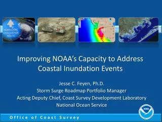
Improving NOAA’s Capacity to Address Coastal Inundation Events. Jesse C. Feyen , Ph.D. Storm Surge Roadmap Portfolio Manager Acting Deputy Chief, Coast Survey Development Laboratory National Ocean Service. NOAA’s Storm Surge Roadmap.

E N D
Improving NOAA’s Capacity to Address Coastal Inundation Events Jesse C. Feyen, Ph.D. Storm Surge Roadmap Portfolio Manager Acting Deputy Chief, Coast Survey Development Laboratory National Ocean Service
NOAA’s Storm Surge Roadmap Bottom line: comprehensive NOAA strategy to holistically address needs and establish a coordinated response • Plan for improving models, products and services • Addresses tropical and extratropical cyclones • Cross-NOAA team of experts • NWS, NOS, and OAR experts in meteorology, oceanography, observing, modeling, social science, …
Storm Surge Roadmap Vision Highly accurate, relevant, and timely information CLEARLY COMMUNICATED which results in reductions in loss of life and ensures communities are resilient
Roadmap Goals Customers Ask: • Who will get flooded? • How much? • When? • What will the impacts be? Roadmap Goals: • Accurately predict and assess storm water levels • Total Water Level (TWL) • Intuitively describe inundation as flooding above ground level • Communicate actionable information
NOS Water Level Observations • National Water Level Observational Network (NWLON) • tidesandcurrents.noaa.gov/nwlon.html • Ingested by NWS into AWIPS and accessible via publicly available web services • http://opendap.co-ops.nos.noaa.gov/ioos-dif-sos/ • Preliminary data delivered to NWS for post-storm reports within days of a tropical cyclone
NOS Storm QuickLook • Highlights real-time water level and meteorological observations at coastal locations affected by a tropical cyclone • Updated 4 times daily, following NWS public advisories for tropical cyclones impacting the U.S. coast tidesandcurrents.noaa.gov/quicklook.shtml
Clarifying Water Levels and Datums • Inundation occurs when storm tide levels reach normally dry ground, and NHC forecasts describe flooding above ground • Mean Higher High Water (MHHW) is being used to approximate where inundation could begin • Storm Quicklook and NOS web services include water level data relative to MHHW National Ocean Service working with the National Hurricane Center (NHC) to alleviate confusion regarding tidal datums
Advancing Storm Surge Model Guidance • NOS & NWS are building total water level models • Working to combine effects of storm surge, tides, waves, and rivers into operational surge models • Accelerating transition of research to operations • Partnering with researchers on new prediction capabilities • Developing new operational models
Upgrading Operational SLOSH Model: Tides Surge + Tides = SLOSH+Tides • NOS’ tide model coupled to NWS’ surge model • Added to operational probabilistic SLOSH guidance PSurge • Utilizes hundreds of individual SLOSH tracks per forecast
Extratropical Surge and Tide Prediction • Extratropical Surge+Tide Operational Forecast System (ESTOFS) running in Atlantic • First operational surge model to include tide signal • Delivers surge, tide, and combined water level • Output produced 4 times per day • Being installed in AWIPS • Pacific version in development http://www.opc.ncep.noaa.gov/estofs/estofs_surge_info.shtml http://www.ftp.ncep.noaa.gov/data/nccf/com/estofs/prod http://nomads.ncep.noaa.gov/
ESTOFS Water Level Fields EC2001 grid (NetCDF) NDFD 2.5 km CONUS grid (GRIB2)