Download
1 / 27
330 likes | 626 Views
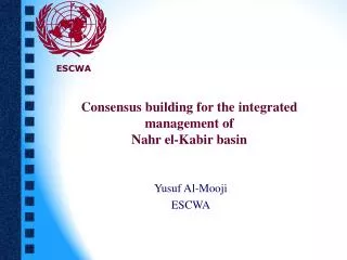
Consensus building for the integrated management of Nahr el-Kabir basin. ESCWA. Yusuf Al-Mooji ESCWA. Consensus building for the integrated management of Nahr el-Kabir basin. Natural characteristics Water management issues Water management options. Nahr el-Kabir: Basic information.

E N D
Consensus building for the integrated management of Nahr el-Kabir basin ESCWA Yusuf Al-Mooji ESCWA
Consensus building for the integrated management of Nahr el-Kabir basin Natural characteristics Water management issues Water management options
Nahr el-Kabir: Basic information • Catchment area: 991 km2 • Highest point: 2215 m (Qarnat Araba in Lebanon) • Channel length: 56 km • Current population: ~ 400,000
Fig 2: Study area with simple topographic divisions and major settlements
Natural characteristics : Geomorphologic features • The southern catchment zone • The northern catchment zone • The Sahlet el Bqaiaa • The Gorge • The Akkar-Hamidiye plain
Natural characteristics : Drainage system • Controlled mainly by the Yammoune/Akkar fault systems • Two major sub-basins: • Noura el Tahta-Arouss: 572 km2 • Safa-Raweel: 491 km2
Fig 4: Major drainage superposed on a digital terrain model of the watershed area
Fig 5: Major Drainage superimposed on the hydrological monitoring network
Natural characteristics: geo(hydro)logical features • Regional context • Dead Sea /Yammouneh Fault system • Palmyrides fold belt/ Jhar fault system • Mount Lebanon massif/Jebel Ansariyah massif • Akkar fault
Fig 6: Surface Geology of Nahr el-Kabir Basin (re-drawn from FAO, 1972) Faults Anticline axis River Syncline axis Monocline axis Holocene (unidentified) Pliocene (sst/lst) Miocene (marl, cgl, lst) Pleistocene (lst, marl) Lower Cretaceous (mudstone, lst) Albian (dol, lst, marl) Cennonian Jurassic (dol, lst) Pliocene Volcanic Scale: 1-200,000
Natural characteristics : geo(hydro)logical features • Aquifer system • Upper basalt in hydraulic connectivity with overlying alluvium (water level 5-10 m in 1971) • Lower basalt (confined aquifer) separated from upper basalt by a 2-m thick clay
Fig 7: The mean monthly precipitation in the el-Kabir watershed
Natural characteristics : geo(hydro)logical features • Rainfall • Southern catchment (Akkar): 1000 mm • Sahlet el Bqaiaa (Tell Kolkh): 871 mm • Watershed range (mean annual): 600-1000 mm • Surface water discharge (1931-1980) • Arida station (Safa-Raweel): 165 Mm3 • Daboussiyeh station (Noura el Tahta-Arouss): 323 Mm3
Natural characteristics : geo(hydro)logical features • Groundwater discharge (springs) • Safa-Raweel sub-basin: 140.5 Mm3 (Nassiriyah, Farash, Safa) • Noura el Tahta-Arouss: 13.8 Mm3 (Khalifa) • Groundwater recharge • Recharge estimated at 15% of rainfall in Akkar • Hydraulic parameters • Transmissivity > 10-2 m2/s (lower basalt)
Water management: demand side • Lack of awareness on water issues • One of the least developed regions • Lack of adequate infrastructure • Increasing demand for fresh water • Increasing population • Increasing urbanization • Intensification of agriculture
Water management: supply side • Abundant supply of freshwater • No signs of surface water reduction yet But • Increasing risk of pollution • Uncontrolled groundwater abstraction • Potential risk of recharge reduction
Water management options :basis for consensus • A basin-wide management approach • A surface water-groundwater conjunctive development, use, and management • A regional development policy and water-use strategy • Effective involvement of all stakeholders • Balancing water quality and quantity
Water management options : underlying principles of the Lebanese-Syrian water-sharing agreement • Objective criteria based on the 1997 UN Convention • Ecological considerations • Joint implementation mechanism • Data legitimacy • Win-win strategy
Water management options : Priorities for activation of agreement • Current ESCWA-BGR involvement • Training workshop for Lebanese-Syrian delegations on negotiation skills and dispute resolution over international water resources (Beirut, October 2003) • Supporting and promoting the Nahr el Kabir positive experience
Water management options : Priorities for activation of agreement • Proposed short-term (future) ESCWA-BGR involvement • Assessing the hydrological monitoring needs of the basin • Guidelines for joint operation and management of proposed dam and reservoir • Guidelines for assessing the socio-economic and environmental impacts of the proposed dam • Preliminary survey of groundwater resources