Download
1 / 17
180 likes | 379 Views
Ice Thickness Measurements Over Antarctica and Overview of PRISM. Pannirselvam Kanagaratnam & Sivaprasad Gogineni Radar Systems and Remote Sensing Lab ITTC University of Kansas 2335 Irving Hill Road, Lawrence, KS 66045 Tel: 785/864-7742, Fax: 785/864-7789 E-mail: pkanagar@rsl.ku.edu.

E N D
Ice Thickness MeasurementsOver AntarcticaandOverview of PRISM Pannirselvam Kanagaratnam & Sivaprasad Gogineni Radar Systems and Remote Sensing Lab ITTC University of Kansas 2335 Irving Hill Road, Lawrence, KS 66045 Tel: 785/864-7742, Fax: 785/864-7789 E-mail: pkanagar@rsl.ku.edu
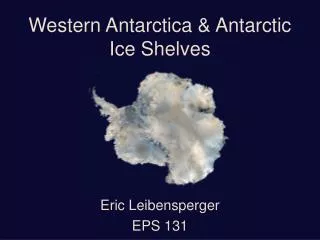
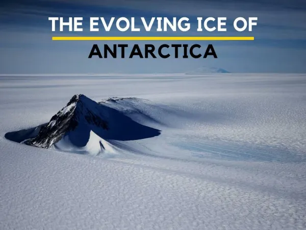
Motivation • Recently outlined in an article titled “On Thin Ice?” in Scientific American (Dec 2002). • How soon humanity will have to move inland depends in great part on how quickly West Antarctica’s massive ice sheet shrinks. • It holds more than three million cubic kilometers of freshwater. • Global sea level would rise five meters if the ice sheet were to disintegrate completely. • It would swamp coastal lowlands and force many of their two billion inhabitants to retreat inland.
Introduction • The Pine Island and Thwaites glaciers (PIG/TG) are the fastest measured glaciers in Antarctica. • They have been identified as the part of the West Antarctica ice sheet most prone to instability. • The reasons for the rapid retreat of these glaciers have not been resolved, due to insufficient data. • In particular, the role of ice shelves in regulating the ice discharge of these glaciers has been a point of contention in the glaciology community.
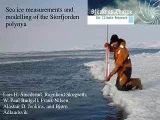
Approach • To help resolve this issue, the Centro de Estudios Científicos (CECS) and NASA, with the support of the Armada de Chile, conducted airborne remote sensing missions. • We conducted four missions over the PIG/TG regions and two missions over the Antarctic Peninsula. • The University of Kansas operated its Coherent Radar Depth Sounder (CORDS) to measure the thickness in these regions. • NASA operated its Laser Altimeter Topographic Mapper (ATM) to measure the surface elevation.
System Description • COherent Radar Depth Sounder (CORDS) is a coherent pulse-compression radar. • The combination of pulse compression and coherent processing has allowed us to obtain high-sensitivity and high-resolution in the along-track direction while keeping the transmitted power low. • CORDS transmits a 140-160 MHz chirp signal with 200 Watts of peak power (<4 W average power) and has a vertical resolution of about 5 meters in ice. • We used four-element dipole arrays on either side of the wing to transmit and receive the radar signals
CORDS installed in a rack on the Chilean Navy’s P-3 Dipole antenna array mounted on the wing of the P-3 System Description (II)
Signal Processing We performed the following signal processing steps: • 10 coherent averages are done to reduce the random noise. • The DC offset is estimated using the tail end of the A-scope where there are no signals from ice. It is then subtracted from the A-Scope. • Gain compensation is applied to normalize the noise power in the echogram. DC offset removal and gain compensation remove the fluctuations in the intensity levels of the noise. This results in an echogram that has good contrast between the ice features and the background noise. • Coherent Noise Reduction is performed to remove coherent noise such as antenna leakage and feed-through signals. An estimate of the coherent noise is obtained by averaging the received signal over a fairly long period (5 seconds). This ensures that signals from the ice decorrelate. The coherent noise estimate is then subtracted from each record.
Flight Lines 2002 Antarctica Missions
Pine Island Glacier Radio echogram along Pine Island Glacier Thickness profile along Pine Island Glacier
Thwaites Glacier Thickness profile across Thwaites Glacier Radio echogram across Thwaites Glacier
A-Scopes Smooth bedrock Rough bedrock
Summary • The Pine Island and Thwaites glaciers are the fastest measured glaciers in Antarctica. • The reasons for their fast retreat have not been determined, due to insufficient data. • NASA and CECS conducted four airborne missions over PIG and TG to measure the surface elevation and ice thickness. • The University of Kansas operated its Coherent Radar Depth Sounder to obtain ice thickness over these glaciers. • We were successful in measuring the ice thickness over 99% of the PIG and TG flight lines.
This project aims to design and develop a sensor web with intelligent radars to measure ice thickness and determine bedrock conditions below the ice sheets in Greenland and Antarctica. • Grant from NSF and NASA • International collaboration • University of Alaska-Fairbanks • NASA's Jet Propulsion Laboratory • Ohio State University • U.S. Army Cold Regions Research and Engineering Laboratory • University of Chicago • University of Copenhagen (Denmark) • Alfred Wegner Institute (Germany) • University of Bristol (UK) • Australian Antarctic Division • Phoang Institute of Technology (Korea) • Involves the following labs in ITTC • Radar Systems & Remote Sensing • Intelligent Systems & Information Management • Networking & Distributed Systems • Wireless Communications & Digital Signal Processing Polar Radar for Ice Sheet Measurements (PRISM)
Three main objectives: • a) determine the presence or absence of a film of water between • the ice and the bedrock; • b) measure ice thickness and • c) map internal layers in both shallow and deep ice. • Monostatic/Bistatic SAR generates two-dimensional reflectivity maps of the ice bed for determining basal conditions, including the presence of water. • The dual-mode radar measures ice thickness and maps internal layers in both shallow and deep ice. • The system must • collect, process and analyze radar data in conjunction with a priori information— RADARSAT • determine and select an optimum sensor configuration–bistatic or monostatic SAR and platforms’ distance • have intelligence—a requirement for future planetary sensors. Objective and Method
Sensors • Each rover will be equipped with • A monostatic/bistatic synthetic aperture radar (M/BSAR) • A multi-frequency dual-mode radar for determining ice thickness (h) and near-surface internal layers. • Sensors for navigation and communication • Intelligent processor, command and control system. • The distance between platforms (d) for SAR imaging is a function of ice thickness, which is measured by the dual-mode radar.
Outreach • PRISM has a strong public outreach and educational program. • Alliances with staff from Haskell Indian Nations University and ALTEC (Advanced Learning Technologies). • The K-12 outreach will provide educational resources related to: a) polar regions and their inhabitants b) global weather and climatic change c) radar d) robotics • There will also be near-real-time broadcasts of data from the field. • Will transform the data into maps more easily understood by the general public. • http://www.ku-prism.org/