Download
1 / 14
140 likes | 249 Views
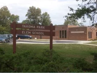
Takoma Park is home to approximately 4,000 street trees and 1,240 trees in parks and parcels within a 2.5-square-mile area, serving 17,000 residents. The tree inventory reflects 58 genera and 110 species, with Quercus, Acer, and Prunus as the most prevalent. The city manages tree maintenance, removal, and pruning through web-based forest management tools, tracking both financials and resources. Takoma Park emphasizes sustainable practices by recycling organic waste and sourcing local tree mulch, promoting community engagement in urban forestry.

E N D
Takoma Park Trees Where? What? When? Why?
Parameters • 2.5 square miles • 42 miles of road • 17,000 residents • 4,000 street trees • 1,240 park and parcel trees • 250 removal permits annually • 100 protection permits annually
Original Inventory: Davey Resource Group, 2001 • 4,697 trees, stumps and sites • 58 genera 110 species • Quercus comprised 25% of inventory, Acer 16% and Prunus 7.2% • 38% <6, ~51% >6”but < 24”, 11% >24” • 61 trees Excellent, 2,197 Good, 1,570 Fair, 462 Poor, and 37 dead. • 157 recommended removals, 461 Hazard Reduction Pruning, 3,709 maintenance pruning
Flat files and maps • Street tree data in spreadsheet format • Web based forest management software • Work order forms • Reports available • Finance tracking
Learning GIS Data Management Transforming flat file datasets to georeferenced GIS information can require negotiating several corners, but it can be done. After 6 years what was still good? What parcels were what? When 16 trees were on one lot? How can faulty data be used/corrected?
Parks and municipal property • Tree in parks and undeveloped property were mapped using ESRI • Included all city owned parcels excepting ROWs • The same set of web based management tools were available for this set of trees.
Resources • No field staff dedicated to tree care • $110,000 budget for tree work • $10,000* plus various fees for planting • $15,000 for resource management
Information requirements • Existing trees • Existing tree spaces and limitations • Utilized tree spaces • History of tree work • History of tree spaces • Requested tree work • Requested tree installations • Special tree needs
Edited Data To make the data usable: • Georeference • Refer to spaces not trees • Relate to tree data • Create additional data sets with history of trees including work or requests for service
GEO Database Design • Site information • Address • Which side of road • What block of road • What size space • Is there overhead conflict, underground • Is it occupied (link to following table) • History of trees in space (another linked table with perhaps other linked tables) • Other issues • Information for current tree, if present • Type • Date planted • Source • Size • Pruning\problems history (maybe another table with dates, amounts, contractor, costs, reason) • Public complaints requests • Date • Request • Response
In the meantime • Use what we got • Work to enter data • Edit incorrect data • Make others aware of potential • Combine with other data sets for mapping and analysis.
Green waste, or gold ?Takoma Park • Uses raw wood chips from our trees for mulch in some areas • Buys locally manufactured chips for playgrounds and locally produced mulch for gardens
Takoma Park • Recycles yard waste excepting grass clippings for reuse by TP citizens or other people within 10 miles • Cooperates with citizens desiring stove or fireplace wood
Has been working with Woodmizer owners and other woodworkers


![[t]inking about takoma](https://cdn1.slideserve.com/2255899/t-inking-about-takoma-dt.jpg)


![[t]inking about takoma](https://cdn2.slideserve.com/4849323/t-inking-about-takoma-dt.jpg)