Download
1 / 19
190 likes | 306 Views
Understanding the necessity of Low Impact Development (LID) in Mecklenburg County to mitigate water quality issues due to increased development. Learn the goals, working principles, strategies implemented, and the comprehensive approach to stormwater management. Explore case studies, such as Gar Creek in Huntersville, and the McDowell Creek Water Quality Model to grasp the significance of LID techniques in reducing pollutants effectively.

E N D
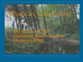
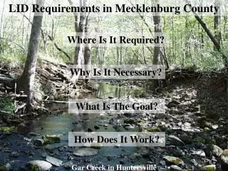
LID Requirements in Mecklenburg County Where Is It Required? Why Is It Necessary? What Is The Goal? How Does It Work? Gar Creek in Huntersville
Huntersville Jurisdiction Effective February 2003 Stream Miles = 40 Impaired Stream Miles = 25 @ 63% Town Limits = 38.9 square miles ETJ = 22 square miles Total Area = 60.9 sqaure miles
Increased Development Results in Declining Water Quality Conditions
Storm Water Runoff Pollutants Bacteria Sediment Heavy Metals Pesticides Fertilizers Petroleum Products
Channel erosion due to storm water runoff volumes and rates.
Mountain Island Lake McDowell Creek, Huntersville
McDowell Creek Water Quality Model Developed by Tetra Tech, Inc. – Private consulting firm Objectives of the Modeling Effort: Quantify the negative impacts Identify causes Predict future impacts Develop solutions
Modeling Results Total Phosphorus Total Nitrogen Bank Full Conditions Existing Future Existing Existing Future Future
Goal Established by Elected Officials To establish storm water management requirements and controls to prevent surface water degradation by controlling discharges of pollutants as well as runoff volumes and rates.
Performance Criteria: 6 Basic Elements Need to be addressed: • 85% TSS removal. • Using LID treat the runoff from the first 1 inch of rainfall. • Use LID in combination with conventional practices to treat the difference in runoff from pre versus post conditions for the 2 year 24 hour storm. • Any temporary water quality storage pools must drawdown in 48 to 120 hours. • Peak storm water runoff rates shall be controlled for development above 12% impervious • No one BMP shall receive runoff from an area greater than 5 acres.
Conventional LID Wet Ponds Rain Gardens Grassed Swales Dry Ponds • Use a combination of conventional and Low Impact Development (LID) techniques to mimic, to the extent practicable, the natural hydrology of a site by: • infiltrating, • storing, • retaining, and • detaining • storm water.
BMPs for Use in Huntersville (Tables 6.1 and 6.2, Pages 48 and 49) BMP Applicable Zoning Districts(1) Applicable Performance Criteria (2) Design Function(3) Function(4) (WQ, VC, PC) Strategic Clearing & Grading U, T, R 3(a) WQ, VC, PC Reduce Impervious Surfaces U, T, R 3(a) WQ, VC, PC Bioretention (Rain Garden) U, T, R 3(a), 3(b) Section 4.0 WQ, VC, PC Infiltration Trench U, T, R 3(a), 3(b) Section 8.0 WQ, VC, PC Infiltration Swale U, T, R 3(a), 3(b) Section 8.0 WQ, VC, PC Swales U, T, R 3(a) Section 5.0 WQ, VC Swales with Outlet Control T, R 3(a), 3(a) Section 5.0 WQ, VC, PC Vegetative Filter Strips & Buffers U, T, R 3(a) Section 7.0 WQ, PC Dry Well, Cistern & Rainbarrel U, T, R 3(b) WQ, VC, PC Porous Paving U, T, R 3(b) WQ, VC Curb & Gutter Elimination R 3(b) WQ, PC Rooftop Storage U, T, R 3(b) VC, PC Wet Pond U, T, R 3(b), 3(d) Section 1.0 WQ, VC, PC Extended Dry Pond T, R 3(b), 3(d) Section 6.0 VC, PC Storm Water Wetlands T, R 3(b) Section 2.0 WQ, VC, PC Sand Filter T, R 3(a) Section 3.0 WQ, VC, PC (1)Applicable Zoning Districts: These are the Zoning Districts where the BMP can be used including U = Urban; T = Transitional; R = Rural. (2)Applicable Performance Criteria: These are the Performance Criteria Section numbers (see Section 3) that the BMP can be used to satisfy. (3)Design Function: All BMP designs are contained in the N.C. Department of Environment & Natural Resources, Storm Water Best Management Pratices, April 1999 (4) Functions: These are the dominate functions that the BMPs perform including WQ = Water Quality; VC = Volume Control, PC = Peak Control.
Other Areas of Mecklenburg County where LID is being Considered Davidson Goose, Duck & Stevens Creek Watersheds in Mint Hill