Download
1 / 29
290 likes | 548 Views
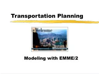
Christchurch Transportation Planning Post Feb 2011 Earthquake. Presented by Andrew Metherell. Contents. Introduction Land Use Available Data Estimating Changes Modelling The CTM Application and Results. Where is Christchurch?. Christchurch Statistics. Population: 415,000

E N D
Christchurch Transportation Planning Post Feb 2011 Earthquake Presented by Andrew Metherell
Contents • Introduction • Land Use • Available Data • Estimating Changes • Modelling • The CTM • Application and Results
Christchurch Statistics • Population: 415,000 • Households: 150,000 • Total Area: 1,425 km2
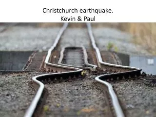
~1,200 road surface defects >50,000 road surface defects
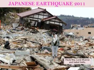
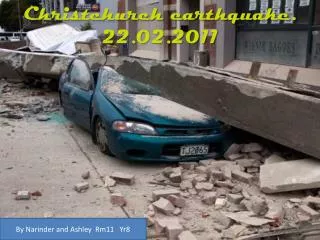
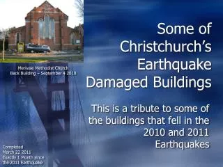
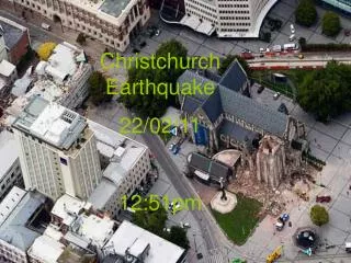
The Effects • Roads closed, CBD shut • Households, business, schools and shops re-located • Traffic increases on key routes • Increased travel time • Reduced trip reliability
The Responses • “Get Christchurch Moving” – Emergency Response • “Keep Christchurch Moving” • Review of Forward Capital Works Programme • Utilise Christchurch Transportation Model (CTM)
The Model • Land use based, various forecast years • Person-based travel • Strategic network representation • Wide geographic area • Daily travel calculations
Policy Assumptions Land Use Data Network Data Zonal Trip Ends Generation Modal Choice Trip Distribution Route Choice (Assignment) Results Christchurch Transportation Model
Modelling Plan • Immediate effects covered by emergency response • 6 month post EQ (2011) • Compare pre and post EQ travel demand changes • Confirm observed change in travel patterns • 5 years hence, 2016 various rates of recovery to CBD • Identify recovery travel demand changes • Test forward work programme effects • Long term, 2026 and 2041, assume full recovery (for now)
Land Use – Available Data • Post Redirections • Residential “stickers” (red/yellow/green) • Local knowledge • Transport planners • Real estate experts
Household Postal Redirections • FROM • TO • As of 12 April 2011 • 64% redirects remain with City
Net Postal Redirections • 3,700 redirects from (red) • 2,400 redirects to (green) • Excludes PO boxes
“Stickers”/Placards • What do the three colours mean? • RED – Do not enter a red placarded building because it is unsafe • YELLOW – Buildings suitable for restricted access until issues are resolved • GREEN – Building accessed and no structural hazards apparent
Residential “Sticker” Status • Red or yellow stickers • 5,750 households “lost”
Land Use – Estimating Changes • Determine overall net loss (pop/HHs) • Determine geographic distribution • Reductions • But increases in some areas • With CBD closed, where will business (& jobs) be?
Net Loss – Population / HHs • Population loss • 10,000 Christchurch • Estimate household reduction from population (2.6 ppl/hh) • 3,800 less households Waimakariri Christchurch Selwyn
Geographic Distribution • Household loss areas • Residential sticker status • Postal redirection • Vacant residential land • Where will people move to? • Zoned “vacant” residential land • Some in damaged areas
CBD Job Loss • Main job loss in CBD • Unemployment likely to rise (so fewer jobs overall) • Pre-quake 55,900 • Post-quake 30,900 CBD Fringe -50%* Pre=8,100 Post=4,900 CBD Outer -10% Pre=25,100 Post=24,400
AIRPORT CBD PORT Job changes around the city Existing Major Business Areas
Modelling – Scenarios Evaluated 2016 Onwards 2011 Pre Post Initial RoNS Full RoNS Pre 2011 Post Post LAND USE 2016 Pre Pre 2026 2041 Pre 4 Stage Model Run Assignment only, fixed demands
Forecast Post-Quake Changes INCREASE DECREASE • 2011 Daily Demand
Future Network Implementation – Initial RoNS INCREASE DECREASE • 2016 Daily Demand Change with Initial Road of National Significance (CSM1 and Western Corridor)
Initial RoNS – Congestion Relief Land use: 2016 Post-Quake Network: 2011 Post-Quake Land use: 2016 Post-Quake Network: 2011 Initial RoNS
Outcomes • CTM useful in post earthquake planning • Traffic forecasts consistent with post quake counts • Able to demonstrate initial RoNs required