Download
1 / 33
370 likes | 734 Views
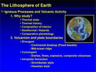
Earth’s Interior and divergent plate boundaries. Instructor: Prof. Dr. Boris Natalin. Gravity and Layered Planet. Metallic core→ rocky mantle → water → gas Gravity force Increase of pressure and density with depth Mineral phase change. Probing Earth’s interior.

E N D
Earth’s Interior and divergent plate boundaries • Instructor: Prof. Dr. Boris Natalin
Gravity and Layered Planet • Metallic core→ rocky mantle → water → gas • Gravity force • Increase of pressure and density with depth • Mineral phase change
Probing Earth’s interior • The deepest well is 12.3 km (Kola Peninsular, Russia) • Seismic waves:- earthquakes- explosions • Wave front • Ray path • Mineral physic experiments • Meteorites studies • Xenolith studies Earthquakes Mw = 6 are recorded all around the globe
Seismic waves • P waves • S waves
Analysis of seismic wave paths Refraction Reflection
Cross-sectional view of Earth Rheological and compositional layering • Crust: • Continental crust • Oceanic crust
Mohorovich discontinuity (Moho) The lover boundary of the crust is Moho = The Mohorovičić discontinuity
The crust • Oceanic crust • 7 km thick • Density 3.0 g/cm3 • Basalt, gabbro • Continental crust • 35-40 km thick (max. 70 km) • Density 3.0 g/cm3; too light, float • Average composition: 1) granodiorite and diorite; 2) anorthosite/basalt
- Upper mantle - Transition zone - Lower mantle The mantle Crust + upper mantle = lithosphere
Mantle • Composition • Seismic anisotropy • Lower velocity zone (asthenosphere) • Transition zone between 410-660 km • Phase changes in the transition zone
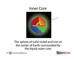
The core • 13.5 g/cm3 • Iron- nickel • Segregated during the earliest stage of accretion of the Earth • Convection in the outer core generates the magnetic field
Earth temperature (5500° at center) • Heat from impacts and rate of impacts • Temperature rise because of compression • Heat from radioactive disintegration • Heat flow at surface 87 mW/m2 Conduction – collision of atoms or electron flow Convection – fluid-like heat transport Radiation– t the thermal motion of charged particles in matter Types of Heat Transport - conduction - convection - radiation
Heat transfer in the Earth Conduction Convection + conduction Convection Radiation
Seismic tomography Seismic waves are faster in cooler rocks and slower in hot rocks
Depth-age relations • Depth-age: Solid line indicates theoretical topography limiting thickness at 80Ma; Dash line – ever-thickening lithosphere • D = 2500 + 350 √T • Depth-age controlled by time • Mechanism: thermal contraction of the newly formed lithosphere
Spreading rate and ridge topography • Slow spreading 1-5 cm/y • Intermediate spreading is 5-9 cm/y • Fast spreading is more than 9 cm/y
Deep-water sediments Nature of oceanic crust Basaltic pillow lavas Sheeted dyke complex Gabbro Ophiolite succession Layered gabbro and dunite Peridotite (upper mantel)
Divergent plate boundaries: Continental rifts East African rift valleys and the opening of the Read Sea and the Gulf of Aden
Definitions • Rifts are elongated depressions where the entire thickness of the lithosphere is deformed under the influence of extensional forces • Grabens are those extensional structures that do not penetrate the entire thickness of the lithosphere • Taphrogens are lithospheric-scale structures commonly formed from a linked system of rifts and grabens that stretch the lithosphere
Pangea supercontinent 250 Ma Continental crust is isolator for heat dissipationMantle plume