Download
1 / 9
90 likes | 119 Views
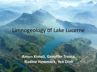
Arbutus Lake Overview by: Leah Taylor & Robert Owen. December 7 th, 2006 EFB 525. Morphology of Arbutus Lake. Approximately ¾ of a mile long fetch. Few small islands not pictured on the map may disrupt the fetch. A maximum depth of ~ 25 feet.

E N D
Arbutus LakeOverview by: Leah Taylor & Robert Owen December 7th, 2006 EFB 525
Morphology of Arbutus Lake • Approximately ¾ of a mile long fetch. • Few small islands not pictured on the map may disrupt the fetch. • A maximum depth of ~ 25 feet. • Was the first lake sampled on the field trip
Raw Data from Arbutus • Multiprobe readings showed our data in the range of -.25 meters to 7.19 meters of depth. • Negative reading above water for calibration. • Temperature data shows the existence of thermal stratification. • Rest of the data consistent for a stratified lake • Turbidity, Dissolved Nitrogen and Oxygen
Arbutus Thermocline • Thermocline ~ Depth at which the rate of decrease of temperature with increase of depth is the largest • Found at approximately 5 meters depth. • Temp changed 2.45 degrees within the span of 1/3rd of a meter • Below the thermocline there is very little primary production • Dissolved Oxygen percentages drop sharply • From 3.9 to .31 • No mixing
Arbutus:Secchi disk • Vanished at ~ 3 meters • Reappeared at ~ 2.8 meters • These values point to a mesotropic lake • applied to clear water lakes and ponds with beds of submerged aquatic plants and medium levels of nutrients • Data agrees
Arbutus:Chlorophyll • By Layer: • Epi: 72.3 ug/l • Meta: 49.3 ug/l • Hypo:150 ug/l Silica: • By Layer: • Epi: 5.62 um • Meta: 3.37 um • Hypo: 15.31 um
Arbutus:Turbidity • Turbidity: the measure of water clarity • Water is extremely clear until reaching the thermocline. • Jump from values of 1 NTU to 6.3 NTU with 1 meters depth (NTU = Nephelometric Turbidity Unit) • Due to non decomposed floating organic matter and increased nutrient and salinity load.
Arbutus:Zoop • Daphnia Clodocerans • 5 individuals per liter in metalimnion • Calanoid Copepod • 76.25 individuals per liter in epilimnion Phytoplankton • Chrysophyta Mallamonas • 7 individuals • Chrysophyta Microcystis • 4 individuals • Low Abundance
Arbutus: Macrophytes • Nuphar variegata • Bullhead Lily • Pontedaria cordata • White Pickeral Weed • Utricularia vulgaris • Bladderwort