Download
1 / 25
250 likes | 353 Views
Study the impact of additional data sources on streamflow simulation results in an Idaho watershed, examining model performance across different geographies. The study assesses a single model structure's adaptability to varied natural processes and minimizes manual calibration.

E N D
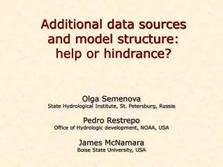
Additional data sources and model structure: help or hindrance? Olga Semenova State Hydrological Institute, St. Petersburg, Russia Pedro Restrepo Office of Hydrologic development, NOAA, USA James McNamara Boise State University, USA
Objectives • Test the Hydrograph model in semi-arid snow-dominated watershed • Study the effect of additional observations on the quality of the streamflow simulation results • Answer the question, if the model developed for completely different geographical settings can handle the additional data in a satisfactory way without change of its fixed structure?
Dry Creek Grasses, shrubs, and conifer forests vary with aspect and elevation Catchment Area: 28 km2 Elevation Range: 1030-2130 m Low Elevation Grass High Elevation Forest Mid Elevation Shrub
Available data High Elevation Hydrometeorological Data 963 mm 77% Snow • Air Temperature • Relative Humidity • Wind Speed/Direction • Solar Radiation • Net Radiation • Soil Moisture • Soil Temperature • Precipitation • Snow Depth Low Elevation 335 mm 32% Snow
Single model structure for watersheds of any scale • Adequacy to natural processes while looking for the simplest solutions • Minimum of manual calibration R Hydrograph model Forcing data: precipitation, temperature, relative humidity Output results: runoff, soil and snow state variables, full water balance State Hydrological Institute, St. Petersburg, Russia
Watershed discretization Representative points Runoff formation complexes
Lower Weather station, soil state variables 30 cm depth, 2007-2008
Lower Weather station, soil state variables 100 cm depth, 2007-2008
Main soil characteristics and parameters Additionally calibrated: • solar radiation input to effective air T changed from 1 to 0.5 2) added correction factor to snow 1.4, rain 1.2
Snow state variables, Tree Line station (1651 m) Simulated and observed snow depth (m) 2002-2003 2008-2009
Lower Gauge Annual Water Balance P-(ET+Q+R) =0 Groundwater recharge assessed by chloride mass balance Q R Aishlin and McNamara (2010)
Distributed Water Balance BG TL C1W C1E C2M C2E LG Evapotranspiration (ET) Groundwater Recharge (R) Streamflow (Q) Treeline catchment “loses” approximately 44% of annual precipitation to deep groundwater recharge
Handling of Riparian Vegetation • Assume Riparian vegetation transpires at the potential rate from May through August • Increases linearly from 0 on 1 May to the potential rate on 31 May • Decreases linearly from the potential rate on Sept 1st to 0 on Sept 30. • Assume evapotranspiration losses from riparian vegetation directly affect streamflow • Used climatological pan evaporation, with k=0.7. • Average seasonal water use • Approach followed compares favorably with measured cottonwood water (966mm) and and open water evaporation (1156mm) use in the San Pedro River Basin (Arizona)1 1“Hydrologic Requirements of and Evapotranspiration by Riparian Vegetation along the San Pedro River, Arizona” Fact Sheet 2006-3027, USGS, May 2007
Runoff: final results 2000-2004 2005-2009
Runoff: final results 2000-2004 2005-2009
Model versus wrong observations… 2mgage Lower gage
Conclusions • The Hydrograph model produces reliable soil moisture and temperature, snow water equivalent and streamflow simulations without changes to the model structure. • We handled water usage from riparian vegetation by post-processing the data. The model can handle that situation with its algorithm for simulating shallow groundwater. This will be done later on. • Use of models which require modest amount of parameter adjustment serves also as a quality control for observations • Overall, simulation results were satisfactory, with minor amount of parameter calibration.