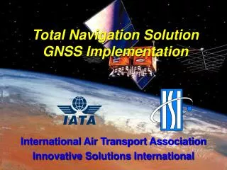
Total Navigation Solution GNSS Implementation
Total Navigation Solution GNSS Implementation. International Air Transport Association Innovative Solutions International. South African Development Community (SADC) GNSS Implementation. Apply Total Navigation Solution in Southern Africa -- 14 nations – 26 airports

Total Navigation Solution GNSS Implementation
E N D
Presentation Transcript
Total Navigation SolutionGNSS Implementation International Air Transport Association Innovative Solutions International ISI Proprietary
South African Development Community (SADC) GNSS Implementation • Apply Total Navigation Solution in Southern Africa -- 14 nations – 26 airports -- Support Airline Operations Throughout Region Through Development of GNSS arrivals, LNAV/VNAV approaches, and departures at Selected Airports -- Provide Turnkey capability -- Kenya and Cape Verde were added midway through project --- 11 additional airports
SADC Project • IATA is the project sponsor coordinating activities through their offices in Montreal • Project developed through • SADC member states (CAAs) • IATA member airlines • ISI is delivering its Total Navigation Solution in partnership with IATA
Operational Goals • Increase Approach Availability • Decrease Minima where possible • Provide a Stable Arrival/Approach to Terminal Area Operations • Provide Constant Rate of Descent Throughout Arrival and Approach • Minimum Flight Time in Terminal Area • Minimize Impact to ATC • Provide Regulatory Framework to Enable Operations
Total Navigation Solution- Philosophy - • Project is divided into “Modules” • Designed as a turnkey GNSS solution • Consistent, reliable, and repeatable process with integrity • Addresses all aspects of implementation; from legislative infrastructure through to flight validation • Flexibility for customization both in how and to what level of end state expertise
Total Navigation Solution- Philosophy - • Bring all stakeholders together • Minimize capital outlay by customer, maximize return on investment • Emphasis is placed on the end state operational capability being delivered to each stakeholder • ICAO ANC endorsed the Modules for Global GNSS Implementation
Procedure Design Workflow Initial Data Sources NIMA DAFIF (Airspace, Aerodrome Data, and current procedures) NIMA DTED (Terrain data) NIMA DVOF (obstructions) Commercial data resources (Airspace, Approaches, obstructions) Commercially available data (Maps, Charts and obstruction data) GIS Data Sources (Roads, Topography, Hydrology, transportation, political boundaries) IATA Airport Obstruction Database (airfield obstructions) Digital Chart of the World - DCW (terrain) Project Geographic Information System database designed Design team collects background data Design team builds sample procedures Tools PrecisionWare ATC and user operational requirements gathered with review and validation of sample procedures Initial Site Visit by ISI team GNSS briefings for CAA officials and GNSS Procedure Design Training Training Coordination Mapping/Charting and Geodetic data collection with airfield and obstruction surveys Criteria PANS-OPS TERPS National Geographic Information System database refined Geotranslation tools Database Management
Procedure Validation Validator (Flight Check, Obstruction Verification, System Performance, Client Review and Approval) Work Flow (Cont’d) Procedure Design Process (Airspace Evaluations, Approach, Departure, and STAR Design) SAFETY First !! Criteria Compliance Flight Routes ATC and User Compliance Database Integrity Simulator (Flyability, Data Continuity, 424 Coding Validation, Aircraft Performance) Procedure Simulation and Quality Assurance Process ICAO Annex 4 Charts Developed and Navigation Database Coding Procedure Ready for Publication
Total Navigation SolutionModules • National/Regional GNSS legislation • WGS-84 surveys • LNAV/VNAV approaches • Safety Analysis (if required) • RNAV SIDs and STARs • FMS coding • RNAV based ATS airspace • Chart development • Flight verification • Specific training to meet needs
National GNSS Legislation • Incorporate or reference relevant regulatory materials • Compliance with international standards and recommended practices • A generic legislative framework to cover all required aspects of allowing for the use of GNSS procedures while addressing specific national/regional requirements • Consultation with key regulators and service providers at international (ICAO), regional (JAA) and national (FAA) levels
WGS84 Survey Techniques • Primary/secondary airport control points and runway surveys • Surveys with two different techniques • Surveys of obstacles on airport surface • Surveys of obstacles in approach, missed approach, departure areas and radius around airport • Conducted by experienced survey teams with ICAO compliant techniques
GNSS/RNAV Approach Procedures • Procedure development using PrecisionWare Designer • Construction of complete procedures from initial segment through missed approach holding waypoints • Precise evaluation of obstacles • Local or NIMA terrain data for airports • PANS-OPS or TERPS compliant
GNSS/RNAV Approach Procedures Step 1 Organize using A Datum Conversation Tool PrecisionWarei is a Suite of FOUR Tools that will help Procedure Developers in the SURVEY, DESIGN, SIMULATION, and VALIDATION of GNSS procedures. Step 2 Step 4 Develop using Validate using A Procedure Design Tool A Flight Check Tool Step 3 Verify using An Approach Simulation Tool
Safety Analysis • Some airports will require a statistical safety case to ensure combined error budget will not exceed protection limits, e.g. Cape Town • Safety analysis will provide basis for FAA/CAA approval, if waivers are required
GNSS/RNAV SIDS and STARS • SIDs using PANS-OPS criteria for each identified runway and developed to accommodate the broadest range of aircraft • STARs providing a standard routing for aircraft entering busy terminal areas integrated into existing ATC structure as required • Based on optimal criteria as identified in PANS-OPS Doc 8168-OPS/611 Volume II • If required, exceptions or waivers to PANS-OPS criteria can be documented and coordinated with the appropriate authorities
FMS Coding • Interpretation by various FMCS’s • Ensure that our intent is clear • An extract of the Terminal Area Procedure (SID/STAR and APPROACH) is coded in the form of the waypoint and path and terminator leg types as would be found in the full ARINC 424 database coding compatible with the data requirements of client FMCS
ATS Airspace Design Structure • Study of existing airspace structure • Use of existing airspace structure and fixesto the extent possible • Identification of optimal air traffic flow for safety and efficiency • Efficient link between en route and terminal airspace • GNSS provides optimum flexibility for terminal area airspace design
Development and Publication of Charts • Procedure verification chart • Data verification • Additional quality assurance review • ICAO Annex 4 and Aeronautical Chart Manual 8697 compliant “camera ready chart” • Internationally accepted format
Flight Verification • Validation of survey, approach design, flight suitability • Linked to design tools to provide a seamless electronic transition from Design and Simulation to Validation • Carry-on package, 20cm tracking • Simple user interface • Completion of end-to-end audit trail • Consistent with ICAO and FAA flight inspections requirements
Flight Verification – Validator Airborne Unit
Flight Verification Validator Ground Unit Not Required for Most Approaches
FAA Participation • Provided Aircraft Support and Flight Inspection Expertise at Many Locations • Installed Validator Directly on FAA Aircraft
Flight Verification Chart
Flight Verification Ground Track
GNSS/RNAV Approach Procedures Simulation • Computer-based procedure verification with PrecisionWare Simulator • Software allows the evaluation of approach procedures to minimize costly flight inspection time • Evaluate and verify obstacle, FTE, clearance areas and turning radii • Simulate different aircraft types and different wind conditions • Data useful for waivers and specials
Training • Workshops: • Tactical by design. • Last from two to six weeks dependent on the desired end level of expertise. • Cover the complete procedure development training for the front line working level of the air navigation service provider. • Introduction to GNSS, PANS-OPS criteria, GNSS specific criteria, and approach design workshops. • Aim is to introduce the participant to GNSS procedures and create a level of understanding to allow for review, approval and potential maintenance of GNSS procedures.
Benefits Realized • Safety 3-D Guidance for All Phases of Flight Inside Terminal Areas Increased Situational Awareness Through Continuous Access to Navigation Information -- Reduction in CFIT Accidents • Efficiency Ability to Reduce Impact of Weather on Traffic Flow
Quality Control Process • QC for any individual module as a separate service • Runway and obstacle data only handled once but validated throughout development process through use of PrecisionWare • Flexibility for customer provided module(s) to be integrate into process
SADC Project Summary • Project initiated Jan 1, 2001: • 37 WGS-84 surveys completed • 238 procedures designed and charted • GNSS LNAV/VNAV approaches • SIDs • STARs • Airspace redesign for 37 airports • 3 2-week PANS OPS Design Courses • 16 One Day GNSS courses (in each State) • Flight validation for all procedures -- Rejection rate – less than 2/10ths of 1% of all procedures • Created first Nation to have all IFR runway ends served by GNSS RNAV approaches – Cape Verde
Total Navigation Solution Summary • Modular design • Overall quality management plan covers each process as well as the total system • Approach provides for maximum flexibility: • Modular implementation puts the process in “digestible” pieces for all stakeholders • Customers choose the solution set which meets their requirements • CAAs or other service providers who may be at various stages of implementation select what works from a menu of products • Benefits accrue to clients within twelve to eighteen months of project inception
Questions?Jeff CochranePh. 703-883-8088 Ext. 150E-mail Jcochrane@isicns.com
Santo Dumont Airport Rio de Janeiro