Download
1 / 19
190 likes | 311 Views
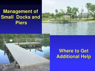
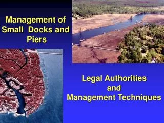
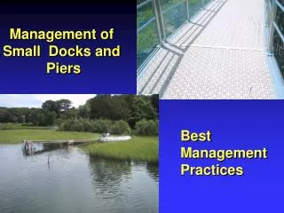
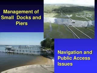
Management of Small Docks and Piers. Navigation and Public Access Issues. This presentation funded by the National Oceanic and Atmospheric Administration National Centers for Coastal Ocean Science and The Office of Ocean and Coastal Resource Management

E N D
Management of Small Docks and Piers Navigation and Public Access Issues
This presentation funded by the National Oceanic and Atmospheric Administration National Centers for Coastal Ocean Science and The Office of Ocean and Coastal Resource Management Materials prepared by Steve Bliven of Bliven & Sternack
General Impacts to Navigation • Extending into federal navigation projects or traditional navigation passages. • Extending into a designated mooring field. • Disrupting navigation between docks
Limit of Federal Project 3 X Channel Depth = Minimum Setback * * Mean Low Water Mean High Water *Note: Coordinates required for limits of structure 200’ or less from federal project Shore
Mean High Water Mean Low Water Reasonable Riparian Line P/L P/L P/L Not to scale
Mean High Water Mean Low Water Maximum 25% Minimum 50% Reasonable Riparian Line P/L P/L P/L Not to scale
Mean High Water Mean Low Water Maximum Length Reasonable Riparian Line P/L P/L P/L Not to scale
Impacts to visual ability to navigate Sight lines Significantly limited
Mean High Water Mean Low Water Min. 25’ Min. 25’ Reasonable Riparian Line P/L P/L P/L Not to scale
Mean High Water Mean Low Water “Infilling” with new docks P/L P/L P/L Not to scale
Mean High Water Mean Low Water P/L P/L P/L Not to scale
Mean High Water Mean Low Water X P/L P/L P/L Not to scale
Mean High Water Mean Low Water P/L P/L P/L Not to scale
Mean High Water Mean Low Water Inter-tidal lands Public Trust Areas Sub-tidal lands and waters Not to scale
Mean High Water Mean Low Water Danger from Vessels Lateral Access Blocked * * * * * * * * * * * * Private Property (Upland) Private Property (Upland) Private Property (Upland)
Mitigating Impacts to Public Access • Require comfortable passage past the dock • Minimum height/width opening through the structure to allow foot passage • Stairs to allow passage over the structure • Right of way around landward end of structure
Mitigating Impacts to Public Access • Require comfortable passage past the dock • Establish setbacks from shellfishing or aquaculture areas • Negotiate perpendicular access • Rules for safe boating in nearshore waters