Download
1 / 13
130 likes | 152 Views
This update provides an overview of the activities and progress of the NGAC Innovative Strategies for Geospatial Programs and Partnerships Subcommittee, including updated recommendations on Federal geospatial leadership and coordination. The subcommittee aims to strategically leverage and influence technologies, policies, and trends, foster a data integration environment, and utilize public-private partnerships to develop geospatial data and maximize resources.

E N D
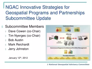
NGAC Innovative Strategies for Geospatial Programs and PartnershipsSubcommittee Update • Subcommittee Members • Dave Cowen (co-Chair) • Tim Nyerges (co-Chair) • Bob Austin • Mark Reichardt • Jerry Johnston January 12th, 2012
Subcommittee Activities • Shepherdstown Meeting action item • Updated the recommendation on Federal geospatial leadership and coordination • Joint Subcommittee Meeting on December 8th • Reviewed changes to the paper • Reviewed overarching and specific recommendations • Since December 8, updated the final draft report… • Completed reformatting of the document • Introduced more positive tone into executive summary • Added a table of contents • Clarified barriers wording • Simplified and clarified recommendations and rationales
FGDC Request to NGAC… “Provide feedback and recommendations on how FGDC partner agencies can take the use of geospatial data and technology to a new level in the future by: • Strategically leveraging and influencing technologies, policies, & trends, • Fostering a data integration environment that facilitates better decision-making and supports place-based policies, [and] • Utilizing public-private partnerships and other innovative solutions to develop geospatial data, fill critical data gaps, and leverage scarce resources.”
Major Charge Shepherdstown Meeting From the meeting summary: • ACTION: By December 2011, the NGAC will update the recommendations on Federal geospatial leadership and coordination that were provided in the October 2008 NGAC Transition Recommendations paper and incorporate them into the NGAC Innovative Strategies white paper. Text inserted into draft white paper… • “The NGAC believes there is a need to reconfigure, focus, reposition, empower and authorize the FGDC as the national lead for developing, managing and assuring Geospatial Information Services for the Nation. These services are critical to support the development of information products required by the public sector, and form the basis for the Geospatial Platform and the implementation of A-16 Supplemental Guidance.”
Draft Overarching Recommendation • NGAC recommends the establishment of a "leadership role" in the Executive Office of the President that would coordinate and direct the efforts of the federal geospatial enterprise, including choosing, directing and enabling the Managing Partner of the Geospatial Platform.
6.1 Strategically Leverage and Influence Technologies, Policies, and Trends – Draft Recommendations 1. Measure and Monitor Progress with the Geospatial Platform (B7, B14). Develop a comprehensive business plan to manage and operate the Geospatial Platform. 2. Adopt Operating Formula (B8). Adopt a funding and/or in-kind services strategy for the Geospatial Platform and for the purchase, production and dissemination of critical geospatial data that provides resources to participants on a multi-tier basis to encourage seeding, cultivation and pursuit of ideas that work to achieve expected outcomes.
6.1 Strategically Leverage and Influence Technologies, Policies, and Trends – Draft Recommendations 3. Foster Coordination. (B9) Strengthen FGDC’s ability to fulfill its responsibilities under OMB Circular A-16 and to successfully manage the Geospatial Platform by moving the administrative home to a higher level in the administration with substantial cross-government programmatic, budgetary and procurement authority.
6.2 Foster a Data Integration Environment That Facilitates Better Decision-Making and Supports Place-Based Policies – Draft Recommendations 4. Develop Application to Track Common Data Interests (B4). Enhance efforts to eliminate redundant data creation and funding across all levels of government by focusing on reprogramming funds rather than requesting new funds.
6.3 Utilize Public-Private Partnerships And Other Innovative Solutions To Develop Geospatial Data, Fill Critical Data Gaps, And Leverage Scarce Resources – Draft Recommendations 5. Foster Broader View of FGDC Partnership Programs.(B1) Future partnership programs initiated by the FGDC should be conceived in the context of all relevant partnership programs, and should be designed to augment and leverage them to achieve maximum impact. Partnership activities should focus on Geospatial Platform activities that can be measured.
6.3 Utilize Public-Private Partnerships And Other Innovative Solutions To Develop Geospatial Data, Fill Critical Data Gaps, And Leverage Scarce Resources – Draft Recommendations 6. Perform Assessment of Federal Interagency Partnerships.(B3) Coordination of partnerships should be reassessed every five years to determine what is needed to better build interagency relationships with Federal data-providing agencies that have responsibilities related to geospatial issues. 7. Enable Identification of Shared Interests. (B12) Enable organizational units to readily identify shared interests in geospatial services across the Federal government, thereby cultivating potential partnerships for cost savings; facilitate cooperative agreements to avoid duplication of effort.
6.3 Utilize Public-Private Partnerships And Other Innovative Solutions To Develop Geospatial Data, Fill Critical Data Gaps, And Leverage Scarce Resources – Draft Recommendations 8. Develop Innovative Procurement.(B3) Develop a strategy for “procurement” partnerships; facilitate cooperative agreements to avoid duplication of effort. 9. Enforce A-16 Stewardship.(B9) Encourage OMB to enforce A-16 stewardship.
Subcommittee Next Steps • Finalize White Paper. • Post on the NGAC website. • Identify briefing opportunities at upcoming FGDC meetings. • Consider feedback on White Paper recommendations. • Consider opportunities to work with partners across the geospatial community. • Consider future discussion and support of the White Paper recommendations.
Subcommittee gratefully acknowledges contributions of: • Ivan DeLoatch, direction • John Mahoney, coordination • Tricia Gibbons, summary notes and facilitation • EPA editorial staff • Esri graphics staff QUESTIONS & COMMENTS