Download
1 / 46
460 likes | 559 Views
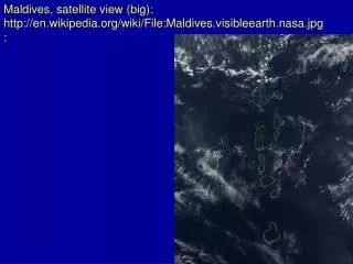
Discover Europe's fascinating features such as the Danube River, the Alps, and the Mediterranean Sea through a satellite view and political-physical map. Learn about the regions, peninsulas, and mountains that define European geography.

E N D
The Geography of EuropeUnit 3 NotesSS6G8 The student will locate selected features of Europea. Locate on a world and regional political-physical map: the Danube River, Rhine River, English Channel, Mediterranean Sea, European Plain, the Alps, Pyrenees, Ural Mountains, Iberian Peninsula, and Scandinavian Peninsula
Rhine River • Longest river in Germany • An important waterway for trade • Begins in Switzerland, winds through Germany, France, Luxembourg, & The Netherlands
Danube River • 2nd largest river in Europe (Volga is first) • Flows through the 12 countries of Germany, Austria, Slovakia, Hungary, Serbia, Croatia, Bosnia and Herzegovina, Slovenia, Bulgaria, Romania, and the Ukraine! • 1,770 miles long • Played a vital role in the development of central Europe (trade & cultural diffusion)
The English Channel • Small body of water that separates England from France • 350 miles long • In the past, it was used as a good system of defense for England • An important waterway for trade
Southern Peninsulas CrimeanPeninsula Iberian Peninsula Italian Peninsula Balkan Peninsula
Iberian Peninsula • The Pyrenees form the northern border • 2nd largest peninsula in Europe • Includes the countries of Spain & Portugal
Scandinavian Peninsula • Largest peninsula in Europe (1,150 miles long) • Consists of Norway, Sweden, and the northern region of Finland • Region is rich in timber, iron, & copper
Mediterranean Sea • Important route for trade & cultural exchange • “Crossroads for 3 continents” (Europe, Africa, & Asia) • Covers an area of 965,000 square miles • Name means “in the middle of the earth” (surrounded by land)
The Alps • Located in Austria, France, Germany, Switzerland, Italy, Slovenia, & Liechtenstein • Major tourist destination • Extend for almost 700 miles!
Mt. Blanc in the Alps It’s the highest mountain in the Alps: 15,771 feet.
Pyrenees Mountains • Form the natural border between France & Spain • Extend for about 270 miles
Ural Mountains • Considered the natural boundary between Europe & Asia • Divide Russia: 1/4 is in Europe, 3/4 is in Asia • 1,500 miles long! • Among the world’s OLDEST mountain ranges • Huge deposits of gold, nickel, silver, platinum, coal, iron, & other minerals
Ural Mountains: “The Great Divide” 1500 miles It divides the European and Asian sections of Russia.
The European Plain • Largest mountain-free landform in Europe • Stretches from the Pyrenees in the west to the Ural Mountains in the east • Extends 2,000 miles • Successful agricultural area
Credits • Original presentation retrieved from www.Slideshare.net Sept 24, 2011. Modifications made by B. Morgan • Geography of the World: Europe: Land and Resources . Prod. Academic Media Network, Inc.. Academic Media Network, Inc., 2006. Discovery Education. Web. 7 October 2011. <http://www.discoveryeducation.com/>. • Segments: Introduction; Countries, Peninsulas, Islands, and Rivers; Landforms