Download
1 / 21
210 likes | 383 Views
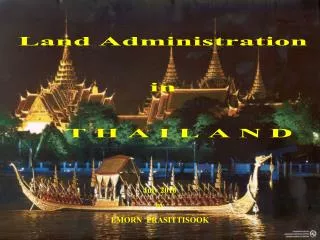
Land Administration in T H A I L A N D. July 2010 by EMORN PRASITTISOOK. T H A I L A N D. Total area 513,115 Sq.km. (51.3 Million ha) 76 Provinces Population 64 million Estimate of Land Type and Use

E N D
Land Administration in T H A I L A N D July 2010 by EMORN PRASITTISOOK
T H A I L A N D • Total area 513,115 Sq.km. • (51.3 Million ha) • 76 Provinces • Population 64 million • Estimate of Land Type and Use • Forest 23 million ha • State land 7.7 million ha • Public land 4.2 million ha Department of Lands
Evolution of Land Administration • Historically land belonged to the King but people had right to use and to transfer to their heirs • Red stamp title for tax collection purposes introduced in 1360 • Private rights in land introduced in 1872 • First title of ownership issued in 1901 • Law consolidated into the Land Code in 1954 Department of Lands
Institutional Arrangements • Land Registration Department created in 1901 • At various times: • Separate survey and registration functions • Other functions part of Lands (eg Mines) • Part of MA and MOI • Single agency in MOI since 1943 responsible for: • Land registration • Cadastral survey and mapping • Collection of land related fees and charges Department of Lands
Land Code 1954 • Land Code in Thailand provides clear basis for: • Recognition of rights in land • Allocation of public land • Systematic & sporadic registration of private rights • Cadastral surveys and registration of dealings • Administrative procedures to settle disputes and correct records • Changes to Land Code fundamental for Land Titling Project Department of Lands
Land Tenure Typology • State Land • Forest and protected areas • Government real estate • Land manageded by local administration • Public Domain • Private Land (under Land Code) • Title Deeds (NS4) • Certificates of utilisation (NS3/NS3K) • Pre-emptive certificates (NS2) • Claim certificates (SK1 and others) Department of Lands
Adjudication Processes • Sporadic application (in 76 Provincial and 435 Branch land offices) • Systematic adjudication • Ground survey • Using photomap as a map base • Office conversion of NS3K • Issuance of pre-emptive right (in 396 District land office) Department of Lands
Adjudication Processes • Systematic process undertaken on a village-by-village basis (units of sub-village) • Undertaken by teams from central office with limited interaction with land offices • Concrete corner marks emplaced (except for NS3K conversion) • Village officials paid a fee to participate • Single fee charged at the end of process – only covers part of the cost • Process (including 30 day public display) routinely produces titles in 3 months • Very few disputes Department of Lands
Systematic AdjudicationOutput • Systematic output between 1985 and 2009 - 12.357 million titles • Ground survey 4.919 million (39.8%) • Photomap survey 4.078 million (33.0%) • NS3K Conversion 3.361 million (27.2%) • Title register in 1984 was 4.4 million; in 2009 was 26.898 million • Sporadic titles issued between 1985 and 2009 was 10.14 million Department of Lands
Land Document Department of Lands
Land Registration • DOL is the only agency responsible for registration • System based on Torrens Title system • System supported by good records management system • More than 143 types of registration • Registration on day of application (unless legal issue or survey required) • One stop service • Very efficient with high public acceptance Department of Lands
Land Records • Land office holds all land records (title, dealings, survey) • Cannot issue title unless parcel is charted on a cadastral map • Cadastral maps at a range of scales (1/4,000, 1/2,000, 1/1,000, 1/500) • Dealings held in parcel files • Use of national personal identification system as proof of identity • Pragmatic approach to survey: • Accuracy specified at map scale • First order – with TS/GPS • Second order using graphical means/photomaps Department of Lands
Land Registration • Legal basis for registration • Civil and Commercial Code • Land Code • Land records can only be updated by registration • The land records have strong legal recognition (by law and in practice) Department of Lands
Land Registration • Registration fees and taxes collected by DOL: • Transfer fee (2%, 1%, or 0.5% of CVA value) • Income tax (similar to a capital gains tax) • Surcharge for property held less than 5 years (3.3% of CVA value) • Stamp duty (0.5% of CVA value or declared price) Department of Lands
Land Registration Fee and Tax Collected in 2009 Registration 5,618,470 applications Department of Lands
ThailandLand Titling Project(1985-2004) Land Titling Project • 20 year plan, designed as 4 five-year phases • Implemented with support of World Bank and the Australian government Department of Lands
PHASE I PHASE II PHASE III PHASE IV Title Deeds Completed Land Titling Project Department of Lands
DOL difficulties prior to LTP: Insufficient control for title issuance Lack of up-to-date cadastral map sheets Inconsistencies in Province/District records Land records degrading Limited systematic registration capacity (200 years to complete task) Land Titling Project Department of Lands
Land Titling Project • Key outputs: • Systematic registration of 11.2 million titles • Establishment of 345 provincial/branch land offices • Generation of 105,101 rural and 38,298 urban cadastral maps • Socio-economic studies have demonstrated: • Titled land is more valuable • Increased access to institutional credit • Increased use of farm inputs on titled land • Productivity increased for titled land • Increase in cultivated area Department of Lands
Continuing Challenges • Recruiting and keeping staff • Facilitating access to mostly manual records • Definition of boundaries of forest and other public land • Need to further develop land policy Department of Lands
Thank You Department of Lands