Download
1 / 13
130 likes | 263 Views
US IOOS Coastal and Ocean Modeling Testbed Overview. Becky Baltes US IOOS COMT PM April 17, 2012. U.S. IOOS Coastal and Ocean Modeling Testbed. IOOS Program FFO – 1 st Grant: $4M 2 nd Grant: $1M 5 teams, 64 scientists/analysts (Smaller Footprint for 2 nd Grant)

E N D
US IOOS Coastal and Ocean Modeling Testbed Overview Becky Baltes US IOOS COMT PM April 17, 2012
U.S. IOOS Coastal and Ocean Modeling Testbed • IOOS Program FFO – 1st Grant: $4M • 2nd Grant: $1M • 5 teams, 64 scientists/analysts • (Smaller Footprint for 2nd Grant) • SURA is overall lead for execution • 1st Grant (May 2010-11, w/ NCE to Jun ‘12) • 2nd Grant (Jun 2011-13, no $ in FY12) • Multi-sector engagement (federal • agency, academia, industry) Coastal Inundation Gulf & Atlantic Coast Rick Leuttich, UNC-CH Shelf Hypoxia Gulf of Mexico John Harding, USM Katja Fennel, UD Estuarine Hypoxia Chesapeake Bay Carl Friedrichs, VIMS Marjy Friedrichs, VIMS Cyber Infrastructure Eoin Howlett, ASA Testbed Advisory Evaluation Group Rich Signell, USGS
Original Testbed Goals • Build a common infrastructure for access, analysis and visualization of all ocean model data produced by the Federal Backbone and the IOOS Regions • Build stronger relationships between academia and operational centers through collaboration (improve R2O and O2R) • Develop skill metrics and assess models in three different regions and dynamical regimes • Transition models, tools, toolkits and other capabilities to federal operational facilities
Surge, Waves and Inundation Results • Development of common Testbed infrastructure • Data Archiving • Model development/ Enhancement • HPC Time • Skill Analysis Gulf of Maine / Scituate Harbor - Extratropical Domain • Don Slinn’s coupled SLOSH/SWAN model in • transition with NHC
Shelf Hypoxia Team Results • Improving Collaboration • Improving Data • Model Development • Supporting Operations • Transitioning biogeochemical operating equations to FVCOM community modeling group via CSDL
Estuarine Hypoxia Results • Transitioning information to federal agencies • Model Comparison • Conducting sensitivity experiments • New, simple DO formulation for hypoxia model Five Hydrodynamic Models Configured for the Chesapeake Bay CH3D Cerco & Wang USACE EFDC Shen VIMS UMCES-ROMS Li & Li UMCES ChesROMS Long & Hood UMCES CBOFS (ROMS) Lanerolle & Xu NOAA
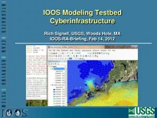
Cyber Infrastructure Results • Interactive Model and Observation Explorer: Browse model results, view model grid data, side by side comparisons, and MUCH MORE • Unstructured Grid Support:Time series extraction completed for FVCOM, SELFE, ELCIRC, ADCIRC • NCToolbox: standardized data transformations, new methods for comparing data (including unit conversion) • Matlab as a Web Service: Matlab processes - no desktop license required • Skill Assessment Tools: Measure the degree of correlation between model prediction and observations • Collaborative Web Site: public/private access to portal, content organization with internal/external tools
Looking Ahead • Model Transitions • Cyber infrastructure development • Permanent Infrastructure • Priority Planning Development