Download
1 / 15
150 likes | 330 Views
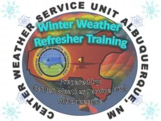
Winter Weather Refresher Training. Prepared by: Center Weather Service Unit Albuquerque. Overview. Jet Stream Compression Turbulence Mountain wave Icing IFR ceiling and visibility CWSU Products MIS CWA PIREPS Questions and Comments. Jet Stream. Moves south during fall and winter

E N D
Winter Weather Refresher Training Prepared by: Center Weather Service Unit Albuquerque
Overview • Jet Stream • Compression • Turbulence • Mountain wave • Icing • IFR ceiling and visibility • CWSU Products • MIS • CWA • PIREPS • Questions and Comments
Jet Stream • Moves south during fall and winter • Vectoring problems • Sloppy turns • Altitude vs. Vectoring • Compression • Turbulence
Jet stream - Compression “Compression on approaches creates problematic turns and possibly results in overshooting turns. Additionally if PHX is on an east flow with a strong tail wind miles in trail becomes an issue for handing off aircraft. Yet, some advantages can be using the winds when possible to slow aircraft by turning them into the wind.” -Steve Wright, Supervisor Southwest Specialty
Jet Stream - Turbulence • The strongest high altitude turbulence is above or below a jet speed maximum • Jet Streams intensify in segments from 1,000 to 3,000 miles long, 100 to 400 miles wide, and 3,000 to 7,000 feet deep • Jet stream CAT often occurs in patches 2,000 feet deep, 20 miles wide, and 50 miles long
Turbulence – mountain Wave • Potential for up and downdrafts to reach 5000 feet per minute • Playbook and carrier re-routes • Increases miles-in-trail
Jet stream winds and turbulence result in: • NRP Routes - Jet Stream & Turbulence Avoidance • Increased mile-in-trail • Increased controller stress • Terminal approach compression • Vectoring issues and sloppy turns • Overtakes • Decreased AAR due to cross winds and or LLWS Jet stream & Turbulence – Summary
Icing • A layer of frost increases drag by 40% and reduces lift • MOD or greater icing is a significant hazard • Aircraft without de-icing equipment encounter problems with trace to light icing • Be aware of freezing level heights during icing events
IFR CEILING AND VISIBILITY • Most common from central NM through SW TX & TX PNHDL • Winter storm systems will produce IFR conditions across AZ to include PHX • Icing chart includes IFR and MTN OBSC
Meteorological Impact Statement (MIS) • Details weather conditions expected to adversely impact air traffic flow • Valid up to 12 hours • Center Weather Advisory (CWA) • Is an aviation weather warning • For conditions meeting or approaching (AIRMET, SIGMET or SIGMET for convection) criteria • Valid up to 2 hours • MIS/CWA are transmitted via AISR and KVDT CWSU Products
Pilot Reports (PIREPs) Why bother? • Upper Air (UA) Observations • Very limited, only 6 sites in ZAB airspace • Only 2 UA observations per day 00Z and 12Z • Aircraft • Several Thousand aircraft transit ZAB airspace daily • Can provide current reports of turbulence, icing, weather conditions, etc. • PIREPs enhance local and national AIRMET/SIGMET forecasts
Ceilings at or below 5,000 feet. These PIREPs shall include cloud base/top reports when feasible. • TERMINAL. Ensure that at least one descent/climb out PIREP, including cloud base/s, top/s, and other related phenomena, is obtained each hour. • EN ROUTE. When providing approach control services, the requirements stated in TERMINAL above apply. • Visibility (surface or aloft) at or less than 5 miles. • Thunderstorms and related phenomena. • Turbulence of moderate degree or greater. • Icing of light degree or greater. • Wind shear. • Volcanic ash clouds. Pilot Reports (PIREPs)When Should I Solicit PIREPs?FAAO 7110.65, PIREP Information, Para 2−6−3 & 7110.10S CHG 1