Download

1 / 21
210 likes | 393 Views
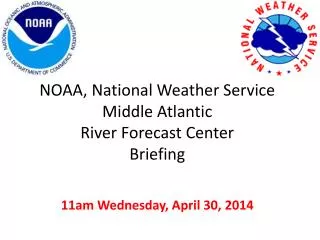
National Weather Service Middle Atlantic River Forecast Center River Flood Potential Briefing. Wednesday, February 19, 2014 NWS Middle Atlantic River Forecast Center. Susquehanna River at Harrisburg, PA February 19, 2014 Photo courtesy of Azrael Group. Key Message.

E N D
National Weather ServiceMiddle Atlantic River Forecast CenterRiver Flood Potential Briefing Wednesday, February 19, 2014 NWS Middle Atlantic River Forecast Center Susquehanna River at Harrisburg, PA February 19, 2014 Photo courtesy of Azrael Group
Key Message • With this briefing we are transitioning from a river ice briefing to a flood potential briefing. • River rises are likely from rain and snowmelt this week. Main stem rivers should stay within their banks. Smaller streams and rivers could reach bankful. • We cannot rule out some minor flooding in New Jersey, Southeast Pennsylvania, and in the Potomac River basin. There is a small chance the flooding could be significant. • Ice jams are possible this week and can cause rivers to rise quickly and even flood. • Stay alert and prepared to take quick action.
Flood Outlook for next 5 days Area colored in orange highlight the area where we are most concerned for possible flooding Friday and Saturday. This outlook is posted at: http://www.erh.noaa.gov/marfc/fop/ and is updated daily around noon.
Flood Outlook Through Next Two Weeks • Cold will return next week which will lower our flood threat since snow melt will temporarily end and precipitation will be in the form of snow. Beyond next week, there is much uncertainty.
Snow Melt Potential • We’ve all heard the great news that warmer temperatures are forecast later this week. • We’ve learned from past snowmelt seasons that it is not the warm temperatures that melt the snow. We need warm, humid air and we need a strong wind to drive that energy into the snowpack to ripen it, before it can melt.
Snowmelt • The only places we are expecting warm, humid air plus wind is in Southeast PA, New Jersey and in the Potomac River basin in Maryland and Virginia. These areas can expect significant snowmelt later this week. • Cold air will return the middle of next week to all of our basins and snowmelt will temporarily end.
Flood Threat from Ice Jams • Ice jams and the associated flooding is a real threat, especially on smaller streams and tributaries this week. These happen very quickly and cannot be forecast in advance. Be alert and be prepared to take quick action.
A Sample of some recent River Ice Photographs • We continue to find many helpful photographs from Facebook and Twitter from across our area. The following are a good sample from across our service area from the past couple of days. • FYI – most every afternoon we share the latest batch of river ice photos on our Facebook page. To see these, please follow us at https://www.facebook.com/#!/US.NationalWeatherService.MARFC.gov
Raritan River at Rutgers University, New Brunswick, NJ Photo by Josh Feldman Feb 17, 2014
Susquehanna River at West Pittston, PA Photo by kristine , Feb 18, 2014
Susquehanna River at Towanda, PA Photo by Chelsea Newbury Feb 17, 2014
Susquehanna River at Columbia, PA Photo by Ben Cloninger Feb 18, 2014
Susquehanna River at Harrisburg, PA Photo by Azrael Group Feb 19, 2014
Susquehanna River near York, PA Photo by Al Frazier Feb 18, 2014
Lehigh River at White Haven, PA Photo by White Water Challengers Feb 17, 2014
Schuylkill River in Southeast PA Photo by Katie Virtue Feb 17, 2014
Delaware River in Southwest New Jersey Photo by Alexa Marshmallow, Feb 18, 2014
Shenandoah River in Shenandoah State Park, VA, NJ Photo by Megan Burgess Feb 17, 2014
Recent River Ice Photos & News • Following MARFC on Facebook & Twitter is the best way to stay up to date on the river ice because, as you know, conditions can change rapidly. Our facebook is at: https://www.facebook.com/#!/US.NationalWeatherService.MARFC.gov Our Twitter handle is @NWSMARFC • We are sharing river photos, plus any news we gather, through our Facebook & Twitter accounts, everyday.
Additional Resources • NWS Middle Atlantic River Forecast Center Website: http://weather.gov/marfc • NWS Temperature Forecasts: http://preview.weather.gov/graphical/ • NWS Precipitation Forecasts: http://www.hpc.ncep.noaa.gov/qpf/day1-7.shtml • NWS MARFC Water Temperature Observations (raw data - not quality controlled): http://www.erh.noaa.gov/marfc/Maps/water_temps/ • NWS Susquehanna and Delaware River Basins River Ice Website http://www.erh.noaa.gov/er/ctp/hydro/riverice/index.php
If you have any questions or concerns, please email patricia.wnek@noaa.gov