Download
1 / 235
2.35k likes | 2.37k Views
Discover the rich history and highlights of Acworth, Albany, Alexandria, and more charming towns in New Hampshire. Explore their incorporation dates, counties, and interesting origin stories. Ideal for history enthusiasts!

E N D
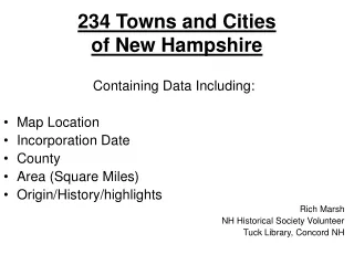
234 Towns and Citiesof New Hampshire Containing Data Including: • Map Location • Incorporation Date • County • Area (Square Miles) • Origin/History/highlights Rich Marsh NH Historical Society Volunteer Tuck Library, Concord NH
ACWORTH • Incorporated:1722 • County: Sullivan • Population Density: 2000: 21.5 persons per square mile of land area. Acworth contains 38.9 square miles of land area and 0.1 square miles of inland water area. • Origin: Acworth was first chartered in 1752 as Burnet, in honor of William Burnet, colonial governor of Massachusetts and New Hampshire in 1728. However, no settlements were made under this charter. In 1766, the town was re-granted under the name Acworth, honoring Sir Jacob Acworth of the British Admiralty, who had Portsmouth shipping interests.
ALBANY • Incorporated: 1833 • County: Caroll • Population Density: 2000: 8.7 persons per square mile of land area. Albany contains 75.4 square miles of land area and 0.3 square miles of inland water area. • Origin: First chartered in 1766 as Burton, for General Jonathan Burton of Wilton. The town was incorporated and renamed Albany in 1833, when the New York Central railroad from New York City to Albany was chartered. Albany includes Mount Chocorua, Mount Paugus and the southeastern corner of the White Mountain National Forest.
ALEXANDRIA • Incorporated: 1782 • County: Grafton • Population Density: 2000: 30.5 persons per square mile of land area. Alexandria contains 43.5 square miles of land area and 0.1 square miles of inland water area. • Origin: First granted in 1753, Alexandria was named for Alexandria, Virginia, location of a conference that resulted in the declaration of the French and Indian War. Alexandria NH was the birthplace of Luther C. Ladd, the first enlisted soldier to lose his life in the Civil War.
ALLENSTOWN • Incorporated: 1831 • County: Merrimac • Population Density: 2000: 236.7 persons per square mile of land area. Allenstown contains 20.5 square miles of land area and 0.1 square miles of inland water area. • Origin: First granted in 1721, the town was named after Samuel Allen, governor of the province in the late 1600's. A portion of Bow was annexed in 1815, and a portion of Hooksett in 1853. Home of Bear Brook State Park, the area was once known as excellent bear country, and a good hunting ground for wild geese and ducks.
ALSTEAD • Incorporated: 1763 • County: Cheshire • Population Density, 2000: 49.9 persons per square mile of land area. Alstead contains 39.0 square miles of land area and 0.4 square miles of inland water area. • Origin: Alstead began in 1735 as one in a line of nine forts intended to protect southwestern New Hampshire from Indian attacks. The town was named for Johann Henrich Alsted, who compiled an early encyclopedia that was popular at Harvard College. Alstead is the location of New Hampshire's first paper mill, established in 1793.
ALTON • Incorporated:1796 • County: Belknap • Population Density, 2000: 70.4 persons per square mile of land area. Alton contains 63.9 square miles of land area and 19.3 square miles of inland water area. • Origin: Originally called New Durham Gore, because of Mount Major's rocky terrain, the town was settled by a group from Roxbury, Massachusetts. The name Roxbury had already been used, so the town was named for the Alton family. The town fronts Alton Bay, the southeastern point of Lake Winnipesaukee, and its 19.3 square miles of inland water area is the largest of any town in New Hampshire.
AMHERST • Incorporated:1760 • County: Hillsborough • Population Density, 2000: 317.4 persons per square mile of land area. Amherst contains 33.9 square miles of land area and 0.5 square miles of inland water area. • Origin: First granted in 1728 as Narragansett Number 3, the town was named after Lord Jeffrey Amherst, commander-in-chief of the colonials in the French and Indian War. Amherst was the birthplace of Horace Greeley, founder of the New York Tribune. The town is home to Baboosic Lake.
ANDOVER • Incorporated:1779 • County:Merrimack • Population Density: 2000: 52.5 persons per square mile of land area. Andover contains 40.2 square miles of land area and 0.8 square miles of inland water area. • Origin: First settled by Dr. Anthony Emery, the town was named Emerystown. It was then named New Breton, after Cape Breton, site of a campaign against the French. The town was incorporated in 1779 as Andover, the year Phillips Andover Academy was completed. The school's founder, John Phillips, was a college friend of Dr. Emery. Andover includes the villages of Cillyville and Potter Place.
ANTRIM • Incorporated:1777 • County:Hillsborough • Population Density, 2000: 68.7 persons per square mile of land area. Antrim contains 35.7 square miles of land area and 0.8 square miles of inland water area. • Origin: This town was settled prior to the American Revolution, but did not get its incorporated name until 1777. It was named for County Antrim in Ireland, which was the native home of the land's owner, Philip Riley. The town was home to the now-defunct Nathaniel Hawthorne College.
ASHLAND • Incorporated:1868 • County: Grafton • Population Density, 2000: 172.9 persons per square mile of land area. Ashland contains 11.3 square miles of land area and 0.5 square miles of inland water area. • Origin: Once the southwest section of Holderness, Ashland was not incorporated until 1868. It was named in honor of Henry Clay, for his birthplace in Ashland, Virginia, and his estate in Kentucky. Ashland includes the geographic center of the state, located just west of Lake Winnipesaukee.
ATKINSON • Incorporated:1767 • County:Rockingham • Population Density, 2000: 553.1 persons per square mile of land area. Atkinson contains 11.2 square miles of land area and 0.2 square miles of inland water area. • Origin: Named for Colonel Theodore Atkinson, whose farm once covered nearly all of the area set aside from Plaistow that became the town. He was a brother-in-law to Governor Benning Wentworth, and served as secretary of the colony until the Revolution.
AUBURN • Incorporated:1845 • County: Rockingham • Population Density, 2000: 183.8 persons per square mile of land area. Auburn contains 25.5 square miles of land area and 3.3 square miles of inland water area. • Origin: Once part of Chester, it was known as Chester Woods, Chester West Parish, Long Meadow, and then Auburn. The name comes from English literature by Goldsmith, as did Auburns in New York, Massachusetts, and Maine. Auburn includes a large portion of Lake Massabesic, water supply for the City of Manchester.
BARNSTEAD • Incorporated:1727 • County: Belknap • Population Density: 2000: 90.5 persons per square mile of land area. Barnstead contains 42.9 square miles of land area and 2.0 square miles of inland water area. • Origin: Granted in 1727, the town was established to deal with rapidly expanding population in the seacoast area. A majority of new settlers came from either Barnstable on Cape Cod or Hampstead on Long Island, and the town's name is a conjunction of the two. The town includes three villages, South Barnstead, Center Barnstead, and Barnstead; and is home to at least nine lakes and ponds.
BARRINGTON • Incorporated:1722 • County:Strafford • Population Density: 2000: 160.1 persons per square mile of land area. Barrington contains 46.7 square miles of land area and 1.9 square miles of inland water area. • Origin: Barrington bears the family name of the English governor of Massachusetts and New Hampshire, Samuel Shute of Barrington Hall, whose brother was Viscount Barrington. It was once the third most populous town in the state. The smelting of iron ore was at the time the area's primary industry.
BARTLETT • Incorporated:1790 • County:Carroll • Population Density: 2000: 36.2 persons per square mile of land area. Bartlett contains 74.8 square miles of land area and 0 square miles of inland water area. • Origin: Named for Dr. Josiah Bartlett, the first chief executive to bear the name "governor," a representative to the Continental Congress, and one of New Hampshire's three signers of the Declaration of Independence, placing his signature directly under that of John Hancock. Dr. Bartlett founded the New Hampshire Medical Society in 1791. The town includes the villages of Glen, Lower Bartlett, and Intervale.
BATH • Incorporated:1760 • County:Grafton • Population Density: 2000: 23.4 persons per square mile of land area. Bath contains 38.2 square miles of land area and 0.4 square miles of inland water area. • Origin: The charter of the town of Bath, granted in 1761, set aside land in equal shares for 68 families, with a church and a school. The town was named for one of England's prominent statesmen, William Pulteney, first Earl of Bath.
BEDFORD • Incorporated:1750 • County:Hillsborough • Population Density: 2000: 558.0 persons per square mile of land area. Bedford contains 32.8 square miles of land area and 0.3 square miles of inland water area. • Origin: Established in 1730 as Narragansett Number 5 for the benefit of soldiers who fought against the Narragansett Indians in Rhode Island. It was re-granted first as Souhegan East, then as Bedford in 1750. The town was named for Lord John Russell, fourth Duke of Bedford, a close friend of Governor Benning Wentworth.
BELMONT • Incorporated: 1727 • County:Belknap • Population Density: 2000: 222.8 persons per square mile of land area. Belmont contains 30.1 square miles of land area and 1.8 square miles of inland water area. • Origin: First chartered in 1727 as a parish of Gilmanton, known as Upper Gilmanton. In 1859, the voters of the town petitioned to rename the town Belmont, to honor Mr. August Belmont, a New York financier, in hopes that he might make a financial contribution to the town. Mr. Belmont, however, never even bothered to acknowledge the act. The town borders Lake Winnisquam
BENNINGTON • Incorporated:1842 • County:Hillsborough • Population Density: 2000: 123.4 persons per square mile of land area. Bennington contains 11.4 square miles of land area and 0.2 square miles of inland water area. • Origin: Taken from portions of Hancock, Greenfield, Deering, and Francestown, the town was named in commemoration of the Battle of Bennington, fought on August 14-16, 1777, near Bennington, Vermont. Vermont's Bennington was named for Governor Benning Wentworth, who was responsible for naming many towns in New Hampshire and Vermont.
BENTON • Incorporated:1764 • County:Grafton • Population Density: 2000: 6.5 persons per square mile of land area. Benton contains 48.5 square miles of land area and 0.2 square miles of inland water area. • Origin: Originally granted in 1764 as Coventry, after a town in Connecticut. Renamed Benton after Thomas Hart Benton, senator from Missouri, and incorporated as such in 1840. Senator Benton was known for championing Western expansion. Benton is the site of Mount Moosilauke.
BERLIN • Incorporated:1829 • County:Coos • Population Density: 2000: 168.1 persons per square mile of land area. Berlin contains 61.5 square miles of land area and 0.7 square miles of inland water area. • Origin: First granted in 1771 as Maynesborough, after Sir William Mayne, an associate of Governor John Wentworth in the West Indies trade. The area was not settled by the original grantees, and the town was renamed Berlin in 1829 by new settlers from Berlin, Massachusetts. Berlin was incorporated as a city in 1897. It is the northernmost city in the state, and includes the village of Cascade.
BETHLEHEM • Incorporated:1799 • County:Grafton • Population Density: 2000: 24.2 persons per square mile of land area. Bethlehem contains 90.9 square miles of land area and 0.1 square miles of inland water area. • Origin: First established in 1774 as Lloyd's Hills, the town was incorporated on December 27, 1799, as Bethlehem. The name was selected on the last Christmas Day in the century. Bethlehem was the last of the provincial land grants in the state. The town is home to Mount Agassiz, named for Jean Louis Rudolph Agassiz, explorer and naturalist. Today, the town is known for its special Christmas postal cancellation stamp.
BOSCAWEN • Incorporated:1760 • County:Merrimack • Population Density: 2000: 147.9 persons per square mile of land area. Boscawen contains 24.8 square miles of land area and 0.5 square miles of inland water area. • Origin: Named for an English admiral, Edward Boscawen, who fought under General Amherst in the conquest of Canada. One of the first log forts was located here. The Contoocook Fort on the Merrimack, built in 1739, was used for protection against the Indians. Boscawen includes the village of Gerrish, and is home to the State Veterans Cemeter
BOW • Incorporated:1727 • County:Merrimack • Population Density: 2000: 253.4 persons per square mile of land area. Bow contains 28.2 square miles of land area and 0.4 square miles of inland water area. • Origin: One of several towns established in the Merrimack Valley to alleviate population congestion in the seacoast, which formed a 'bow' on the map. There is also a bend in the Merrimack River within its borders, and the name Bow may have come from either source. Bow is the birthplace of Mary Baker Eddy, founder of the First Church of Christ, Scientist and leader of the Christian Science movement.
BRADFORD • Incorporated:1787 • County:Merrimack • Population Density: 2000: 41.3 persons per square mile of land area. Bradford contains 35.2 square miles of land area and 0.7 square miles of inland water area. • Origin: First granted in 1771, the town was named New Bradford, then Bradfordton, and finally was incorporated as Bradford in 1787, the year of the constitutional convention. New Hampshire's delegation was not going to approve the constitution, but under the leadership of Bradford's Thomas Stickney the delegation approved ratification, and, being the ninth state to do so, gave the United States its constitution. Bradford includes the villages of Bradford Center and Melvin Mills, and Lake Massasecum.
BRENTWOOD • Incorporated:1742 • County:Rockingham • Population Density: 2000: 188.5 persons per square mile of land area. Brentwood contains 17.0 square miles of land area and 0 square miles of inland water area. • Origin: Originally known as Brentwood Parish, a parish of Exeter. This and several other towns were separated from their parent communities due to overpopulation. The name was taken from Brentwood, England, a suburb of London containing the king's forest, the burning of which gave it the name "Burnt Wood."
BRIDGEWATER • Incorporated:1788 • County:Grafton • Population Density: 2000: 45.4 persons per square mile of land area. Bridgewater contains 21.5 square miles of land area and 0.2 square miles of inland water area. • Origin: Bridgewater received its charter in 1788, when it was part of the town of New Chester. New Chester was separated into Bridgewater, Hill, Bristol, Danbury, and Wilmot. Early settlers of the area were from Bridgewater, Massachusetts, thus giving the town its name. The town line follows the eastern shore of Newfound Lake.
BRISTOL • Incorporated:1819 • County:Grafton • Population Density 2000: 177.7 persons per square mile of land area. Bristol contains 17.1 square miles of land area and 4.8 square miles of inland water area. • Origin: Extensive deposits of fine sand or clay similar to the "Bristol sand" used in Bristol, England, to make fine china and pottery gave the town its name. Here the sand was used to make a superior quality brick, marketed as "Bristol brick." The town was center of manufacturing in the early days for goods such as paper, leather, woolens, flannel, bedsteads, and piano stools. Bristol includes the lower two-thirds of Newfound Lake.
BROOKFIELD • Incorporated:1778 • County:Carroll • Population Density: 2000: 26.4 persons per square mile of land area. Brookfield contains 22.9 square miles of land area and 0.4 square miles of inland water area. • Origin: Settled in 1726 by Scotch-Irish immigrants, the town was first named Coleraine. It was later named Brookfield, after a town of the same name in Massachusetts, and was made part of Middleton. In 1794, it became an independent town, a popular settlement for farmers because of the fertile ground.
BROOKLINE • Incorporated:1769 • County:Hillsborough • Population Density: 2000: 210.0 persons per square mile of land area. Brookline contains 19.9 square miles of land area and 0.3 square miles of inland water area. • Origin: First a part of Dunstable, then settled as West Hollis, the town was granted in 1769 as Raby. Governor John Wentworth named the town in honor of his cousin, fourth Earl of Strafford and Baron of Raby Castle, in County Durham, England. The town was renamed in 1798 at the suggestion of one of the town's leading citizens, who hailed from Brookline, Massachusetts.
CAMPTON • Incorporated:1767 • County:Grafton • Population Density: 2000: 52.4 persons per square mile of land area. Campton contains 51.9 square miles of land area and 0.6 square miles of inland water area. • Origin: First granted in 1761, the town was probably named Campton by Governor Benning Wentworth in honor of his friend Spencer Compton, Earl of Wilmington. Compton was influential in Wentworth's becoming governor in 1741. Campton was the boyhood home of Sylvester Marsh, builder of Mount Washington's Cog Railway.
CANAAN • Incorporated: 1761 • County: Grafton • Population Density: 2000: 62.3 persons per square mile of land area. Canaan contains 53.3 square miles of land area and 1.8 square miles of inland water area. • Origin: Chartered in 1761, the town probably took its name from the hometown of early settlers from Canaan, Connecticut, which was named for the Biblical land.
CANDIA • Incorporated: 1763 • County: Rockingham • Population Density: 2000: 129.0 persons per square mile of land area. Candia contains 30.3 square miles of land area and 0.2 square miles of inland water area. • Origin: Once a part of Chester, the town was known as Charmingfare, probably because of the many bridle paths or parades through pleasant scenery. It was named Candia in 1763 by Governor Benning Wentworth, possibly in memory of his sea travels following his graduation from Harvard. Candia was the name of the principal city of Crete.
CANTERBURY • Incorporated: 1741 • County: Merrimack • Population Density: 2000: 45.0 persons per square mile of land area. Canterbury contains 43.9 square miles of land area and 0.9 square miles of inland water area. • Origin: First granted in 1727, the town was named for William Wake, Archbishop of Canterbury. Canterbury in England is famous for its cathedral, and for being the center of English Christianity since 597 AD. The town was originally a fort or trading post where the Penacook Indians came to trade. Canterbury was home to the last colony of Shakers, and the Canterbury Shaker Village is now a museum.
CARROLL • Incorporated:1882 • County:Coos • Population Density: 2000: 13.2 persons per square mile of land area. Carroll contains 50.3 square miles of land area and 0.02 square miles of inland water area. • Origin: Originally granted as Bretton Woods in 1772, for Bretton Hall, an estate of Governor John Wentworth. The town was renamed Carroll in 1832, for Charles Carroll of Maryland, a signer of the Declaration of Independence. The town includes the villages of Fabyan's, Bretton Woods, and Twin Mountain. Bretton Woods is home to the Mount Washington Hotel, site of the July 1944 International Monetary Conference that resulted in the creation of the International Monetary Fund and the World Bank. Nearby is Mount Washington's Cog Railway, the world's first mountain-climbing cog railway, in operation since 1869.
CENTER HARBOR • Incorporated:1797 • County:Belknap • Population Density: 2000: 74.7 persons per square mile of land area. Center Harbor contains 13.3 square miles of land area and 2.9 square miles of inland water area. • Origin: Center Harbor gets its name from two sources: from its location, centered between Meredith and Moultonborough Harbors, and also for the Senter family, who were owners of a large amount of property in the area. The town was a landing place for lake steamers and stagecoaches, making it a popular summer resort. Center Harbor was a favorite spot of John Greenleaf Whittier, and the home of Dudley Leavitt, author of the first Farmer's Almanac in 1797.
CHARLESTOWN • Incorporated:1783 • County:Sullivan • Population Density: 2000: 132.6 persons per square mile of land area. Charlestown contains 35.8 square miles of land area and 2.2 square miles of inland water area. • Origin: Named in honor of Admiral Sir Charles Knowles of the British Navy, then governor of Jamaica. Charlestown was originally the site of Number Four, the fourth in a line of forts on the Connecticut River border established as trading posts. A reproduction of Fort Number Four is now a historical site. A historical marker commemorating the fort was erected in 1958--the second such marker erected in the NH Historical Marker Program.
CHATHAM • Incorporated:1767 • County:Carroll • Population Density: 2000: 4.6 persons per square mile of land area. Chatham contains 56.7 square miles of land area and 0.5 square miles of inland water area. • Origin: First granted in 1767, the town was named in honor of William Pitt, Earl of Chatham and Prime Minister of England. Chatham was regranted in 1770 to a group including Abiel Chandler, founder of the Chandler Scientific School at Dartmouth College, and Samuel Langdon, president of Harvard College and creator of the "Blanchard Map" of the North Country.
CHESTER • Incorporated:1722 • County:Rockingham • Population Density: 2000: 145.7 persons per square mile of land area. Chester contains 26.0 square miles of land area and 0.1 square miles of inland water area. • Origin: First called the "chestnut country," it may have been the first of the settlement grants by Massachusetts selected for expansion of growing populations in the seacoast. The name may have derived from Cheshire, Chester being the county seat of Cheshire in England. Earl of Chester is a title held by the Prince of Wales.
CHESTERFIELD • Incorporated:1752 • County:Cheshire • Population Density: 2000: 77.7 persons per square mile of land area. Chesterfield contains 45.6 square miles of land area and 2.0 square miles of inland water area. • Origin: Established in 1735, this town was the site of Fort Number 1 in the line of forts bordering the Connecticut River, and was later known as Fort Dummer. The town was incorporated in 1752 as Chesterfield, after Philip Stanhope, fourth Earl of Chesterfield. Chesterfield includes the village of Spofford, and Spofford Lake.
CHICHESTER • Incorporated:1727 • County:Merrimack • Population Density: 2000: 105.5 persons per square mile of land area. Chichester contains 21.2 square miles of land area and 0.1 square miles of inland water area. • Origin: Chichester is one of seven towns granted in 1727 when New Hampshire was still a part of Massachusetts. As were several other towns, it was named in honor of Thomas Pelham Holles, Duke of Newcastle, Earl of Chichester, and England's Secretary of State.
CLAREMONT • Incorporated:1764 • County:Sullivan • Population Density: 2000: 304.8 persons per square mile of land area. Claremont contains 43.1 square miles of land area and 0.9 square miles of inland water area. • Origin: Named in honor of Thomas Pelham Holles, Earl of Clare and Duke of Newcastle, builder of Claremont Castle, and a cousin to Governor Benning Wentworth. The original grant was a six-mile square area bordering the Connecticut River. Claremont was incorporated as a city by popular vote in 1947. It is the home of New Hampshire's first Roman Catholic Church, built in 1823.
CLARKSVILLE • Incorporated:1853 • County:Coos • Population Density: 2000: 4.9 persons per square mile of land area. Clarksville contains 60.4 square miles of land area and 1.9 square miles of inland water area. • Origin: Part of a large tract granted to Dartmouth College, portions of the land were sold to raise cash for the college. Purchased by Joseph Murdock of Norwich, Vermont, and Benjamin Clark of Boston, and cleared for settlement by the Clark family, the town was named Clarksville. It was also known as Dartmouth College Grant until 1872. The town is south only to Pittsburg.
COLEBROOK • Incorporated:1796 • County:Coos • Population Density: 2000: 56.9 persons per square mile of land area. Colebrook contains 40.8 square miles of land area and 0.02 square miles of inland water area. • Origin: First granted in 1762, the territory was named Dryden, after English poet and playwright John Dryden. Due to the inability of grantees to settle the area, it was regranted in 1770 to new colonizers, who renamed the grant Colebrook, after Sir George Colebrooke of England, the East India Company's chairman of the board.
COLUMBIA • Incorporated:1797 • County:Coos • Population Density: 2000: 12.3 persons per square mile of land area. Columbia contains 61.2 square miles of land area and 0.06 square miles of inland water area. • Origin: First chartered in 1762, and named Preston for Richard Graham, Viscount Preston of Scotland. The town was re-granted in 1770 due to the settlers' failure to meet the terms of the grant, and renamed Cockburntown, after Sir James Cockburn of Scotland. It kept that name until 1811, when Governor John Langdon renamed the town Columbia in the spirit of patriotism preceding the War of 1812.
CONCORD • Incorporated:1733 • County:Merrimack • Population Density: 2000: 636.2 persons per square mile of land area. Concord contains 64.0 square miles of land area and 3.2 square miles of inland water area. \ • Origin: The first settlement in 1659 was named Penacook, for the Indian name 'Pannukog,' meaning crooked place or bend in the river. The first land grant was in 1725, and the town was incorporated as Rumford in 1733. The name was changed to Concord in 1765 upon resolution of a bitter boundary dispute between Rumford and Bow. Concord became the state capital in 1808. The State House, built in 1818 and first occupied in 1819, is the oldest in continuous use in the country. In 1853, the State granted Concord a city charter. It was in Concord that the Abbotts built the famous Concord Coach, modeled after King George III's coronation coach.
CONWAY • Incorporated:1765 • County:Carroll • Population Density: 2000: 123.5 persons per square mile of land area. Conway contains 69.7 square miles of land area and 2.0 square miles of inland water area. • Origin: Named for Henry Seymour Conway, ambitious son of a prominent English family, who was elected to the House of Commons at age twenty, fought at Culloden, and became Secretary of State. Early settlers had named the area Pequawket, known colloquially as Pigwacket, after the nearby mountain. Conway boasts many natural features such as Cathedral Ledge, Echo Lake, and Mount Cranmore. Conway includes the villages of North Conway, Center Conway, Intervale, Redstone, and Kearsarge.
CORNISH • Incorporated:1765 • County:Sullivan • Population Density: 2000: 39.6 persons per square mile of land area. Cornish contains 42.0 square miles of land area and 0.6 square miles of inland water area. • Origin: Established in 1763, the town was once known as Mast Camp, because it was the shipping point for the tall masts floated down the river by the English. It was named for Sir Samuel Cornish, a distinguished admiral of the Royal Navy. Cornish is now a well-known summer resort for artists and writers, with residents including Maxfield Parish and Augustus Saint-Gaudens.
CROYDON • Incorporated:1763 • County:Sullivan • Population Density: 2000: 18.0 persons per square mile of land area. Croydon contains 36.8 square miles of land area and 0.7 square miles of inland water area. • Origin: Named for a suburb of London, the location of a palace under which several archbishops of Canterbury were buried. Among the grantees was Captain Stephen Hall, whose grandson Samuel Read Hall (b. 1795) developed plans resulting in the present American school system. Professor Hall was reputed to be the first teacher to use a blackboard.