Download

1 / 30
520 likes | 1.37k Views
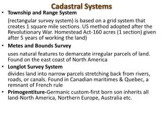
The Public Land Survey System (PLSS) is a method used in the United States to survey and identify land parcels, particularly for titles and deeds of rural, wild or undeveloped land. Its basic units of area are the township and section.

E N D
The Public Land Survey System (PLSS) is a method used in the United States to survey and identify land parcels, particularly for titles and deeds of rural, wild or undeveloped land. Its basic units of area are the township and section. • It is sometimes referred to as the rectangular survey system, although non rectangular methods such as meandering can also be used. • The survey was "the first mathematically designed system and nationally conducted cadastral survey in any modern country."
Cadastral Survey Land Grant: A land grant is an area of land to which title was conferred by a predecessor government and confirmed by the U.S Government after the territory in which it is situated was acquired by the United States. These lands were never part of the original public domain and were not subject to subdivision by the PLSS. Public domain: Land owned by the Federal government for the benefit of the citizens. The original public domain included the lands that were turned over to the Federal Government by the Colonial States and the areas acquired later from the native Indians or foreign powers. Sometimes used interchangeably with Public lands. Public lands: Lands in public ownership, therefore owned by the Federal government. Sometimes used interchangeably with public domain.
Cadastral Survey (Continued) Initial point: The starting point for a survey. Base line: A parallel of latitude, or approximately a parallel of latitude, running through an arbitrary point chosen as the starting point for all sectionalized land within a given area. Principal meridian: A meridian line running through an arbitrary point chosen as a starting point for all sectionalized land within a given area. Range: A vertical column of townships in the PLSS. Section: A one-square-mile block of land, containing 640 acres, or approximately one thirty-sixth of a township. Due to the curvature of the Earth, sections may occasionally be slightly smaller than one square mile. Township: An approximately 6-mile (9.7 km) square area of land, containing 36 sections. Also, a horizontal row of townships in the PLSS. Witness Corner: A marker set on a property line, near a corner. The witness corner is used when it is impossible to place a monument in the exact location of a section, quarter, or sixteenth corner.
Surveying a new country
First, need to know baselines & meridians
The sections were originally marked with wood posts, rocks or mounds of earth. • Record of the original survey called the General Land Office (GLO) survey is found in the original field notes and plats. • Today, new permanent monuments are placed at the section and 1/4 section corners (halfway between section corners). • These monuments may also be aluminum pipes, iron rods, concrete markers or iron pipes with caps stamped to identify the corner.
A chain is a unit of length; it measures 66 feet or 22 yards or 100 links[1] (20.1168m). • There are 10 chains in a furlong, and 80 chains in one statute mile. • An acre is the area of 10 square chains (that is, an area of one chain by one furlong). • The chain has been used for several centuries in Britain and in some other countries influenced by British practice.
Map Symbols
Coordinate Systems • Spherical: • Spheres and spheroids. • Latitude/Longitude. • Planar: • Cartesian coordinate system. • State Plane. • UTM (Universal Transverse Mercator).
Coordinate Systems - Example Spherical measurements Latitude/Longitude Cartesian coordinate system State Plane zones
Map Projections • Transforming three-dimensional space onto a two-dimensional map. • This process inevitably (unavoidably) distorts at least one of these properties - shape, area, distance, direction - and often more. • The advantage of a planar system is that measures of length, angle, and area are constant across the two dimensions.
Map Projections - Example Conic projection Cylindrical projections Planar projections
UTMs The Universal Transverse Mercator (UTM) projection is used to define horizontal, positions world-wide by dividing the surface of the Earth into 6 degree zones, each mapped by the Transverse Mercator projection with a central meridian in the center of the zone. UTM zone numbers designate 6 degree longitudinal strips extending from 80 degrees South latitude to 84 degrees North latitude. UTM zone characters designate 8 degree zones extending north and south from the equator.