Download
1 / 5
50 likes | 128 Views
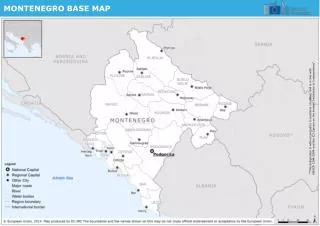
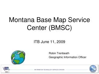
This report, conducted by the Montana Base Map Service Center (BMSC) in June 11, 2009 and led by Robin Trenbeath, the Geographic Information Officer, provides insights from in-person interviews with 12 participating agencies. The assessment categorizes GIS usage into four levels: Primary, Heavy, Moderate, and Light. Key recommendations include customized agency strategies, fostering enterprise-wide GIS adoption, establishing a federated IT/GIS model, standardizing architecture, leveraging the GIS Portal at MSL, minimizing data redundancy, constructing a State Base Map, offering GIS web services, and hosting a State GIS Forum. For more information, feel free to ask questions or share comments.

E N D
Montana Base Map Service Center (BMSC)ITB June 11, 2009 Robin Trenbeath Geographic Information Officer
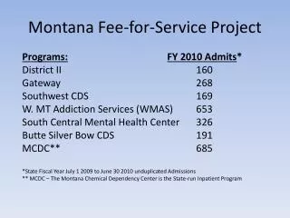
GIS Assessment Survey • In-person Interviews • 12 Agencies Participated • 4 Categories of GIS Usage • Primary • Heavy • Moderate • Light
Recommendations • Agency Specific • Enterprise Wide
Enterprise Wide • Build State IT/GIS Federated Model • Implement Standardized Architecture • Utilize the GIS Portal @ MSL • Reduce Data Redundancy • Create State Base Map • Develop GIS Web Services • Provide a State GIS Forum
Questions? Comments?