Download
1 / 30
310 likes | 502 Views
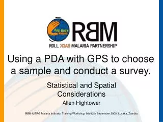
Sampling Considerations, Including Using a PDA with GPS to choose a sample and conduct a survey. Statistical and Spatial Considerations Allen Hightower. Sampling Design – Considerations: 1. Precision at the national and first level administrative units.

E N D
Sampling Considerations, Including Using a PDA with GPS to choose a sample and conduct a survey. Statistical and Spatial Considerations Allen Hightower RBM-MERG Malaria Indicator Training Workshop, 9th-12th September 2008, Lusaka, Zambia
Sampling Design – Considerations: 1 • Precision at the national and first level administrative units. • The ability to evaluate large scale programs • National in scope • First admin level • Not the second admin level! • The ability of the survey to give answers to your tabulation plan (mock report). RBM-MERG Malaria Indicator Training Workshop, 9th-12th September 2008, Lusaka, Zambia
Sampling Design – Considerations: 2 • Appropriate sampling frame • Is your target population correct? • Survey the whole country or only areas with malaria risk? • Cost benefit /logistics • Should you include large/remote areas with little population? • Eg, NE province in Kenya: large, arid area • Political Considerations • Program evaluation • Ethnic groups of interest RBM-MERG Malaria Indicator Training Workshop, 9th-12th September 2008, Lusaka, Zambia
Sampling Design – Considerations: 3 • Usually use a multi stage survey with a combination of the below components: • Simple Random Sample • Best precision, valid • Systematic sample….actually is a cluster sample. • Cluster Sample • Less precision, valid. Operationally easier to implement. • Multi-stage clustering: potential analytic issues • Stratified sample: to increase precision. Often used to define domains of interest. RBM-MERG Malaria Indicator Training Workshop, 9th-12th September 2008, Lusaka, Zambia
Sampling Design – Considerations: 4 • Be sure that your sampling plan will cover domains/target populations of interest: • Rural/urban : 75/25? • Malaria endemic zones • Pregnant women: This was the hard one for Kenya • Achieved by increasing cluster size • CU5s RBM-MERG Malaria Indicator Training Workshop, 9th-12th September 2008, Lusaka, Zambia
Sampling Design – Considerations: 5 • What do you do if your sampling frame is out of date or does not exist? • Work with the CSO to develop a new one. • Work with CSO to improve the existing one. • Two tracks: • Paper: the household listing system • PDA: Use GPS Survey RBM-MERG Malaria Indicator Training Workshop, 9th-12th September 2008, Lusaka, Zambia
Why Use GPS Survey? • CSO maps often out of date • Peri urban areas • Urban areas • All of them? • GPS survey creates an up to date sampling frame (ie, HH list) • GPS survey creates a statistically valid sample RBM-MERG Malaria Indicator Training Workshop, 9th-12th September 2008, Lusaka, Zambia
Why Use GPS Survey? • GPS survey can be used in cluster or simple random samples at the last stage. • GPS Survey can provide information on the interviewer not possible with paper-based surveys. RBM-MERG Malaria Indicator Training Workshop, 9th-12th September 2008, Lusaka, Zambia
PDA data collection: How safe? Data saved field-by-field • Battery Loss – non-issue. • Memory is nonvolatile like a digitall camera. • Battery life >>16 hrs • Better than laptop/tablet computers • Big screens, HDs use power! • No moving parts (ie, better than a laptop) • Encryption/PW at OS level • PDAs we use are very, very sturdy. • Have never had one stolen/lost. • CDC Kenya collected > 12 million pieces of paper electronically with PDAs last year. RBM-MERG Malaria Indicator Training Workshop, 9th-12th September 2008, Lusaka, Zambia
PDA data collection: Can Paper do this? • Live skip patterns – less training • Only see the right questions. • QC at Data Collection point • Autoword completion: less typing • Turn off unneeded features (games/buttons) • Know where interviewer is/should be • Know when the interview started/stopped • Very, very rapid data availability RBM-MERG Malaria Indicator Training Workshop, 9th-12th September 2008, Lusaka, Zambia
Concept of PDA-GPS system • Interview teams take nothing more than PDAs with attached GPS units into a cluster • Map HHs in the cluster • Choose a statistically valid sample • Conduct Software Guided Interview w/PDA • Data Rapidly Available for Reporting/Spatial Analyses RBM-MERG Malaria Indicator Training Workshop, 9th-12th September 2008, Lusaka, Zambia
PDA-GPS mapping system • Simple, fast • Most clusters mapped in 4 hrs or less • Village Name (auto carry) • HH number (auto increment) • Comment (e.g., the house in the middle, family name) • GPS gets you close, Comment provides final ID info • Allows Multiple mappers RBM-MERG Malaria Indicator Training Workshop, 9th-12th September 2008, Lusaka, Zambia
GPS Survey Program:GPS readings • Program checks the CF-GPS unit for a valid reading • Gives color coded GPS validity • Green – good precision • Yellow – marginal • Red – poor • Random number assigned to HH when data are saved. RBM-MERG Malaria Indicator Training Workshop, 9th-12th September 2008, Lusaka, Zambia
RBM-MERG Malaria Indicator Training Workshop, 9th-12th September 2008, Lusaka, Zambia
Sampling Design • It is your decision! • The system only affects how households or compounds are sampled within a cluster. RBM-MERG Malaria Indicator Training Workshop, 9th-12th September 2008, Lusaka, Zambia
GPS Survey-Sampling: • You tell the PDA program : • How many HHs to sample from the EA. • How many alternates HH’s? • SRS or Cluster Sample • Parameters set up in XML file • You get: • a random sample where each HH has a known probablity of selection. • A File of the GPS data for all mapped HH’s and features of interest • Denotes which HH’s are in the sample RBM-MERG Malaria Indicator Training Workshop, 9th-12th September 2008, Lusaka, Zambia
GPS Navigation Software • Guides the interviewer back the sample HH • List of HH ID’s with distance and compass direction /pointer • Also a map of HHs • Can mark HH off list • Can divide a list RBM-MERG Malaria Indicator Training Workshop, 9th-12th September 2008, Lusaka, Zambia
GPS Navigation Software • List of HH ID’s with distance and compass direction/pointer • Can mark HH off list • Can divide a list to allow multiple interviewers to split work. RBM-MERG Malaria Indicator Training Workshop, 9th-12th September 2008, Lusaka, Zambia
GPS Navigation Software • Also a map of HHs • Can show HH ID info RBM-MERG Malaria Indicator Training Workshop, 9th-12th September 2008, Lusaka, Zambia
More to this than technology!!! • This is a system that uses technology. • Software development and testing. • Training, training. • Stay in touch with the data collectors in the field regularly. RBM-MERG Malaria Indicator Training Workshop, 9th-12th September 2008, Lusaka, Zambia
Training!!! • Can train people to use a lousy system • Poor training can ruin a perfect system • Learn how to solve common problems • Tip sheets/manuals • Training schedules/exercises • Stay in touch with the data collectors in the field regularly. RBM-MERG Malaria Indicator Training Workshop, 9th-12th September 2008, Lusaka, Zambia
Advantages of GPS-based Simple Random Sample • Gold Standard Approach • SRS – better precision than other approaches. • Unbiased (accurate) • Any HH in village can be a part of sample • You know the probability of selection for a HH. • IE, a probability sample. • Spatial Analyses RBM-MERG Malaria Indicator Training Workshop, 9th-12th September 2008, Lusaka, Zambia
Why is “Statistical Validity” Important? • For any survey, even those not using statistically valid methods, you can compute means, proportions, std errors. • However, to know the statistical distribution and compute confidence intervals for the means and proportions, you MUST use a random sampling process. • Or you must pretend that you used a random sampling process. RBM-MERG Malaria Indicator Training Workshop, 9th-12th September 2008, Lusaka, Zambia
How much work to map cluster? • 4 hours to map the EA, typically • Some take 2 days! • 1 to 3 minutes between GPS readings (between HH’s) • Each interviewer mapped between 30 to 45 HH’s per EA RBM-MERG Malaria Indicator Training Workshop, 9th-12th September 2008, Lusaka, Zambia
GPS can be used for quality control. Here we caught someone standing in one place. All GPS readings were within 60m. Sept 2005 Bad (Red): Green =remapping of village! RBM-MERG Malaria Indicator Training Workshop, 9th-12th September 2008, Lusaka, Zambia
GPS can be used for quality control. In the Kenya MIS, we had an “extra” cluster mysteriously appear. RBM-MERG Malaria Indicator Training Workshop, 9th-12th September 2008, Lusaka, Zambia
As we looked, the phantom cluster consisted of points that belonged to other 4 clusters. All pts were very close together. Turns out, the team had stopped at a meeting place to “complete their quota.” Our system has an audit trail, taking a GPS reading each time a household record is changed. RBM-MERG Malaria Indicator Training Workshop, 9th-12th September 2008, Lusaka, Zambia
Can Produce a Map of HH’s in each EA,Showing which were in the Survey • Survey Program produces Database file with: • Lat/Lons for all HH’s in EA • Indicator for whether HH was included in sample • Lat/Lons for all other features of interest • Easily Imported into other GIS products RBM-MERG Malaria Indicator Training Workshop, 9th-12th September 2008, Lusaka, Zambia
Standardized data collection tools • MIS’s in Zambia, Kenya, Ethiopia • Bednet Ownership/Usage surveys in a number of countries. • Comparable methods, systems • Extremely cost effective if systems and pdas are used multiple times. • Not sure it is worth it to do just once RBM-MERG Malaria Indicator Training Workshop, 9th-12th September 2008, Lusaka, Zambia
Thank you! RBM-MERG Malaria Indicator Training Workshop, 9th-12th September 2008, Lusaka, Zambia