Daniel Krompholz dgkrompholz@gmail
270 likes | 454 Views
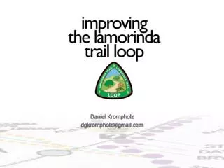
Daniel Krompholz dgkrompholz@gmail.com. Project Scope. The purpose of this project is to improve pedestrian and bicycle transportation along and to the recently established tri-city Lamorinda Trail Loop. Source: bicycling.511.org. Existing Land Use. Lamorinda Trail Loop.

Daniel Krompholz dgkrompholz@gmail
E N D
Presentation Transcript
Daniel Krompholz dgkrompholz@gmail.com
Project Scope The purpose of this project is to improve pedestrian and bicycle transportation along and to the recently established tri-city Lamorinda Trail Loop.
Source: bicycling.511.org Existing Land Use
Multi-Use Path Class I Bikeway Class II Bike Lane Class III Bike Route Existing Cyclist Facility Types
Rating 5 – Safest Rating 4 Moraga Way, Moraga Rating 1 – Least Safe Rating 3 Rating 2 Visual Safety Assessment Ratings for Cyclist Safety
Separated Paths Sidewalks Existing Pedestrian Facility Types
Rating 4 Rating 5 – Safest Rating 1 – Least Safe Rating 2 Rating 3 Visual Safety Assessment Ratings for Pedestrian Safety
Short-Term Recommendations • Widen bike lanes to meet Caltrans design standards (right) • Stripe Class II facilities along designated Class II facilities (bottom right) • Repave uneven surfaces (below)
Long-Term Recommendations • Establish guiding policies in the Lamorinda Cities’ General Plans to: • Provide safe and convenient pedestrian and cyclist circulation along and to the trail loop • Promote trail loop facilities as a priority for funding and maintenance • Promote the development of a tri-city masterplan to address additional connector trails to the loop
Long-Term Recommendations • Given the opportunity to acquire easements or right-of-ways along the loop, trails should be designed preferentially for pedestrians and cyclists (with exception to the Lafayette-Moraga Regional Trail which should remain managed as a mixed-use trail) • Adopt preferred bicycle lane width standards for facilities and implement them along existing Class II facilities or pending easement or right-of-way acquisition
Approach – McHarg Overlay Method • Maximum Social Benefit at the Least Social Cost • The darker the tone the greater the cost, the lighter the tone the less cost
Conclusion • Recommendations were made to promote both short-term and long-term improvements to the trail loop. • The feasibility for using GIS and widely accessible data to plan additional connector trails to the trail loop was demonstrated. • Consideration of this project by the Lamorinda cities can hopefully bring the region a step closer to being a walkable and cyclist-friendly place
Acknowledgements Francis, Mark Professor, LDA Greco, Steve Professor, LDA Gutstein, Joyce Director - PSRP Ustin, Susan CSTARS Director & UC Davis Professor of Resource Science Huber, Patrick Graduate Student Researcher, UC Davis Geography Grad Group Whiting, Mike Post-Doctoral Scholar - CSTARS & UC Davis LAWR Skinner, Todd Director - Parks and Recreation, City of Orinda Wolff, Greg Senior Planner – Planning Services Division, City of Lafayette Fazel, John Vice President - American Discovery Trail Society Trombetti, Marco Post-Doctoral Scholar - CSTARS Greenberg, Jonathan Post-Doctoral Scholar - CSTARS Lay, Mui Post Graduate Researcher - CERES Andrew, Margaret Graduate Student Researcher – CSTARS Hestir, Erin Graduate Student Researcher - CALSPACE Noujdina, Nina Remote Sensing Analyst - CSTARS Keightley, Keir Graduate Student Researcher – CSTARS Hart, Quinn Programmer, CERES Scheer, George Programmer/Systems Analyst, CSTARS Hill, Scott Orinda Watershed Ranger Supervisor - EBMUD Skahill, Jeff Senior GIS Programmer - EBMUD Stone, Beth GIS Analyst - EBRPD
Thank you Daniel Krompholz 925-285-7206 dgkrompholz@ucdavis.edu