Download
1 / 29
290 likes | 406 Views
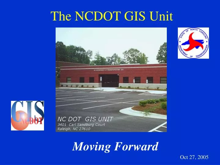
The NCDOT GIS Unit. Moving Forward. Oct 27, 2005. Today’s Discussion. Road Data - Current Core Process Change - Moving Forward Priority Projects Where We Go From Here Questions? . Road Data - Current Core Process. Current Core Process - Issues. Many data format changes, back and forth

E N D
The NCDOT GIS Unit Moving Forward Oct 27, 2005
Today’s Discussion • Road Data - Current Core Process • Change - Moving Forward • Priority Projects • Where We Go From Here • Questions?
Current Core Process - Issues • Many data format changes, back and forth • Mainframe Database • Oracle • Microstation DGN’s • Coverages • Shapefiles • Multiple copies of datasets need to be synchronized • De-centralized control of the process
Current Core Process - Results • Error Prone • Slow • Corrections are difficult to make • Data dissemination is difficult • Resource intensive
Change • Re-organize the GIS Unit to better take advantage of GIS technology and to better serve our customers • Streamline and improve core data flow processes • Continue to integrate with NCDOT IT
Continue to Integrate with NCDOT IT • Ownership • Better Accountability • More Customer Oriented Across the Organization • More Participation with other State and Local Agencies
Top Priority Project • Linear Referencing System (LRS) • GIS Unit Reorganization • TransIMS Phase II • Implement an Enterprise Spatial Database
NCDOT LRS • The “Linear Referencing System (LRS) Project” was an effort that began sometime ago and fell prey to shifting goals and purposes. • One key result of these shifting goals and purposes was to have the Project and even the term “LRS” take on different meanings for different people and groups. • An LRS Task Force was formed in July 2005 to address these issues and to complete the LRS Project.
LRS Defined • At its core, a Linear Referencing System (LRS) is a geospatial concept that is defined as: • “A method for storing geographic data by using a relative position along an already existing linear feature; the ability to uniquely identify position along lines without explicit x,y coordinates. Location is given in terms of a known linear feature and a position, or measure, along it. Linear referencing is an intuitive way to associate multiple sets of attributes to portions of linear features.” -ESRI
LRS Task Force Purpose • The purpose of the LRS Task Force and the new LRS effort is to clearly define the “LRS Project” in terms of deliverable data products, establish a repeatable business process, and finally to manage these products. • It is also the intention of the LRS Task Force to produce a Data Migration Guide for LRS Deployment for customers to assist them in preparation, if needed, to attach their various data sets to the LRS.
NCDOT LRS Goals and Objectives • Integrate the following Core Linear Referencing Methods (LRMs) • Route and Mile Post • Generation1 (G1) FTSeg’s and Offsets • Link-Node • FTSeg • Coordinate Route • Transformations • The LRS must support transformations between referencing methods without losing accuracy. • Maintain the Linear Datum • Conceptually, this is the “system” or underlying network itself. The Linear Datum is also sometimes referred to as the base reference network. • Data Extent • The LRS currently includes only NCDOT state maintained roads. It does not currently include non-NCDOT state maintained roads.
NCDOT LRS Goals and Objectives, cont. • Maintain Timely Data • Changes to the NCDOT state maintained road network will be added to the LRS within an average of two weeks after official notification to the GIS Unit. • Provide Ad hoc and Pre-defined Data Processing • User access to the LRS, will facilitate the use of decision support systems, and will support report generation (map and tabular). • Be a Scalable System • The LRS will be extendable to all ground transportation systems. • Changes to the System Will Not Affect Existing Event References • Existing routes, events, or activities will not change their location or occurrence as roads are changed, removed, or added.
NCDOT LRS Constraints • The LRS should not mandate, but only recommend, which of the core LRMs should be used in the field for data collection. • The LRS will be developed using NCDOT’s technology standard product lines: Oracle and ESRI. • The LRS will use existing NCDOT base map data, although perhaps not in their current structure. • Initially the LRS will include ONLY NCDOT state maintained roads. Additional roads will be included in future releases. • The LRS must have one linear datum that supports all stated networks and LRMs.
LRS Products and Deliverables • NCDOT LRS v.1 Document • This document is to explain the definition, goal, and schedule of the NCDOT GIS Unit’s LRS effort. • Data Migration Guide for LRS Deployment • This document is intended to assist customers in preparing their current datasets for use with the NCDOT LRS v.1 • State LRS Personal Geodatabase • This dataset represents the combined information from the individual County Personal Geodatabases to form a single State wide dataset. In addition, the link-node attributes are added to this dataset.
LRS Products and Deliverables, cont. • Route and Mile Post • The dataset is created from the State LRS Personal Geodatabase and the Road Inventory LRS v.7 Oracle database. It is a subset representing the NCDOT State maintained road system with route, milepost, and link-node attributes. • Road Characteristics • The dataset is created from the State LRS Personal Geodatabase and the Road Inventory LRS v.7 Oracle database. It is a subset representing the NCDOT State maintained road system identified with road characteristics (or conditions) attributes.
LRS Products and Deliverables, cont. • Road Intersections • The dataset is created from the State LRS Personal Geodatabase and the Road Inventory LRS v.7 Oracle database. It is a subset representing and identifying (through attributes) the intersections of the NCDOT State maintained road system. • Cartographic Linework • This dataset is created from the individual County Personal Geodatabasesand contains digital line, point (cell), and polygon layers; stored in Microstation format. Data represents all CAD elements required for Microstation cartographic production.
GIS Unit Priorities • LRS Completion • Business Process Improvement • Unit Reorganization • AD Migration • Hardware/Software Upgrades • GIS Unit Line Edit Tool • TransIMS Phase II • LARS • LRS Access and Reporting System • PMS/GIS Integration • Enterprise Spatial Data Environment • ArcSDE / Oracle Implementation
GIS Unit Priorities (cont.) • Local Roads Data Development • TIMS • Traffic Information Management System • LIDAR Tool • Watershed Delineation Tool • CC V Position • AP I Positions • AAP II Position • LRS/Universe Reconciliation • Training
GIS Unit Priorities (cont.) • Dataset Inventory • Maps • Metadata Standards • Functional Classification Maps • Oracle 9i Migration • ESRI ELA - Implementation • Data warehousing for PDEA/TPB
GIS Unit Priorities (cont.) • Div Query Tool / MMS Integration • URS Hydro IMS App • Archeological Predictive Modeling App • Photogrammetry and MrSID • Bridge Dataset Maintenance • Lumber River RPO
GIS Unit Priorities (cont.) • BMU Field Application • TIP Query Tool • DOT Division of Aviation
Where We Go From Here... • Full integration with the LRS process and ArcSDE • Implementation and deployment of ESRI new server technology - ArcServer • Local Roads as part of core dataset • Deployment of Metadata Services • Leading the Nation for Transportation GIS!
Questions? • John Farley • jcfarley@dot.state.nc.us