Download
1 / 25
250 likes | 502 Views
GEO Work Plan Symposium Capacity Building Side Event Capacity Building in South-America Hilcéa Ferreira INPE - Brazil. 01 May 2014, Geneva, Switzerland. NATIONAL INSTITUTE FOR SPACE RESEARCH – INPE - BRAZIL. INPE’s space technology agenda

E N D
GEO Work Plan SymposiumCapacity Building Side EventCapacity Building in South-AmericaHilcéaFerreiraINPE - Brazil 01 May 2014, Geneva, Switzerland
NATIONAL INSTITUTE FOR SPACE RESEARCH – INPE - BRAZIL INPE’s space technology agenda “Global EO” – Brazil as global player in Earth observation Bilateral agreements China, USA, Argentina, UK… Multilateral Agreements CEOS, GEO
Contribution to different SBAs Energy Ecosystems Agriculture Health Civil Defense Weather Urban Management
CAPACITY BUILDING INITIATIVES - INPE • EARTH OBSERVATION DIRECTORATE - OBT • CENTER FOR WEATHER FORECAST AND CLIMATE STUDIES – CPTEC • AMAZON REGIONAL CENTER - CRA
EARTH OBSERVATION DIRECTORATE • Remote Sensing Ground Station • CBERS Chinese Brazilian Satellite • Remote Sensing Data Centre • Remote Sensing Research and Applications • GIS Technology Research and Applications • Environmental Modeling • Capacity Building: graduate courses, short courses in GIS and Remote Sensing, face to face and distance learning • Satellite Data ReceptionStation – Cuiabá, Brazil
Remote Sensing and GIS Technologies are essential from management of Brazilian territory • SPRING: GIS (http://www.dpi.inpe.br/spring) • Open geospatial technologies and open standards • TerraLib(http://www.terralib.org/index.php): a functions library developed in C++ that allows a collaborative environment and its use for the development of multiple GIS tools. • TerraView • TerraMA2: Open Plataform for Monitoring, Analysis and Alert Systems • TerraHidro: tool built on TerraLib´s library, designed to develop distributed hydrological models, using elevation and hydrological data • TerraAmazon – open source software for large-scale land change monitoring
Remote Sensing Education at OBT • Graduate Program in Remote Sensing (MsC and PhD) • 400+ graduate students • Short Courses in GIS and Remote Sensing (40 h) • www.dpi.inpe.br/cursos • Establishment, in 2004, of a distance learning program in GIS and Remote Sensing • 500+ trained people • International course on remote sensing at the specialization level: professionals from Latin American and Caribbean countries. • Total of 475 professionals have been trained in South America • On-line material (books, presentations, video-classes)
Short-Term Courses Face-to-Face 1999 – Image Processing Division (DPI/OBT), in partnership with SELPER-Brazil (Society of Latin-American Specialists in Remote Sensing): courses aimed at supporting the use of geotechnology in Brazil
Online Education: Introduction to Remote Sensing (From May 2004 to June 2013 From May 2004 to June 2013 Backgrounds of selected students from Intro_SR courses
CENTER FOR WEATHER FORECAST AND CLIMATE STUDIES • Operational Forecast Systems (time scales) • ModelingForecastproducts • SupercomputerFacilities • Monitoring products based on remote sensing • Research and Satellite Applications • Training andEducation Cachoeira Paulista, SP-Brazil
GIS FOR ENVIRONMENTAL INFORMATION Cachoeira Paulista, SP-Brazil http://sigma.cptec.inpe.br/sigma/
Provide education and training in satellite meteorology for the Portuguese-Speaking Countries
http://poapem.cptec.inpe.br/moodle/?lang=en MOODLE FACTS 11 Courses in the last 2 years 650 + Registered Users 60+ training material developed and additional references
ABOUT OUR COURSES... • OBJECTIVE: Provide high quality training and updated resources on current and future weather satellites. Encourage the use of satellite data and products for Portuguese-speaking countries. • COURSES METHODOLOGY: 30% classroom courses – 70% on-line courses. • AVERAGE DURATION: 3 days (2 sessions per day) – Seminar type presentations. • INSTRUCTORS: Satellite and Environmental Systems Division, Rio de Janeiro Federal University, Itajuba Federal University, National Center for Monitoring Natural Disasters Alerts, among others.
ABOUT OUR PARTICIPANTS... PARTICIPANTS: 288 students (2011) 379 students (2012) AVERAGE ATTENDANCE: 48 students/course Uruguay Colombia Portugal Cabo Verde Angola Mozambique South Africa Brazil Bolivia Chile Argentina Ecuador Peru Venezuela PARTICIPANT COUNTRIES
AMAZON REGIONAL CENTER - CRA • http://www.inpe.br/cra/ingles/ • The activities of the Amazon Regional Center involve research and scientific development to becoming a world reference center in the monitoring of tropical forests: • Spreading Geotechnology in the region; • Being an international center for the dissemination of technology in order to monitor characteristics of tropical forests.
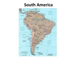
INTERNATIONAL CAPACITY BUILDING Rationale The largest extensions of tropical forests of the world are located in South America, west Africa and southeast Asia. In these regions there are also many developing countries and their need for natural resources is threatened by intense and illegal exploration of the forests resources. Nowadays, the protection of the national forests has became a priority in their agendas, as also has been followed by the international community.
INTERNATIONAL CAPACITY BUILDING To combat the advance of deforestation, the remote sensing techniques have been a very efficient way to quantify the areas of forest deforested. Brazil is the only country in the tropical region that has a tropical forest monitoring program, which was developed by the National Institute for Space Research – INPE in 1988. Considering the importance of the environmental issues to the international community, international organizations such as the Japan International Cooperation Agency – JICA, the Food and Agriculture Organization – FAO and also the Amazon Cooperation Treaty Organization – ACTO developed efforts to establish partnerships with INPE in order to capacitate foreign technicians to operate the TerraAmazon system, which is responsible for forest monitoring. • http://www.inpe.br/cra/ingles/project_research/international_capac_build.php
INTERNATIONAL CAPACITY BUILDING 86 • Capacity Building in Tropical Forest Monitoring • TerraAmazon System • Tutorials (Portuguese, English, French and Spanish) • Presentations and Hands-on activities • Video-classes (being developed) • Pre and pos students assessment • After-course support (Email and Discussion Forums) • Some publications (LARS, 2013 – South America and OTCA data) • PARTICIPANTS PER YEAR 76 53 30 2011 2012 2013 2010
INTERNATIONAL CAPACITY BUILDING • COUNTRIES TRAINED – 2010 - 2013 • SOUTH AMERICA: Bolivia, Colombia, Colombia, Venezuela, French Guyana, Suriname, Peru, Ecuador and Paraguay • CENTRAL AMERICA: Belize, Guatemala, Jamaica, El Salvador, Panama, Mexico, Nicaragua, Costa Rica and Barbados • AFRICA: Angola, Mozambique, Congo Democratic Republic, Zambia, Cameroon, Senegal, Burkina Faso, Burundi and Chad • ASIA: Malaysia, Indonesia, Bangladesh, Thailand, Cambodia, Vietnam, Papua New Guinea, and Philippines
INTERNATIONAL CAPACITY BUILDING Latest course: 17-21 February, 2014 CARICOM
NETWORKING GEO as a coordinator of Capacity Development
THANK YOU Hilcéa Ferreira (hilcea@dpi.inpe.br) Leads in CPTEC and CRA Luiz Augusto Machado (luiz.machado@cptec.inpe.br) Alessandra Gomes (alessandra.gomes@cra.inpe.br)