Download

1 / 29
300 likes | 651 Views
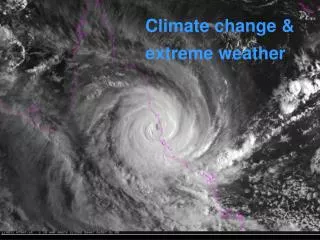
Kenyan Extreme Weather and Climate Events . Samuel Mwangi Kenya Meteorological Department mwangi@meteo.go.ke. Outline. Kenyan Experience Examples Prediction and Forecasting Conclusions. Kenyan Experience.

E N D
Kenyan Extreme Weather and Climate Events Samuel Mwangi Kenya Meteorological Department mwangi@meteo.go.ke
Outline • Kenyan Experience • Examples • Prediction and Forecasting • Conclusions
Kenyan Experience • Kenya experiences various types of high impact extreme climate and weather events e.g. • Drought • Flooding • Storms (Thunderstorms/hail) • Landslides/mudslides • Impacts are many and diverse and may include • Population displacement • Property and infrastructure damage • Loss of life • Disease outbreaks
Current Situation • East Africa; Kenya in particular under the grid of devastating drought. • Water resources, livestock and food security compromised. • Drought is national in extent (most parts of the country affected)
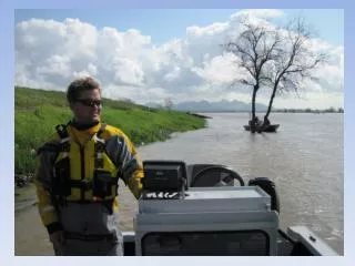
Examples of Flooding • Human displacement • Flooded roads
Droughts Impacts include crop failure, decimation of livestock and depleted hydro-power dams.
Heavy rainfall impacts Landslides and infrastructure destruction 7
Impacts of the Nyahururu Hailstorm • Damaged flower greenhouse • Shredded maize stand
Data • Rainfall Data is primary in monitoring floods and droughts. • Used in monitoring day to day and at bigger time scales. • Other datasets include: • Temperature • Wind • Model output of various parameters • Data sharing • ???? NOT EASY (Departmental policy does not encourage especially raw data exchange and or sharing).
Elements of a Functional Prediction System USERS Commercial products Public sector products Warnings Flood prediciction Severe weather info Data dissemination WWW Mobile Newspaper etc...
Prediction and Forecasting • Kenya Meteorological Department issues several types of forecasts • Daily • 4-day • 7-day • Monthly • Seasonal
Daily, 4-day, 7-day Forecasts • These are based on a combination of Dynamical and chart analysis • HRM 28 Km resolution (ran at KMD) • WRF (ran at KMD) • GFS • Arpege Tropical • UK Met • ECMWF • These are visualized over a forecaster’s workstation with capabilities of overlays, profiles, cross-sections • The visualizations is combined with satellite images from MSG
Daily, 4-day, 7-day Forecasts Accuracy • The General forecast are accurate, they capture trends in rainfall patterns i.e. Increase or decrease of rainfall activities. • Meso-scale developments are more difficult to predict and pinpoint. Tropical systems evolve and dissipate quickly and are of such a scale as to make the difficult to forecast with existing modeling capabilities.
The Nyahururu Hailstorm Case 2 Sept 2008 • There were ice blocks, made up of small granules of hailstones that had coalesced. The granules measured about 10mm in diameter. • The maize plantation in there area had leaves shredded, a confirmation that the precipitation that fell in the area accompanied by hail. The damage was not much apart from the damage done on the maize and the flower green house structure. • The satellite images of between 11130UTC and 1400UTC depicted a rapid development of super cell clouds over the area that had a westward movement. • The rapid development could not be linked to the occurrence of the Hailstorm. Satellite based observation did not point towards a severe storm.
Seasonal Forecasts • Uses current state-of-the-art empirical statistical prediction methods and incorporates: • Sea Surface Temperatures (SSTs) • Sea surface Temperature gradients Δ(SSTs) • ENSO indices • Southern Oscillation indices (SOIs) • Nino regions SSTs • Tropical cyclones • Stratospheric winds ( Quasi-Biennial Oscillation ) • ICPAC coordinates regional consensus climate outlooks for 10 GHA countries
OBSERVED AND PREDICTED OND RAINFALL FOR ZONE8: Dagoretti Z8=0.459inda1m5+0.467inda1m6+0.342atda1m7+0.495pada4m6 R2 = 67%
Seasonal Rainfall Performance Monitoring • Uses the prevailing season’s rainfall and compares it to the Long-Term Mean (LTM) • LTM is computed from long-term observations from each station • Number of days with rain and the dry spells in the season give an indication of the intra-seasonal variability.
2004 Dagoretti Short-Rains Performance Normal Rainfall at Dagoretti during 2004 Short Rains
2005 Mandera Short-Rains Performance Below normal Rainfall at Mandera during 2005 Short Rains
Seasonal Forecasts Accuracy • These are accurate, especially when there extreme forcing events like El Nino, La Nina. • The continuous monitoring ensue that droughts can be picked out early.
Data Collection Analysis Correction Process Model Set Up Calibration Validation Model Implementation Flood forecasting Flood mitigation Flood mapping
Accuracy of Flood Forecasting • Reliable accuracy is only achieved at this basin: • Near real-time data collection and transmission • Automatic stations deployed in the basin • Use of GPRS/GSM technology in data transmission
National Coordination in Kenya • Office of the President coordinates National issues that are cross-cutting e.g. droughts, floods and other hazards that may result into disasters. Specialized NGOs (Red Cross, World Vision) and UN agencies also participate in the activities coordinated from the Office of the President. • The Kenya Meteorological Department (KMD) issues regular forecasts and updates to Keyline ministries. • NGOs are coordinated within their own setup. KMD however participates in some of the activities of NGOs in advising about weather and climate issues.
Conclusions • Nowcasting is the way to go to ensure accurate forecasting of meso-scale weather systems that are short-lived but have high impact. • Monitoring systems, Radar and other high spatial resolution systems can benefit the nowcasting of some of the systems. • Real-time data collection and transmission (Automatic Observation Platforms) would greatly enhance the capacity to predict some of the high impact weather systems like floods.