Download
1 / 32
320 likes | 534 Views
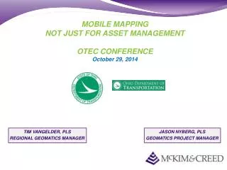
MOBILE MAPPING NOT JUST FOR ASSET MANAGEMENT OTEC CONFERENCE October 29, 2014. TIM VANGELDER, PLS REGIONAL GEOMATICS MANAGER. JASON NYBERG, PLS GEOMATICS PROJECT MANAGER. Presentation Outline:. Introductions National Standards & Specifications Vehicle & Equipment Overview

E N D
MOBILE MAPPINGNOT JUST FOR ASSET MANAGEMENTOTEC CONFERENCEOctober 29, 2014 TIM VANGELDER, PLS REGIONAL GEOMATICS MANAGER JASON NYBERG, PLS GEOMATICS PROJECT MANAGER
Presentation Outline: • Introductions • National Standards & Specifications • Vehicle & Equipment Overview • Survey Grade Accuracies • MOT 75 Stanley Ave Bridge Project • Typical Workflow • Field Procedures • Office Processing Procedures • Office Mapping Procedures • Typical Applications for Mobile Scanning • Limitations of Mobile Scanning • Questions
National Standards & Specifications: • Started Around 2007-2008 in USA • Equipment & Methodologies Continue to Improve • Transportation Research Board (TRB) Standards • http://onlinepubs.trb.org/onlinepubs/nchrp/nchrp_rpt_748.pdf • CALTRANS Standards • http://www.dot.ca.gov/newtech/new_dri_internet/3d_4d_files/caltrans_district_4_mtls_guidelines.pdf • FDOT Standards • http://www.dot.state.fl.us/surveyingandmapping/documentsandpubs/20131007_TML_Guidelines.pdf
LiDAR Acquisition Methods Fixed Wing Rotary Wing Mobile Terrestrial Higher Lower Point Density
Technology Application Speed and Range of Collection High Low Higher Lower Point Density
MoDaCTM Mobile LiDAR • 2 GPS units and Inertial Measurement Unit (IMU) • Distance Measurement Instrument (DMI) • 4 Digital Cameras or Single 360 Ladybug Camera • 2 LiDAR Scanners • Combined 1 million points/sec • 360 degree field of view • Density 500-5000 Points/Meter LiDAR Sensors GPS Antenna IMU DMI
FIELD PROCEDURES – DATA COLLECTION • Why Two Sensors? • Minimize laser shadowing • Optimize FOV • Sensor will see everything behind the vehicle • Sensor will see ~45º in front of vehicle • Full area coverage Sensor head 1 coverage Sensor head 2 coverage All sides covered
Density & Spacing: Typical Collection Speeds 50Km/Hr – 100Km-Hr (30MPH – 60MPH)
Data Processing • The point clouds and imagery contained million of measurements • Information required for client deliverables is extracted from the point clouds and imagery • Client Deliverables can be in almost any format Data Post Processing and Calibration (Software Varies by Sensor) Classification and Feature Extraction (Terrasolid, GeoCue, TopoDot, Virtual Geomatics, Cloudworks) GIS ESRI Smallworld Geomedia Industry Specific PLS_CADD Rail Track Clarion Dbase/Tabular Ascii Excel SQL Oracle CADD AutoCAD Microstation GEOPAK Caice
MOBILE SCANNING SURVEY GRADE ACCURACIES • Survey Requirements • Dual GNSS Base Stations • Mobile Panel Spacing – Maximum 1500’ with 500’ check shots • Mobile Panel Horizontal Accuracy – Positional tolerance 0.07’ • Vertical Accuracy – Positional tolerance 0.02’ • Scanning Requirements • Dual Sensors (500kHz Laser Speed) • Dual GNSS GPS Antennas • Inertial Measurement Unit (IMU) • Distance Measurement Unit (DMI) • QUAD Cameras (5MP) • 60’ Cutoff from Sensors
MOT 75 Project • I-75 from 500’ south of Leo St. to 500’ south of Neva St. and 550’ of Stanley Ave. including ramps & loops in Dayton, Ohio • Length: 8,800 LF • Schedule: 4 weeks
Scope of Work • Mobile Scan Data Collection of LiDAR & Imagery • Drive each lane of I-75, Stanley Ave, ramps & loop • Process LiDAR & Imagery to project datums • Perform Calibration of data • Adjust data to ground truthing & check shots • Perform RMSE analysis of adjusted data • Process Georeferenced Imagery • Extract 3D DTM & 2D Planimetric data • Generate TIN & Contours • Deliver Scan Data, DTM, TIN, Planimetrics & Contours in Microstation V8i/Geopak format per ODOT Standards and Specifications
Survey Control & Mobile Targets • Survey Control provided by ODOT • 39 Mobile Scan Targets and 15 check shots provided by ODOT • NAD 83/2011 and NAVD 88 Datums • Ohio State Plane South Zone • Double Occupation VRS-GPS collection for control • Hz < 0.03’, Z < 0.02’
Sample of Drive Lines • Dual GNSS Base Stations observing data while performing data collection • Drive each lane with proper start/stop procedures to ensure complete coverage and redundancy
Results & Deliverables 3D DTM & Contours • RMSE between surveyed mobile targets and scan data < 0.03’ • Final DTM surface < 0.07’ Deliverables • Calibrated LiDAR point cloud in LAS & POD formats • 3D DTM in Microstation V8i format • 2D Planimetrics in Microstation V8i format • TIN & DAT files in Geopak format • 1ft & 5ft contours • Georeferenced imagery & index file 2D Planimetrics
Accuracy Analysis • Numerous studies from various state agencies, vendors and private companies • Nearly all DOT’s are using Mobile Scanning for design purposes • Transportation Research Board (TRB) embraces Mobile Scanning for design purposes TIN – TIN Comparison Mobile LiDAR vs Static Scanning Maximum error <0.07’
MISSION PLANNING • PANEL PLAN • DRIVE LINES • SURVEY LIMITS • SCOPE OF WORK • TRAFFIC VOLUME
MISSION PLANNING WHEN IS THE BEST TIME TO SCAN? TRIMBLE MISSION PLANNING ONLINE
FIELD PROCEDURES – SURVEY PANEL CONTROL • Spacing – Maximum 1500’ • Horizontal Accuracy – Positional tolerance 0.07’ • Vertical Accuracy – Positional tolerance 0.02’ • Methodologies: • Horizontal – VRS Double Occupation (minimum) • Horizontal – Conventional Adjusted Traverse (Raw 1:20,000) • Vertical – Conventional or Digital Level Loop
FIELD PROCEDURES – GROUND TRUTHING • NEW TARGETS- • SOFTWARE AUTO COLLECTS CONTROL POINTS IN LIDAR • EASIER TO PLACE • DURABLE
PosPac GPS PROCESSING WHAT GOES IN: RAW GPS INFORMATION BASESTATION INFORMATION DMI INFORMATION IMU DATA • WHAT COMES OUT: • ACCURACY FILE • SBET-(SMOOTHED BEST ESTIMATE OF TRAJECTORY)
CALIBRATING DATA FINAL CALIBRATED DATA RAW DATA
Ground Truthing Adjustments & Tie Lines Adjustment to Mobile Target Coordinates Planer Adjustments to Coordinate Flight Lines
LiDAR with Imagery - TopoDOT TopoDOT- 3D Image Data Processing Tool Suite
MoDaC Mobile LiDAR for Roadways • Engineering Topographic Surveys • As-built Surveys • Structure and Bridge Clearance Surveys • Corridor Study and Planning Surveys • Asset Inventory and Management • Deformation Surveys
MoDaC Mobile LiDAR for Bridge Clearances TDOT Bridges Clearances – I-40 Nashville, TN
MoDaC Mobile LiDAR for Rail • Engineering Design • Clearance Studies • ROW Asset Inventory • Rail Yards • Tunnels • Catenary Studies • PTC Mapping and Change Management • Track Alignments • Data can be output to industry standard design packages
LIMITATIONS OF MOBILE SCANNING • Project Must be Drivable • Blockages & Shadowing • Weather • Standing Water • Vegetation • Length of Project Limits • Complexity of Project