Download
1 / 16
160 likes | 241 Views
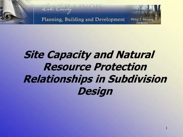
Site Capacity and Natural Resource Protection Relationships in Subdivision Design. Site Capacity Calculations. Determines carrying capacity of the land to be developed – Residential and Nonresidential Density calculated based on “Net Site Area”

E N D
Site Capacity and Natural Resource Protection Relationships in Subdivision Design
Site Capacity Calculations • Determines carrying capacity of the land to be developed – Residential and Nonresidential • Density calculated based on “Net Site Area” • Encourages natural resource and open space integration • Facilitates the planning and design process
Steps to Complete Site Capacity • 1. Base Site Area • 2. Net Site Area • 3. Calculate Density • 4. Determine Resource Protected Land Area • 5. Recreational Land (Residential Development) • 6. Determine Total Open Space Area • * Residential Developments
Step 1 - Base Site Area Calculation • Gross area of property • Subtract road, road easements and ultimate rights-of-way • Subtract land that is not contiguous • Parcel separate from parent parcel by road or natural feature • Parcel that may be developed on its own • Parcel that is of a different zoning classification.
Development Site 33.7 Gross Acres .5 Acre/Unit Density Base Site Area = 33.7
Step 2 - Net Site Area Calculation • Base Site Area • 2. Subtract floodplain, wetland, linear and nonlinear water bodies (natural channels, lakes and ponds)
Step 3 - Dwelling Unit Calculation • Net Site Area • Multiplied by residential density factor based on zoning classification. • 3. Unit Yield = 38
EXISTING EXISTING PROTECTION RESOURCE QTY/AREA REQUIREMENT GROVE 10,000 SF CANOPY 7,000 SF (70%) SIGNIFICANT TREES 7 TREES 5 TREES (70%) YOUNG WOODLAND 6.7 AC 50% (3.35 AC) MATURE WOODLAND 3.5 AC 70% (2.45 AC) FLOODPLAIN 3.5 AC 100% (3.5 AC) WETLAND 5.0 AC 100% of 4.9 AC WETLAND BUFFER 4.5 AC WETLAND 38,850 SF 80% 1.4 AC WETLAND 32,000 SF 80% SIGNIFICANT TREES TAG TYPE SIZE CONDITION 001 OAK 30” GOOD 002 OAK 30” GOOD 003 OAK 32” GOOD 004 OAK 32” GOOD 005 OAK 32” GOOD 006 OAK 34” GOOD 007 OAK 24” GOOD NATURAL RESOURCE INVENTORY (Per UDO, Article 4)
Step 4 - Natural Resource Land Area Calculation • Calculate area contained within each protected resource group • Multiply resource area by resource protection ratio from zoning ordinance to determine minimum resource protection land area for each resource. • 3. Sum the total for each resource to arrive at total protection land area for property.
EXISTING EXISTING PROTECTION PROPOSED RESOURCE QTY/AREA REQUIREMENT PROTECTION GROVE 10,000 SF CANOPY 7,000 SF (70%) 7,200 SF (72%) SIGNIFICANT TREES 7 TREES 5 TREES (70%) 6 TREES (85%) YOUNG WOODLAND 6.7 AC 50% (3.35 AC) 50% (3.35 AC/145,929 SF) MATURE WOODLAND 3.5 AC 70% (2.45 AC) 70% (2.45 AC/106,722 SF) FLOODPLAIN 3.5 AC 100% (3.5 AC) 100% (3.5 AC) WETLAND 5.0 AC 100% of 4.9 AC 100% (4.9 AC) WETLAND BUFFER 4.5 AC WETLAND 38,850 SF 80% 95% (36,850 SF) 1.4 AC WETLAND 32,000 SF 80% 100% SIGNIFICANT TREES TAG TYPE SIZE CONDITION__IMPACT 001 OAK 30” GOOD REMOVE 002 OAK 30” GOOD SAVE 003 OAK 32” GOOD SAVE 004 OAK 32” GOOD SAVE 005 OAK 32” GOOD SAVE 006 OAK 34” GOOD SAVE 007 OAK 24” GOOD SAVE NATURAL RESOURCE PLAN
Step 5 - Recreational Land Area Calculation • Take dwelling unit count proposed and multiply it against the recreational land area *multiplier. • *Based on recreational land area needs from Framework Plan for average County household size
Step 6 - Total Open Space CalculationConventional Option 1. Add the total resource protection land area and recreational land area required to be provided. • Represents the minimum amount of open space for conventional subdivision designs.
REQUIRED RESOURCE PROTECTED AREA PROTECTION RESOURCE AREA REQUIREMENT MINIMUM PROTECTION AREA REQUIREMENT – 13.65 AC *Wetland buffer overlaps woodland area and is subtracted for total area requirement GROVE 10,000 SF CANOPY 7,000 SF (70%) 0.16 AC YOUNG WOODLAND 6.7 AC 50% (3.35 AC)2.35 AC* MATURE WOODLAND 3.5 AC 70% (2.45 AC)1.45 AC* FLOODPLAIN 3.5 AC 100% (3.5 AC) 3.50 AC WETLAND 5.0 AC 100% of 4.9 AC 4.90 AC WETLAND BUFFER 4.5 AC WETLAND 38,850 SF 80% (31,080 SF) 0.71 AC 1.4 AC WETLAND 32,000 SF 80% (25,600 SF) 0.58 AC
Total Open Space CalculationConservation Option • Take Base Site Area and multiply it times the minimum open space ratio for zoning classification. (Determines minimum amount of open space required to qualify for conservation option) 2. Compare conventional open space requirement with conservation requirement and provide additional open space to attain minimum requirement.
Open Space Designation • Designation based on use of open space • Detention • Recreation • Greenway • Resource protection • Landscape • Sewage Disposal