Download

1 / 19
190 likes | 386 Views
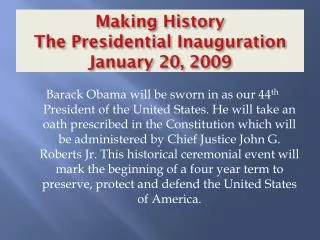
Weather Briefing for The 2013 Presidential Inauguration. NOAA/ National Weather Service Baltimore/Washington Weather Forecast Office January 16, 2013 2000 UTC/3:00 PM EST Ken Widelski Emergency Response Meteorologist. Outline. Weather Hazards Forecast Overview

E N D
Weather BriefingforThe 2013 Presidential Inauguration NOAA/ National Weather Service Baltimore/Washington Weather Forecast Office January 16, 2013 2000 UTC/3:00 PM EST Ken Widelski Emergency Response Meteorologist
Outline • Weather Hazards • Forecast Overview • Forecast Tables and Graphs • Reagan National Airport METAR & TAF • Illumination Data • Space Weather • Plume Modeling • Web Page • Summary of Weather Hazards • Briefing Schedule NWS Baltimore/Washington Weather Forecast Office
Weather Hazards00UTC 17 Jan – 00UTC 22 Jan 2013for Washington, D.C. Snow expected Thursday • Potential for 5 or more inches of snow. • A Winter Storm Watch has been issued. • Light rain in the morning changing to snow. Heavy snow possible for the evening rush hour. • Chance of Light Snow Inauguration Day • Low Confidence NWS Baltimore/Washington Weather Forecast Office
Forecast Snowfall Ranges NWS Baltimore/Washington Weather Forecast Office
Forecast Overviewfor Washington, D.C. NWS Baltimore/Washington Weather Forecast Office
Forecast Overviewfor Washington, D.C. NWS Baltimore/Washington Weather Forecast Office
Weather Element Forecastfor Washington, D.C. NWS Baltimore/Washington Weather Forecast Office
Weather Element Forecastfor Washington, D.C. NWS Baltimore/Washington Weather Forecast Office
KDCA METAR & TAFRonald Reagan National Airport METAR KDCA 161852Z 25005KT 10SM OVC009 05/03 A2992 RMK AO2 SLP131 CIG 008V011 T00500028 TAF KDCA 161828Z 1618/1718 20014G17KT P6SM OVC008 FM162300 00000KT P6SM OVC015 FM170000 00000KT 3SM BR OVC015 FM171100 30005KT 5SM BR OVC015 FM171700 31006KT 1 1/2SM -SN OVC025 NWS Baltimore/Washington Weather Forecast Office
Illumination Data Washington, D.C.
Illumination Data Washington, D.C.
Space Weather Summary/Forecast 1652 1654 1658 • Summary/Forecast Details: • Region 1654 has shown signs of decay but still merits some level of heightened situational awareness • Continued R1 (Minor) radio blackouts still possible • Threat of severe space weather remains relatively low Geomagnetic Storms Solar Flare Radio Blackouts Joint NOAA/USAF Space Weather Briefing Jan. 16, 2013 - 2000 UTC
Phenomena Reference/Impacts • Solar Flare Radio Blackout (R Scale): • No advance warning • Effects lasts for 10’s of minutes to several hours • Impacts High Frequency (HF) communication on the sunlit side of the Earth • First indication significant S and G scale activity may be possible • Solar Radiation Storm (S Scale): • Warnings possible on the minutes to hours time scale • Elevated levels can persist for several days • Impacts to the health and operation of satellites and International Space Station operations and crew • Impacts High Frequency communication in the polar regions, affecting commercial airline operations • Geomagnetic Storm (G Scale): • Advance notice possible given coronal mass ejection (CME) transit times from Sun to Earth range from just under a day to several days (CMEs being the main driver of significant storms) • In extreme storms, impacts to power grid operations and stability • Impacts to Global Positioning System (GPS) accuracy and availability • Driver of aurora; severe to extreme storms may cause aurora to be visible over most of the lower 48 Joint NOAA/USAF Space Weather Briefing Jan. 16, 2013 - 2000 UTC Complete NOAA Space Weather Scale information available online at: http://www.swpc.noaa.gov/NOAAscales/
NOAA/NWSBaltimore/Washington http://www.erh.noaa.gov/washington Always Up-to-date NWS Baltimore/Washington Weather Forecast Office
Summary • Snow expected Thursday • Winter Storm Watch • Potential for 5 or more inches of snow • Chance of Light Snow on Inauguration Day -- Low Confidence NWS Baltimore/Washington Weather Forecast Office
Briefing Schedule • T-7 days: Tue Jan 15 1500 EST • T-4 days: Thu Jan 17 1500 EST • T-3 days: Fri Jan 18 1500 EST • T-2 days: Sat Jan 19 1500 EST • T-1.5 Day: Sat Jan 19 2200 EST • T-1 Day: Sun Jan 20 1500 EST • T-14 hours: Sun Jan 20 2200 EST • T-12 hours: Mon Jan 21 0000 EST • T-9 hours: Mon Jan 21 0300 EST • T-6 hours: Mon Jan 21 0600 EST • T-3 hours: Mon Jan 21 0900 EST • T-1 hour: Mon Jan 21 1100 EST • T+2 hour: Mon Jan 21 1400 EST • T+5 hour: Mon Jan 21 1700 EST • Other times / dates as needed or requested NWS Baltimore/Washington Weather Forecast Office
Next Scheduled Briefing 2000 UTC/3:00 PM EST Thu 17 Jan 2013 Thank you for your participation! NWS Baltimore/Washington Weather Forecast Office