Download
1 / 14
140 likes | 264 Views
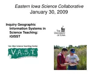
Eastern Iowa Science Collaborative January 30, 2009. Inquiry Geographic Information Systems in Science Teaching: iGISST. IGISST professional development. What is I GISST?. 3 year grant NCLB Title II program University of Iowa and Grant Wood AEA partnership

E N D
Eastern Iowa Science CollaborativeJanuary 30, 2009 Inquiry Geographic Information Systems in Science Teaching: iGISST
What is IGISST? • 3 year grant NCLB Title II program • University of Iowa and Grant Wood AEA partnership • 50 Secondary Science and interdisciplinary teachers • 100 hours PD supported by stipends/sub pay • 5 graduate credits/year in Earth/Environmental Science- leading to Earth Science endorsement.
1987 Iowa Groundwater Protection Act • Code of Iowa, 455E.8 • Develop a program…regarding water quality issues which shall be included in the minimum program required in grades seven and eight pursuant to rules adopted by the state board of education under section 256.11, subsection 4.
Improve science teaching and learning in grades 6-12 • through an intensive Professional Development (PD) program (100 hours/year) Majority of time (3 grad credits) in Summer 09: • Lakeside Labs • Colorado • Local Cedar Rapids investigation
Lakeside Labs • Dr. Mary Skopec
Dr. John Dunkhase • Colorado Summer IGISST program
through an intensive Professional Development (PD) program (100 hours/year)
incorporating inquiry teaching Learning Objectives: discuss how an instructional model that sequences learning experiences can help students build a deeper understanding of important Earth system science concepts; Improve science teaching and learning in grades 6-12
GIS data analysis tools Improve science teaching and learning in grades 6-12 • How can mapping data help students explore Earth processes like plate tectonics and their connection to extreme Earth events, such as earthquakes?
Improve science teaching and learning in grades 6-12 • into a problem-based learning instructional framework.
What is IGISST? • Problem-based learning • Outdoor field investigations • Science as Inquiry • Work with data analysis, geolocation (GIS) and other scientific tools for scientifically valid measurements • Curriculum integration with water quality as a context for Earth, Life and Physical science courses
IGISST Project content • Curriculum integration with field research lessons • Earth/Environmental content knowledge