Download
1 / 18
180 likes | 202 Views
This study focuses on using CryoSat data to observe changes in Arctic multi-year ice thickness and explore ice sheet thickness in Antarctic and Greenland through radar altimetry with innovative technology. The study aims to estimate ice thickness by converting freeboard above the ocean surface and utilizing climatology data. Data products include ice thickness measurements, elevation profiles, and synthetic beams for improved analysis. The research validates its findings and offers valuable insights into sea ice trends and thickness variations.

E N D
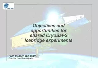
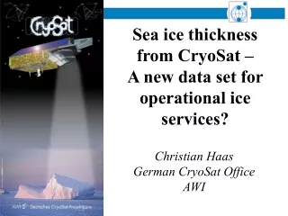
Sea ice thickness from CryoSat – A new data set for operational ice services? Christian Haas German CryoSat Office AWI
First Earth Opportunity Mission, to be launched in November 2004 • Selected after 1999 proposal from European Scientists Group, lead by Prof. D. Wingham, University Collage London, UK • Goals: • Observe changes in Arctic multi-year ice thickness • Observe changes of Antarctic and Greenland ice sheet thickness • Radar altimetry mission with new technology: Synthetic Aperture, Interferometric Radar Altimeter: SIRAL
Ice Sheets Sea Ice h? h?
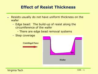
Freeboard to Thickness Conversion • Estimate Freeboard above Interpolated Ocean surface • Conversion assumes reflection from the ice/snow interface • Conversion to thickness using climatology of snow depth/densities [Warren, 1999]
Comparison of satellite and submarine thickness measurements ‘93 to ‘97 Observed thickness trends (ERS-2) (Laxon et al., 2003)
h Time = 2*h/v Pulse-Limited Radar Altimetry
Ocean Ice Sheets Sea Ice
SIRAL: Synthetic-Aperture Interferometric Radar Altimeter SAR 250 m along track resolution InSAR
Orbit (Science Orbit): • 717 km Mean Altitude • 92° Inclination • 369 Days Repeat Cycle • 30 Days Subcycle • 7.5 km Inter-Track Spacing at Equator
CryoSat Data Products Spatially & Temporally Averaged Ice Thickness Along-track Ice Elevations Multi-looked Beams & Phases Coherent Synthetic Beams ~ 1 Mbit/day ~ 400 Gbit/day ~ 3 Gbit/day ~ 20 Mbit/day ~ 400 Gbit/day Level 1 - 1b Level 2 - 3 Level 0 - 1 Level 1b - 2 Level 3 - 4 Coherent, Pulse-limited Radar Echoes Secular trend in ice thickness ~20kbit/day
Level 1B Multi-looked Echoes L0 - L1b Stack & Multi-looking Doppler Beam Stack Over Spherical Surface
Major improvements over ice surfaces due to synthetic-aperture interferometric (InSAR) processing Data is orbit oriented (not imaging) Low point-to-point covariance due to speckle Most reliable for 104 km2 spatial / 1 month temporal resolution Access to data through ESA Data-AOs Uncertainties will be addressed by extensive validation Conclusions See you at: http://www.cryosat.de