Swiftsure 2012 Tidal Currents
330 likes | 528 Views
Swiftsure 2012 Tidal Currents. Richard Dewey RVYC / UVic http://canuck.seos.uvic.ca/SwiftsureTides2012/ Swiftsure_2012_Tides.html rdewey@uvic.ca. Tidal Heights and Currents. Tidal currents “flood” in from the ocean on a rising tide and “ebb” out to the ocean on a falling tide.

Swiftsure 2012 Tidal Currents
E N D
Presentation Transcript
Swiftsure 2012Tidal Currents Richard Dewey RVYC / UVic http://canuck.seos.uvic.ca/SwiftsureTides2012/ Swiftsure_2012_Tides.html rdewey@uvic.ca
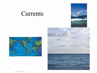
Tidal Heights and Currents Tidal currents “flood” in from the ocean on a rising tide and “ebb” out to the ocean on a falling tide. Tidal currents are driven by hydrostatic pressure and flow down slope from higher to lower water.
Tides in Northeast Pacific M2 Co-Phase
Tides in Juan de Fuca • Tides in Juan de Fuca Strait are forced primarily from the tidal wave (not tsunami) propagating northward up the coast of Washington and BC. • Further in-land (Strait of Georgia/Puget Sound), the “wave” also reflects and becomes more complicated.
Surface Slope Drives Tidal Currents • High water (high tide) represents high hydrostatic pressure, low water (low tide) low hydrostatic pressure. • Water flows from high to low water, down slope. • Sailors needn’t worry too much about tidal height, except when anchoring or rock hopping. • The local current patterns are determined by the large scale basins and channels.
Deep vs Shallow Tidal Currents • Deep water has more inertia, will ride “up-hill” to stop, reversals are lagged/delayed. • Shallow and boundary layer flows have more friction, can be slower & will reverse sooner. • Lateral convergence or vertical shoaling can cause accelerated flows.
Tidal Stations: Currents Port Renfrew Victoria Juan de Fuca West Race Passage and Juan de Fuca East
Reading Tidal Current Tables Victoria PDT=PST+1
Tidal Current Station Tidal Height Station
Tides May 28 – 29, 2011 Start Rounding Finish
Reading Tidal Current Tables Race Passage PDT=PST+1
Tides May 28 – 29, 2011 Start Rounding Finish
Tidal Model Foreman et al., (2004)
Tides May 28 – 29, 2011 Start Rounding Finish
Tidal Currents Summary • Heights only tell part of story • Currents driven by surface slope • Deep water has inertia: tide changes are delayed • Shallow water is frictional: slower, tide changes are more immediate, convergence accelerates flow • Race Passage: Shallow (immediate), Funnel (strong) • Tide tables: • Race Passage (boundaries and near start/finish) • Juan de Fuca East (central east) • Juan de Fuca West/Entrance (central west)
Good Luck! http://canuck.seos.uvic.ca/SwiftsureTides2012/ Swiftsure_2012_Tides.html rdewey@uvic.ca http://www.charts.gc.ca/ publications/ctct-tmcc-eng.asp