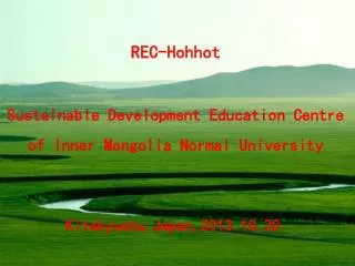
Nei Menggu (Inner Mongolia)
70 likes | 417 Views
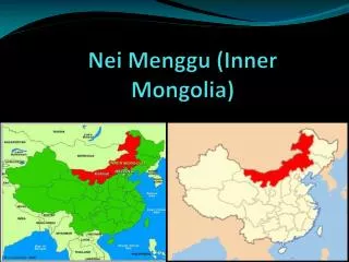
Nei Menggu (Inner Mongolia). Location!!!!. North: 42 degrees north, 108 degrees East; West: 39 degrees north, 99 degrees East; South: 37 degrees north, 108 degrees East. Inner Mongolia is South of Mongolia, North of Shanxi, West of Jilin, East of Gansu.

Nei Menggu (Inner Mongolia)
E N D
Presentation Transcript
Location!!!! North: 42 degrees north, 108 degrees East; West: 39 degrees north, 99 degrees East; South: 37 degrees north, 108 degrees East. Inner Mongolia is South of Mongolia, North of Shanxi, West of Jilin, East of Gansu. • Site: http://www.sacu.org/provmap.html • Site: Google Earth
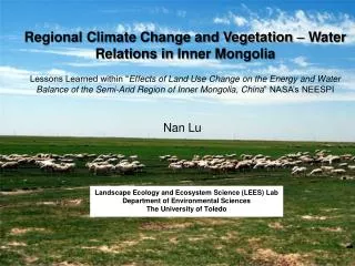
Place!! • The only river in Inner Mongolia is the Yellow River There are many deserts such as Hulunbuir Sands in the north; Horqin Sands in the east; Lesser Tengger Sands in the central east; Hobq Desert and Muus Sands south of the Yellow River; Ulanbuh and Tengger Deserts in the central west, Badainjaran Desert in the west. Yellow River is the only river in Inner Mongolia. There are no mountains in Inner Mongolia.The climate of Inner Mongolia is Burning hot summers, frigid winters and huge, springtime sand storms that send gravel flying and sandblast carsThe only animals are Goats and sheep.The only natural vegetation is Shrubs and herbs (2,351 different species) • Cite: http://en.wikipedia.org/wiki/Inner_mongolia#Geographttp://www.china-information.co.uk/province-inner-mongolia.htmhy • http://www.cbw.com/general/gintro/neimenggu.html
Place continued The population of Inner Mongolia is 23.8 millionEthnic groups: Majority of population is Han Chinese and Mongolian but there are 49 other ethnic groups. The languages are Chinese and MongolianCustoms are Nadaam festival, horse races. Inner Mongolia exports Coal, cashmere, nature gas, ECT.Inner Mongolia has a communist government like the rest of China. • Cite: http://www.cbw.com/general/gintro/neimenggu.html • http://www.stanford.edu/~phoenixl/culture.html
Region!! • Major trade partners of Inner Mongolia are Russia and Mongolia. The largest city is Baotou and the capital is Hohhot. The only river is the Yellow River. Climates of Inner Mongolia are Steppe and Cold arid climate regions. The only vegetation are e bushes and shrubs. Inner Mongolia shares rivers and deserts. The land area is 1.2 million kilometers which is really large! A. Functional1. Major trade partners: Russia and Mongolia • Cite: http://www.e-to-china.com/statistics/analysis/2010/0803/84275.html • Cite: http://en.wikipedia.org/wiki/Inner_Mongolia
Movement!! Ethnic groups that settled in Inner Mongolia are Mongolians who invaded China. Technically the females were slaves and there were Mongol, Turkish and many others. They Manufactured iron, coal, alkali, salt, graphite, mica, and sulfur. They traded Clothes and metals. They also exported wheat, naked oats, millet, sorghum, corn, potatoes, grape, sugar beet, soybeans, flax, wool, shiny-leaved yellow horn, musk, bezoar, and licorice root. • Cite: http://www.cbw.com/general/gintro/neimenggu.html • Cite: http://en.wikipedia.org/wiki/Inner_Mongolia
Other Interesting Facts!! • Inner Mongolia is one of the largest and least populated areas even with 22 million people! • Inner Mongolia only has one river in the whole atominous region! • The majority of Inner Mongolia’s land are deserts!