Download
1 / 20
900 likes | 2.36k Views
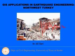
GIS Applications in Civil Engineering Note #1 Introduction to GIS. Xudong Jia, Ph.D., P.E. December, 2011. What is GIS. Every thing, every person, and every event on earth exists or happens somewhere.

E N D
GIS Applications in Civil Engineering Note #1 Introduction to GIS Xudong Jia, Ph.D., P.E. December, 2011
What is GIS Every thing, every person, and every event on earth exists or happens somewhere. If the location of this somewhere can be fixed, information about almost anything can be placed on a map. The map can be used to organize, search, and analyse the information GIS = Map-based Information Management System
What is Spatial Information Spatial information uses geographical location to manage geographical contents of something in the real world. Most data that is used today has a spatial component (a location). This information may vary from the address of a customer, the boundaries of a property to the distribution of areas in a sensitive floodplain.
What is Spatial Knowledge Spatial knowledge contains spatial characteristics that are expressed by locators (boundary of Los Angeles county, Cal Poly Pomona, and bus station), spatial relations (located at and within), and spatial inference (walk and call). IF an incident is located at the boundary of Los Angeles county THEN the Los Angeles county response team should be called. IF network distance from Cal Poly Pomona to its closest bus station is within a half mile THEN access mode is walking
Definition of GIS A geographic information system (GIS), geographical information system, or geospatial information system is any system that captures, stores, analyzes, manages, and presents data that are linked to location(s). In the simplest terms, GIS is the merging of cartography, statistical analysis, and database technology. - Wikipedia
GIS is a Toolbox GIS consists of a set of tools for analyzing spatial data. GIS is a powerful set of tools for storing and retrieving at will, transforming and displaying spatial data from the real world for a particular set of purposes - Burrough, 1986. Engineers prefer this definition.
GIS is an Information System GIS is an information system that is designed to work with data referenced by spatial or geographical coordinates. -Jack Estes GIS is a special case of information systems where the database consists of observations on spatially distributed features, activities or events, which are definable in space as points, lines, or areas. A geographical information system manipulates data about these points, lines, and areas to retrieve data for ad-hoc queries and analyses. - Ken Dueker. Geographers and computer scientists people prefer this definition.
GIS is an Approach to Science The convergence of GIS with other geospatial technologies such as GPS, remote sensing, air photography, mobile computing and communications results in a science called geographic information science. Geographic Information Science deals with the generic issues that surround the use of GIS technology, impede its successful implementation, or emerge from an understanding of its potential capabilities. – Goodchild US Santa Barbara researchers promote this term.
GIS Defined by GIS Developer, ESRI A geographic information system (GIS) integrates hardware, software, and data for capturing, managing, analyzing, and displaying all forms of geographically referenced information. - ESRI GIS allows us to view, understand, question, interpret, and visualize data in many ways that reveal relationships, patterns, and trends in the form of maps, globes, reports, and charts. A GIS helps you answer questions and solve problems by looking at your data in a way that is quickly understood and easily shared. GIS technology can be integrated into any enterprise information system framework.
What is your Definition of GIS • GIS Components: • GIS deals with spatial data, spatial reference, and spatial knowledge through maps. • GIS deals with how to capture, store, analyze, manage, and present spatial data through database management system • GIS is a tool to assist people in solving problems that have geographical nature. • GIS changes the way we do business with information, particularly spatial information.
Benefits of Using GIS • Map Locations • Mapping where things are lets people find places that have the features and see where to take action. • Find a feature—People use maps to see where or what an individual feature is. • Finding patterns—Looking at the distribution of features on the map instead of just an individual feature.
Benefits of Using GIS • Map Quantities • People map quantities, like where the most and least are, to find places that meet their criteria and take action, or to see the relationships between places. This gives an additional level of information beyond simply mapping the locations of features. • Want to find ZIP codes not only around a store, but also those ZIP codes with many young families with relatively high income. • Want to map the numbers of physicians per 1,000 people in each census tract to see which areas are adequately served, and which are not.
Benefits of Using GIS Map Densities A density map measures the number of features using a uniform areal unit, such as acres or square miles, so people can clearly see the distribution. Mapping density is especially useful when mapping areas, such as census tracts or counties, which vary greatly in size. On maps showing the number of people per census tract, the larger tracts might have more people than smaller ones. But some smaller tracts might have more people per square mile-a higher density.
Benefits of Using GIS Map Specific Areas Use GIS to monitor what's happening and to take specific action by mapping what's inside a specific area. A district attorney would monitor drug-related arrests to find out if an arrest is within 1,000 feet of a school—if so, stiffer penalties apply. You may want to find out what's occurring within a set distance of a feature by mapping what's nearby.
Benefits of Using GIS • Map Change • Map the change in an area to anticipate future conditions, decide on a course of action, or to evaluate the results of an action or policy. • Map where and how things move over a period of time • Map change to anticipate future needs • Map conditions before and after an action or event to see the impact.
GIS is a Multibillion-Dollar Business • Total value of the hardware, software, and services conducted by the private, governmental, educational, and other sectors that handle spatial data is billions of dollars a year. • GIS application areas include: • Business • Government • Education and Science • Environmental Management and Conservation • Natural Resources • Utilities
History of GIS More use of map overlay for applications by USGS, USDOA, etc) DIME (dual independent map encoding) by US Census Bureau GBF (geographic base files) The Odyssey program from Harvard on data structure and models. Add weights into thematic maps overlay process, MIT Printer and Plotters invented Digitizer came into market Computer mapping programs: SURFACE II, IMGRID, CALFORM. CAM, MOS, and SYMAP Thematic maps and their overlay for integrative planning Waldo Tobler introduces a computer model for map overlay. MIMO (map in and map out model) Paper Map Centuries ago 1900-1950 1959 1962 Late,1960s
History of GIS Many older GIS packages failed to move to new languages and platforms GUIs on X-Windows Windows Apple’s Macintosh TransCAD, MapInfo, ArcView GIS 3.2 WWW came in with wide use ArcIMS, Geomedia More GIS applications and theories on GIS analyses GPS technologies Internet plays a critical role in GIS GIS maps on Internet Google Earth, Google Map, Mapquest, NASA’s Worldwind Geobrowser, mobile map in vehicles, more real time spatial information on maps More GPS/GIS integration Wireless Communications PDA, Smart phones, iPhone Mobile Computing More GIS extensions, GIS 3-D, GIS geostatistics, GIS business, GIS Network Analyses, etc. GIS term came out It broadened the scope of mapping systems Mapping was done on large computers and FORTRAN Arc/Info mainframe software came into life. GRASS and more IBM introduced PC Arc/Info software was transitioned onto PC Integraph software GIS Science concept ARPANET and NSFNet, the earlier version of WWW or Internet Mobile computing will dominate GIS/GPS practice Paper maps will phase out GPS-guided construction changes design in civil engineering Cloud computing with GIS web services “Surf the future” 1970s 1980s 1990s 2000s 2010 and beyond
GIS People Organize spatial information and knowledge Make informed decisions Improve communication Increase efficiency Share your knowledge with others GIS Managers/Executives GIS Developers/IT techs GIS Users Build and deploy GIS applications on multiple platforms Publish and consume GIS Web services Create simple maps from your enterprise data Get sample code, configurable templates, online data, and more to help you develop useful GIS applications. Work with their choice of programming languages. Use GIS software or applications to improve day-to-day business activities
Sources of Information about GIS The amount of information available about GIS is overwhelming ESRI Web Site: http://www.esri.com GIS-T: http://www.gis-t.org/ URISA: http://www.urisa.org/ Internet Books, Journals and Magazines International Journal of Geographical Information Science Geographical Systems Transactions in GIS American Society of Civil Engineering (ASCE) Journals Transportation Research Board (TRB publications) American Congress of Surveying and Mapping American Society for Photogrammetry and Remote Sensing (ASPRS) Association of American Geographers Urban and Regional Information Systems Association(URISA) ASCE ITE Professional Societies and Conferences