Download
1 / 16
160 likes | 439 Views
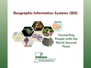
Connecting People with the World Around Them. Geographic Information Systems (GIS). An Information System. Remember those overlay “maps” of the human body from grade school?. A Geographic Information System.

E N D
Connecting People with the World Around Them Geographic Information Systems (GIS)
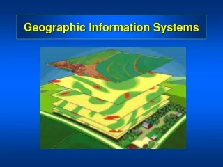
An Information System • Remember those overlay “maps” of the human body from grade school?
A Geographic Information System A GIS is similar, layering mapped information in a computer to help us view our world as a system
What is GIS? A Geographic Information System is a collection of tools to build, maintain, and use electronic maps and associated databases
What Does GIS Do? It locates: • Physical infrastructure, like water and sewer pipes
What Does GIS Do? It locates: • Areas, like land use
What Does GIS Do? It locates: • Incidents, like crime statistics
What Does GIS Do? It locates: • Quantities or densities, like disease mortality rates
What Does GIS Do? It identifies:
From Maps to Information More than just maps… In a GIS, the maps have tables of data behind them. This means when you combine different maps you combine data to get the information you need.
Name Jane Doe Phone 776-6300 School Dist Center Fire Dist No. 12 Police Dist Centertown Zip 46060 Parcel ID 897-2874A Owner Jane Doe Address 110 E Oak City Anywhere State Indiana Zip 46060 Property $72,000 Value What Does GIS Do? It allows questions to be asked from the map side or from the database side 897401 897401
Inside Left Outside From Right Not Adjacent Adjacent To What Does GIS Do? It allows questions to be framed geographically
What Does GIS Do? It organizes a wide variety of spatial information types • CAD data • GIS data • Pictures • Video • Audio
GIS Can Answer Questions • Identify all land parcels between 5 and 10 acres within 1 mile of interstate access with developed utilities. • Highlight all CRP pipes greater than 24” in diameter installed before 1965. • List names and phone numbers of all owners of property within 150 feet of the center of Oak Street between 10th and 14th Streets. List in descending order of property value. • Find county bridge number 75 and play the inspection video that shows its defects.
How Does GIS Provide Benefit? • GIS improves efficiency • GIS identifies opportunities • GIS improves decisions by providing needed tools and data