BC Hydrometric Program Hydrometric Network Review, 2011-13
310 likes | 481 Views
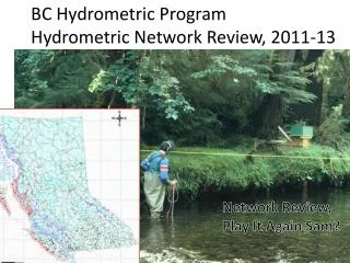
BC Hydrometric Program Hydrometric Network Review, 2011-13. Network Review, Play It Again Sam?. Hydrometric Program: B.C.-Canada Partnership. A Partnership to address water quantity issues common to all Provincial interests.

BC Hydrometric Program Hydrometric Network Review, 2011-13
E N D
Presentation Transcript
BC Hydrometric ProgramHydrometric Network Review, 2011-13 Network Review, Play It Again Sam?
Hydrometric Program:B.C.-Canada Partnership A Partnership to address water quantity issues common to all Provincial interests. A Program with a Fixed Budget, set each year by respective governments.
Hydrometric Program:B.C.-Canada Partnership Approximate Cost of operations in 2012: $6.8 Million provided: BC Ministry of Environment (approx 45%) Environment Canada, WSC (approx 31%) Major single 3rd party (approx 18%) Other 3rd parties (Regional Water Boards, Communities, industries, approx 6%) All Partners work together to operate best network possible.
Hydrometric Program requires network “planning and review evaluations”. Phase 1: 2011-12, -To update network station details, relevant to Program Management (planning, budget support, future directions, etc.). -Undertaken by methods used in the past. Phase 2: 2013, Explore Functional Classification
Simplified Example of Station Inventory Spreadsheets (many collapsed/omitted columns and rows) Use and priority USE: R=regional hydrology W=water management programs E=Environmental questions/leg. FOR=Forestry management Priority: 1=High 455 stations Geographic, operational details
Hydrometric Program:B.C.-Canada Partnership Constrained to a fixed budget each year: Budget completely committed to running existing network; Any additions to network must be balanced by equivalent deletion (e.g., # stations added = # stations deleted) How to accommodate request for additional hydrometric services??!!!
BC Hydrometric Network 2012 Results from Phase 1: -Existing network achieves government’s core mandates (public health & safety, economic & environmental interests); -Both station densities and water needs differ geographically; - Long term stable funding mechanism has proven illusive; -Existing network not overly flexible in its ability to accommodate new and future needs.
Conclusions from 2012 Network Review: • Given that not all stations are presently effective (not many ineffective, but do exist) • And, in areas of high station density, redundant stations may exist • Then, stations that are currently either redundant or ineffective could be re-located to accommodate new hydrometric demands. Considering a functional station classification.
Functional Classification Re-classify active station according to: • Benchmark (BmS): a regional reference (zonally representative), will not be moved or discontinued; • Strategic (StS): to fill hydrological gaps between BmS (due to spatial variability), operated until a statistical correlation established with best BmS, then relocated, typically 10+ years; • Special (Sp): installed for specific research objective (e.g., Upper Penticton Creek, Carnation Creek, etc.).
Exploring and applying a FUNCTIONAL Classification to the BCHP network • Phase 2, Specific Objective: • Develop 2 Station Lists: • -BmS (list of Benchmark Stations) • -StS (list of Strategic Stations)
BmS & StS Determinations: BmSdesignation for three (3) reasons B1: Restricted (third-party stations, legal, stage-only); B2: Statistically unique (stations with r<0.8 for all pairs); B3: Operational Criteria (half of all stations with r>0.8) StS: Remainder of Operational Criteria (B3)
Designation of BmS and StS based on statistical similarity of paired stations. Network serves multiple purposes Cannot rely solely on one hydrograph characteristic to compare stations. Used Nathan and McMahon (1990), for base flow recession analyses.
Recall from Phase 1 Network review: Station “Use” and “Priority” of use included; For correlation of pairs, compare appropriate hydrograph component. Examples: Fish habitat (low flow)—base flow peak flow needs—storm flow Hydroelectric storage– total flow
Blue: McKale River near 940m contour Red: Dore River near McBride
McKale River near 940m contour Dore River near McBride
McKale River near 940m contour Dore River near McBride
Gold River below Ucona River Tsitika River below Catherine Creek
Gold River below Ucona River Tsitika River below Catherine Creek
Pearson Correlation Coefficient r for each Flow Component Example: A – B: r = O.5 Both A & B included as BmS (not correlated, unique) A – C: r = 0.9 Both are candidates, subject to Operational Criteria
If r>0.80 for a pair of stations, use operational criteria to distinguish Of each pair, which: Longest Record Length BmS Shorter Record StS Least stable record StS Most expensive operations StS
Determining Functional Classifications for BC Hydrometric Network First attempt: 1) The list of all Benchmark Stations (BmS) accounts for just under 90% of the total network 2) The list of all Strategic Stations (StS) represents a pool of stations that are candidates for re- location, pool is approximately 11% of total network (50 stations).
StS Candidates IMPORTANT Conditions StS re-location only after:-comprehensive scientific/hydrologic, economic and business cases confirmed.
Summary 1) Hydrometric Network has a fixed budget -work with available funds 2) Functional Classification applied -in an effort to gain flexibility, this is: 3) To accommodate new hydrometric demands & fill hydrologic gaps by expanding the network in small, sustainable increments.
Play it again Sam? Same old... ...hope not Have attempted to: -Rectify network user issues; -Ensure that all stations are effective, efficient and unique; -Add flexibility to alleviate future hydrometric demands, in a timely, comprehensive and economically realistic manner. .


![Review [13]:](https://cdn2.slideserve.com/5360985/slide1-dt.jpg)