Download
1 / 16
160 likes | 268 Views
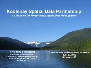
Kootenay Spatial Data Partnership An Initiative for Forest Stewardship Data Management. Per Magnus Wallenius Land Information Specialist Integrated Land Management Bureau Ministry of Agriculture & Lands Nelson, BC. Forest Information Management Workshop June 07, 2006 Richmond, BC.

E N D
Kootenay Spatial Data PartnershipAn Initiative for Forest Stewardship Data Management Per Magnus WalleniusLand Information SpecialistIntegrated Land Management BureauMinistry of Agriculture & LandsNelson, BC Forest Information Management WorkshopJune 07, 2006Richmond, BC
Kootenay Spatial Data Partnership Outline of Presentation • Describe KSDP • History to KSDP • Current status • Future goals • Conclusion & Questions
Kootenay Spatial Data Partnership • Similar to North West Data Sharing Network • Focused on data management and access for FSP • Representation and support from the forest licensees in Arrow-Boundary Columbia Kootenay Lake Rocky Mountain Forest Districts and the government ministries of ILMB, MOE, MOFR • www.kootenayspatial.ca began delivering data early 2005 • 2006/2007 Memorandum of Understanding
Kootenay Spatial Data Partnership History…
Kootenay Spatial Data Partnership History • Many versions datasets were circulating in the regional GIS community • In the summer of 2004, a red flag was raised in relation to data access and availability for the preparation of forest stewardship plans • A joint government and industry partnership was conceived and from which the development of a distribution mechanism for key spatial layers required for FSPs
Kootenay Spatial Data Partnership Current Status…
Kootenay Spatial Data Partnership Goals of MOU: • Increase the quality and reduce the cost of developing FSPs by making available the most up-to-date spatial layers. • Increase cooperation between government and licensees for mutual benefit. • Provide a lead organization to facilitate simplified data-sharing and licensing agreements…
Kootenay Spatial Data Partnership Activities: • Maintain the MOU between KSDP partners laying out the objectives, structure and its terms • Maintain FSP spatial data with the most up-to-date, quality-controlled spatial layers with metadata • Problem statements that identify and communicate issues or concerns relating to data that are submitted to data owners for resolution
Kootenay Spatial Data Partnership Products: • A data distribution service through the website • ArcIMF viewing of the spatial layers • Develop & Maintain reporting software and resultant datasets for Regional Higher Level Plan objectives
Future of KSDP • Develop on-line capacity to update data using licensees’ data. i.e. riparian classification, roads, POD’s • Develop automated overlay, analysis and reporting tools for HLP monitoring • Extend value-added tools for resultant datasets by developing timber, economic and environmental supply modelling and reporting • Develop strategies similar to NWDSN for self-sufficiency in funding
Conclusion • Continuing support from all sectors keeps KSDP working • Selkirk GeoSpatial Research Center provides great support for the web and internet mapping services • Attain self-sufficiency or purely government delivered service… www.kootenayspatial.ca
Kootenay Spatial Data PartnershipAn Initiative for Forest Stewardship Data Management www.kootenayspatial.ca Thank you! Per Magnus WalleniusLand Information SpecialistIntegrated Land Management BureauMinistry of Agriculture & LandsNelson, BC Forest Information Management WorkshopJune 07, 2006Richmond, BC