
Chapter 1: Basic Concepts
E N D
Presentation Transcript
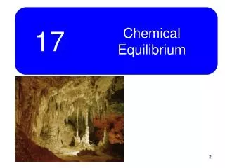
Chapter 1: Basic Concepts The Cultural Landscape: An Introduction to Human Geography
Defining Geography • Word coined by Eratosthenes • Geo = Earth • Graphia = writing • Geography thus means “earth writing” • Geographers ask where and why • Location and distribution are important terms
Contemporary Geography • Geographers are concerned with the tension between globalization and local diversity • Globalization—Modern technology and communications have fostered this, which pulls people into greater cultural interaction with one another. • Local diversity—People are always searching for more ways to express their unique cultural traditions and economic practices. • Geography is divided broadly into two categories: • Physical geography—study of where and why natural forces occur as they do (ex: climates, landforms, and types of vegetation) • Human geography—study of where and why human activities are located where they are(ex: religions, businesses, cities) • We will focus on Human Geography (hopefully you knew that) • We will concentrate on two main features of human behavior—culture and economy.
Human geography is related to many other fields in the Social and Physical Sciences.
Geography’s Vocabulary • Geographers use two basic concepts to explain why every place is unique • Place—a specific point on Earth distinguished by a specific characteristic. • Region—an area of Earth distinguished by a distinctive combination of cultural and physical features. • Geographers want to know why different places on Earth have similar features (i.e. Why do people living far apart from one another practice the same religion?) • Scale—relationship between the portion of Earth being studied and Earth as a whole • Space—the physical gap between two objects • Connections—relationships among people and objects across space
In the 1980s the National Geographic Society created the Five Themes of Geography • Location-absolute (latitude and longitude) and relative location. • Place-the distinctive physical and human characteristics of a place. • Human-Environmental Interaction-how people interact with their environment. • Movement-the mobility of people, goods and ideas-the patterns and change in human spatial interactions-accessibility & connectivity of places. • Regions-an area that displays a selected criteria-one or more distinctive characteristics.
Maps • A map is a two-dimensional model of Earth’s surface, or a portion of it. • Geography relies on maps to display and analyze information. • Two purposes • As reference tools—To find locations, to find one’s way • As communications tools—To show the distribution of human and physical features—also can think about reasons underlying distribution. • For centuries, geographers have worked to perfect the science of mapmaking, called cartography.
Early Map Making • Earliest surviving maps were drawn in Middle East in 6th-7th century BC. • Aristotle (384-322 BC) was the first to demonstrate that Earth was spherical. • Eratosthenes (276-194 BC)—coined “geography” and calculated circumference of Earth was 0.5% accuracy. • Ptolemy (100-170 AD)—took advantage of information given to him by Roman merchants and wrote the 8 volume Guide to Geography. • In this book, he codified basic principles of mapmaking and prepared numerous maps, which were not improved upon for more than 1000 years. Figure 1-2
Maps: Scale • The first decision a cartographer faces is how much of Earth’s surface to depict on the map. • To make a scale model of the entire world, many details must be omitted b/c there is simply not enough space. If a map shows only a small portion of the Earth’s surface, such as a street map, it can provide a wealth of detail about a particular place. • Map scale is presented in three ways: • Ratio or fraction—Shows the numerical ratio between distances on the map and Earth’s surface. The unit on the left of the ratio always refers to a unit of distance on the map, and the number on the right always refers to the same unit of distance of the Earth’s surface. • Written—I might explain in words that “1 inch equals 1 mile” • Graphic—Consists of a bar line marked to show distance on Earth’s surface.
This image depicts the state of Washington. • Ratio—1: 10,000,000 • Written–1 inch represents 10 million inches (about 158 miles) on the ground. • On the next three maps, notice when the scale gets smaller, the maps get more detailed, and 1 inch will represent smaller distances.
Problems with maps • Earth’s spherical shape poses a problem to cartographers b/c drawing Earth on a flat piece of paper produces some distortion. • The scientific method of transferring locations on Earth’s surface to a flat map is called projection. • Four types of distortion: • Shape—may appear elongated • Distance—may become shorter or longer • Relative size—one area may appear larger than another on a map but it may not be in reality. • Direction Gerhardus Mercator Gerhardus Mercator-16th century Flemish Cartographer responsible for the Mercator Projection and the 1st Atlas. The Mercator Projection Map enabled navigators to plot an accurate course at sea, since the compass directions were true.
The Township and Range System • Created by the US Land Ordinance of 1785 to facilitate Western settlement. • The Homestead Act of 1863 encouraged the settlement of the West by giving each settler a quarter section or 160 acres of land. • Each township is 6 x 6 square miles and is divided into 36 sections. Each section is 1 mile by 1 mile and numbered 1 in the NE and 36 in the SE. Each section is dvidied into four quarter-sections, which is 5 x 5 miles (or roughly 160 acres). • Principal meridians—The North-South lines separating townships. • Base lines—East-West lines
U.S. Land Ordinance of 1785 • Township and range system • Township = 6 sq. miles on each side • North–south lines = principal meridians • East–west lines = base lines • Range • Sections
Each township has a number corresponding to its distance north or south of a particular base line. Townships in fhte first row north of a base line are called T1N (Township 1 North) Each township has a second number, known as the range, corresponding to its location east or west of a principle meridian. Example: R1E (Range 1 East). Figure 1-5
Contemporary Tools • GPS (Global Positioning System) • Made possible by satellites that orbit the Earth. • Most commonly used for navigation • Geographers find GPS to be useful in coding the precise location of objects collected in fieldwork. • Remote sensing—Acquisition of data about Earth’s surface from a satellite orbiting Earth or from other long-distance methods. These satellites scan the Earth’s surface in thin images much like a TV camera. These images are transmitted in digital form to a receiving station. • GIS (Geographic Information System) • A computer system that can capture, store, query, analyze and display geographic data is a GIS. • The key to GIS is geocoding: The position of any object on Earth can be measured and recorded with mathematical precision and then stored in a computer. GIS can produce maps more accurately than those drawn by hand, and they are much easier to correct when mistakes are made.
Contemporary Tools • Geographic Information Science • Involve storing information about a location in layers. • Each layer represents a different piece of human or environmental information. • The layers can be viewed individually or in combination. • Enables geographers to calculate whether relationships between objects on a map or significant or merely coincidental.
Mash-up—refers to the practice of overlaying data from one source on top of one of the mapping services (comes from hip-hop practice of mixing songs). • Chicago Transit Authority mash-up shows location of buses and bus stops along three routes. Figure 1-8
Place: Unique Location of a Feature • Location • The position that something occupies on Earth’s surface. • Describing the features of a place is essential for geographers to explain similarities, differences, and changes across Earth. • 4 Ways to Identify Location • Place names—A toponymis the name given to a place on Earth. • Site—The physical character of a place (climate, water sources, soil, etc.) • Situation—Location of a place relative to other locations. • Mathematical location—Can be described precisely by longitude and latitude • Meridians (lines of longitude) • Prime meridian—Arc between North and South Poles. Passes through Royal Observatory in Greenwich, England, which is at 0 degrees longitude. All meridians have numbers between 0 and 180 degrees longitude. • Parallels (lines of latitude) • Equator is at 0 degrees latitude. All parallels have numbers between 0 and 90 degrees latitude. Latitudes are scientifically derived by Earth’s shape and its rotation around the Sun.
Time Zones: Earth is divided into 360 degrees of longitude (0-180 W, 0-180E). As the Earth rotates daily, these 360 lines of longitude pass beneath cascading sunshine. Every 15th degree represents 1 time zone, which is the reason why we have 24 time zones (Do the Math: 360 / 15 = 24). When you cross the Int’l Date Line, you move the clock back 24 hour if you are eastward toward American and move it ahead 24 hours if heading west.
The Cultural Landscape • A unique combination of cultural features such as language and religion, economic features such as agriculture and industry, and physical features such as climate and vegetation. • Regional studies—Cultural landscape approach in geography • Each region has a distinctive landscape by a combination of human and environmental characteristics. • People are the most important agents of change to Earth’s surface. • People can fashion a landscape by superimposing new forms. • Ex: Cotton textile factory—The most important factor isn’t its proximity to where cotton is grown, rather it is location to low-cost labor. • Geographers conclude that political unrest in sub-Saharan African & SW Asia derive in large measure from the fact that distributions of important features, such as ethnicity and resources, do not match the political boundaries of individual countries.
Regions • Designation of “region” can be applied to any area larger than a point and small than the Earth. • Formal Region • A uniform or homogenous area where all share a common attribute such as language, climate or political system. • Some are easy, like Tennessee. TN has clearly drawn and recognized boundaries, and everybody in TN is subject to a common set of laws. • We can distinguish formal regions in US characterized by predominant voting for Republican candidates, although they do not get 100% of vote. • Geographers typically identify formal regions to help explain broad global or national patters, such as variations in religions and levels of economic development.
Regions • Functional or Nodal Region • An area organized around a center, node, or focal point that is organized to function politically, socially or economically. • Region is tied to a central point by transportation or communications systems or by economic or functional associations. • Ex: The reception area of a Local News TV station. The signal is the strongest at the center of its service area, becomes weaker at the edge, then it can no longer be distinguished. People who no longer can hear the local news from Middle TN in Kentucky will watch a local station in Kentucky that gets better signal.
Functional Region Map—This map shows the distribution of television markets in the US, which are groups of counties served by a collection of TV stations. Many of these functional regions cross state lines.
Regions • Vernacular or Perceptual • How people think about or perceive a region-such as Midwest or the South. Some of these regions emerge from people’s informal sense of place rather than from scientific models developed by geographers. • A useful way to identify a perceptual region is to get someone to draw a mental map, which is an internal representation of a portion of Earth.
Blank Map of the US • How would you divide the United States into different perceptual regions. Use a different color for each region and indicate on a key what each color represents.
Spatial Association • To explain why regions possess distinctive features, such as high cancer rates, geographers try to identify cultural, economic, and environmental factors, that display similar spatial distributions. • By integrating spatial information about people, activities, and environments, we can begin to see factors that may be associated with regional differences in cancer. • Great Lakes region may have higher cancer rates in part b/c the distribution of cancer is spatially associated with the distribution of factories. Why do you think people from the South would have higher cancer rates?????
The South may have higher cancer rates b/c with lower levels of education and income, they may be less aware of the risks associated with activites such as smoking and less able to afford medical care to minimize the risk of dying from cancer.
Spatial Association Baltimore City may have higher cancer rates b/c of a concentration of people w/ lower levels of income and education. People living in the rural Eastern shore may be exposed to runoff of chemicals from farms into nearby Chesapeake Bay.
Culture • It is the body of customary beliefs, material traits, and social forms that together constitute the distinct tradition of a group. • Origin from the Latin cultus, meaning “to care for” • “To care for” has two different meanings: • What people care about • Adore or worship something, as in the modern word cult • Language, Religion, Ethnicity • What people take care of • To nurse or look after something, as in modern word cultivate • Geographers divide the world into regions of More Developed Countries (MDCs) and Less Developed Countries (LDCs). • Per capita income, literacy rates, TVs per capita, and hospital beds per capita can distinguish regions of MDCs and LDCs.
Cultural Ecology • The geographic study of human–environment relationships • Two perspectives: • Environmental determinism • Describes how the physical environment caused social development • Ex: Ellsworth Huntington (1876-1947) argued that climate was a major determinant of civilization and stated the temperate climate of maritime NW Europe produced greater human efficiency, as measured by better health conditions and higher standards of living. • Possibilism • The physical environment may limit some human actions, but people have the ability to adjust to their environment. • Modern geographers generally reject environmental determinism in favor of possibilism.
Physical Processes • Climate • The long-term average weather condition at a particular location • Geographers frequently classify climates according to a system developed by German climatologist Vladimir Koppen, which divides the world into five main climate regions: Tropical, Dry, Warm Mid-Latitude, Cold Mid-Latitude, and Polar climates. • Humans have limited tolerance for extreme temperature and precipitation levels and thus avoid living in places that are too hot, cold, wet, or dry.
Physical Processes • Vegetation • Plant life covers nearly the entire land surface of Earth. • Vegetation includes four major forms of plant communities, called biomes: • Forest biome—Many trees, shrubs grow beneath cover • Savanna biome—Lack of shade allows grass to grow • Grassland biome—Land is covered by grass rather than trees. Few trees grow b/c of low precipitation.Early US Settlers thought the American prairies were uninhabitable b/c of the lack of trees. With modern cultivation of wheat, the area has turned out to be productive. • Desert biome—Essentially no vegetation, region contains dispersed patches of plants adapted to dry conditions. Only a small number of animals are fit for survival.
Physical Processes • Soil • The thin interface between air and the rocks • Human geographers are concerned with the destruction of soil that results from a combination of natural processes and human actions. • 2 basic problems contribute to the destruction of soil—erosion and depletion of nutrients. • Erosion occurs when soil washes away in the rain or blows away in the wind. To reduce this problem, farmers reduce the amount of plowing and plant crops whose roots help bind the soil. • Nutrients are depleted when plants withdraw more nutrients than natural processes can replace. Repeated harvesting of the same type of crop every year can remove certain nutrients and reduce soil’s productivity. Farmers also restore nutrients to the soil by adding fertilizers.
Physical Processes • Landforms • Vary from relatively flat to mountainous • Geomorphology, study of Earth’s landforms, helps to explain the distribution of people and the choice of economic activities at different locations. • People generally prefer to live on flat land, which is better suited for agriculture. Concentrations of people on hilly areas may require extensive effort to modify the landscape. • Topographic maps—Show physical features such as bodies of water, forests, mountains, valleys, and wetlands. They also show cultural features such as buildings, roads, farms, etc.
Modifying the Environment Figure 1-21 • Modern technology allows humans to modify the physical environment to a greater extent than it has in the past. • Air conditioning has been a great modern invention, but it has increased the amount of chlorofluorocarbons in the atmosphere, damaging the ozone layer that protects living things from harmful UV rays. • Netherlands (Sensitive Environmental Modification) • “God have made Earth, but the Dutch made Netherlands” • Polder—Piece of land that is created by draining water from an area. The Dutch gov’t has reserved most of the polders for agriculture to reduce dependence on imported food. • Dutch constructed massive dikes to prevent the North Sea from flooding much of the country in two major locations: Zuider Zee and Delta Plan • The Dutch are now deliberately breaking some dikes to flood fields. A plan adopted in 1990 called for returning 650,000 acres of farms to wetlands or forests. Dutch farms had contributed to contaminated drinking water and acid rain.
Modifying the Environment • South Florida (Not-So-Sensitive Environmental Modification) • To control flooding in central Florida, the US army Corps of Engineers straightened the course of the Kissimee River, which was about 98 miles from near Orlando to Lake Okeechobee. • The water was rechanneled into a canal 90 meters wide and 9 meters deep. After the canal opened in 1971, millions of gallons of polluted water, mainly runoff from cattle grazing, began pouring into Lake Okeechobee, which was the major source of freshwater for about half of Florida’s population.
The US Army Corps of Engineers has returned the river from the canal to its original course (look at right picture—they returned it to the windy course).
Globalization of Economy • Globalization • Means that the scale of the world is shrinking—not literally in size, but in the ability of a person, object, or idea to interact with another person, object or idea in another place. • Global Economy is producing a world that is more uniform, integrated, and interdependent. • Most economic activities undertaken in one region are influenced by interaction with decision makers located elsewhere (ex: int’l trade). • Globalization of the economy has been led primarily by transnational corporations—conduct research, operate facilities, and sell products in many countries, not just where its headquarters are located. • Globalization has led to more specialization at the local level. Transnational corporations take this into account and assess the economic assets of each place. • Globalization has also caused heightened economic differences among places. Some places have become centers for technological research while others become centers for low-level tasks.
Yazaki, a transnational corporation that makes parts for cars has factories primarily in Asia and Latin America, where labor costs are relatively low, and offices primarily in Europe, North America, and Japan, where most of the customers (carmakers) are located.
Globalization • The spread of economic activities from one country to many other regions. • The establishment of integrated industrial and service sectors world-wide. • Primarily an economic factor, it has enormous social and political consequences. • Wal-Mart earns more income than most Central American nations. • Picture of containers awaiting loading at Shenzen Harbor in south China-inset of Wal-Mart-destination for many of those products.