Download
1 / 15
150 likes | 173 Views
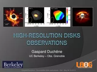
MARGINS Interests in Improved Resolution Altimetry Derived Gravity Observations. Dale Sawyer Dept. of Earth Science Rice University Houston, TX. What is MARGINS?.

E N D
MARGINS Interests in Improved Resolution Altimetry Derived Gravity Observations Dale Sawyer Dept. of Earth Science Rice University Houston, TX Workshop on Global Bathymetry for Oceanography, Geophysics, and Climatology 24-26 October 2002
What is MARGINS? • The MARGINS Initiative seeks to understand the complex interplay of processes that govern continental margin evolution. The objective is to develop a self-consistent understanding of the processes that are fundamental to margin formation and evolution. The MARGINS approach involves concentration on several study areas targeted for intense, multidisciplinary programs of research in which an ongoing dialogue among field experiment, numerical simulation and laboratory analysis researchers is axiomatic. The plan is to investigate active systems as a whole, viewing a margin not so much as a “geological” entity of divergent, translational or convergent type, but more in terms of a complex physical, chemical and biological system, subject to a variety of influences. The processes that fundamentally govern the evolution of margins include lithospheric deformation, magmatism and mass fluxes, sedimentation, and fluid flow. Workshop on Global Bathymetry for Oceanography, Geophysics, and Climatology 24-26 October 2002
Workshop on Global Bathymetry for Oceanography, Geophysics, and Climatology 24-26 October 2002
Workshop on Global Bathymetry for Oceanography, Geophysics, and Climatology 24-26 October 2002
Workshop on Global Bathymetry for Oceanography, Geophysics, and Climatology 24-26 October 2002
Workshop on Global Bathymetry for Oceanography, Geophysics, and Climatology 24-26 October 2002
Workshop on Global Bathymetry for Oceanography, Geophysics, and Climatology 24-26 October 2002
Workshop on Global Bathymetry for Oceanography, Geophysics, and Climatology 24-26 October 2002
All MARGINS Focus Areas are within the latitude range (55S to 55N) Walter Smith indicated was desirable for data quality. • Altimetry derived gravity and bathymetry data will be used to set the plate tectonic framework for all the MARGINS studies. Proposed higher resolution desirable, but not essential. • If bathymetry is an important observable in a MARGINS focus area, the program will likely obtain multi-beam data throughout the study area. Altimetry derived gravity and bathymetry data will continue to play a role in extending bathymetric coverage outside the immediate study area. Proposed higher resolution desirable, but not essential. Workshop on Global Bathymetry for Oceanography, Geophysics, and Climatology 24-26 October 2002
Altimetry derived gravity data can be combined with multi-beam bathymetry to invert for subsurface structure on margins. I envision this to be the primary essential use of altimetry data by the MARGINS program, and the best argument for increasing the resolution of the data. • Data security classification worries me, because MARGINS needs the gravity data, not “a statistical description of the fractal nature of the seafloor.” • I see this method as most likely to be important for the Rupturing Continental Lithosphere part of MARGINS. Workshop on Global Bathymetry for Oceanography, Geophysics, and Climatology 24-26 October 2002
Why RCL? • Rifted fault-bounded blocks of continental crust often have dimensions of 5-25 km by 20-100 km. We must be able to constrain the shapes of these blocks in 3D to understand rifting tectonics. Individual blocks cannot typically be resolved using altimetry derived gravity observations.With the proposed resolution increase, they might be. Workshop on Global Bathymetry for Oceanography, Geophysics, and Climatology 24-26 October 2002
10 KM VE~5X Galicia Rifted Margin ISE97 Line 1 S 5 6 7 8 9 10 Stack, FK Time Migration at 1600 m/s, 1000 ms AGC Workshop on Global Bathymetry for Oceanography, Geophysics, and Climatology 24-26 October 2002
Why RCL? • 2D seismic reflection methods extend ground truth outward from a more expensive borehole. Similarly, 3D seismic reflection data and/or altimetry derived gravity data can extend that truth outward from 2D seismic profiles. We will not soon have regional scale 3D seismic surveys of all the MARGINS focus areas, particularly the RCL focus areas. Workshop on Global Bathymetry for Oceanography, Geophysics, and Climatology 24-26 October 2002
MARGINS is not all there is to studying margins! Many smaller scale, less multi-disciplinary studies of margins will continue to happen outside the MARGINS umbrella (audience says “Amen”). • Presentations by colleagues (including those yesterday by Chris Massel and Barry Eakins) at this meeting describe tectonic applications of the kind pursued by many margins researchers. • Outside the MARGINS Focus areas, investigators depend more heavily on complementary and readily available data sources like altimetry derived gravity and bathymetry. Workshop on Global Bathymetry for Oceanography, Geophysics, and Climatology 24-26 October 2002
Final Thought • Altimetry derived gravity and bathymetry has become part of the fundamental toolset for doing marine geology and geophysics. We all use it, for research and for education, without thinking much about it. • There must/should be a mechanism for the funding of improved global datasets that impact so much learning and so many researchers, students, and citizens. • By the way --- Thanks David and Walter, the Navy, NSF, and whoever else I am leaving out. Workshop on Global Bathymetry for Oceanography, Geophysics, and Climatology 24-26 October 2002