Download
1 / 32
320 likes | 529 Views
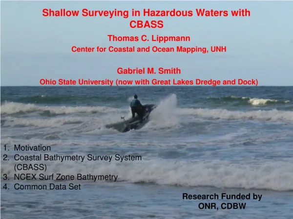
Shallow Surveying in Hazardous Waters with CBASS. Thomas C. Lippmann Center for Coastal and Ocean Mapping, UNH Gabriel M. Smith Ohio State University (now with Great Lakes Dredge and Dock). Motivation Coastal Bathymetry Survey System (CBASS) NCEX Surf Zone Bathymetry Common Data Set.

E N D
Shallow Surveying in Hazardous Waters with CBASS Thomas C. Lippmann Center for Coastal and Ocean Mapping, UNH Gabriel M. Smith Ohio State University (now with Great Lakes Dredge and Dock) • Motivation • Coastal Bathymetry Survey System (CBASS) • NCEX Surf Zone Bathymetry • Common Data Set Research Funded by ONR, CDBW
Motivation: Repeated Surveys within the Surf Zone for Research Purposes
Yamaha GP1200 Waverunner RTK Antenna Navigation & Display Fred Wright, SIO Origin from pressure mooring deployments GPS Antenna Isolated Battery Banks Dual-transducer, 192 KHz VBES (EE Consulting, Bill Boyd, SIO) Surface Temperature, 0.1 deg C 17 Hz ping rate Auto-gain 8-20 deg. Beam width Onboard ruggedized computer Ashtech GPS receiver & radio modem 5 Hz Post-processed; 1 Hz RTK for sync & nav.
3 similar units (SIO, WHOI, CCOM) Initial Design: Chuck Worley, SIO (now with USGS)
CBASS Performance Comparisons(Courtesy of Linden Clarke, SIO)
CBASS Comparisons(Collaborative with Dennis Darnell, SIO)5-7 cm rms differences in elevation Y-coordinate (m) Elevation (m) X-coordinate (m)
Survey Stats • 2 people • 40.5 Hrs survey time over 9 days • 421 Shore-normal lines, @ 20 m spacing • 385 km transited (10 sq km region) • Speed < 25 knots (typical 4-15 knots) • Base Station at Fort Pt. < 4.5 km
Summary • CBASS is a well tested survey tool with RMS errors of +/- 7-10 cm (over sand) at depths ranging from 0.5 to 25 m. • Highly maneuverable, rugged, reliable in the surf • 3 units constructed (SIO, WHOI, UNH; all undergone modification) • other sensors (ADCP; florescence; O2) • Future: Multi-beam; Swath